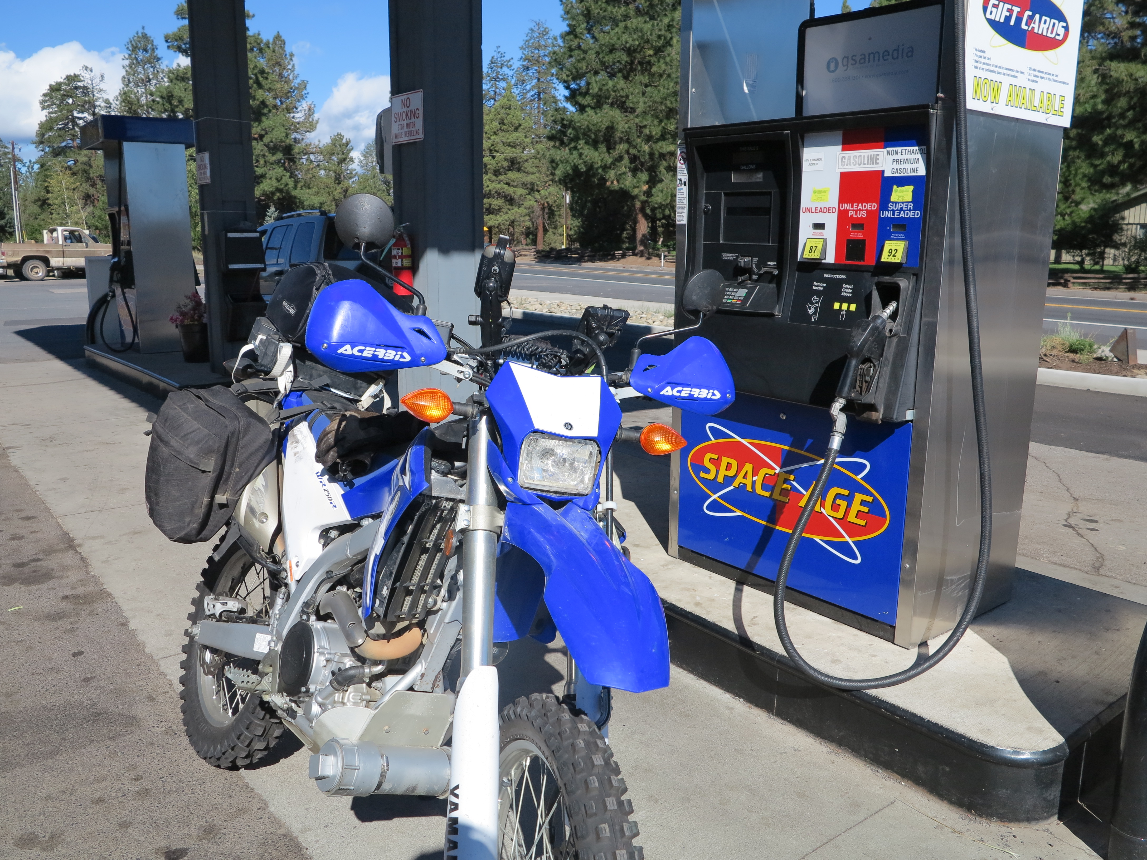
It was still February when finally the riding stars aligned for me for the first time in 2014: I was here at home, it was a weekend, and the weather was reasonable. I had been eying the KTM 1190 adventure motorcycle, the new arrival to the adventure motorcycle world, for several months already. It was sometime in January when I paid a visit to KTM Country here in Eugene and got to see it for the first time.
KTM 1190 Adventure Demo @ KTM Country
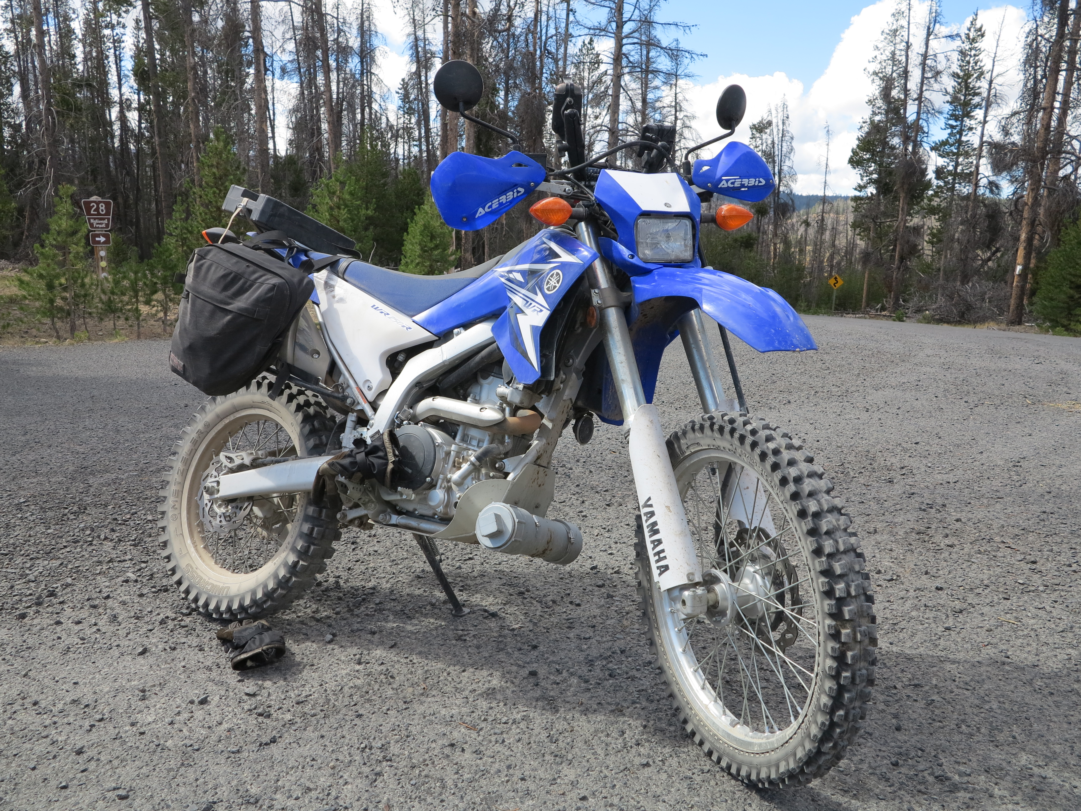
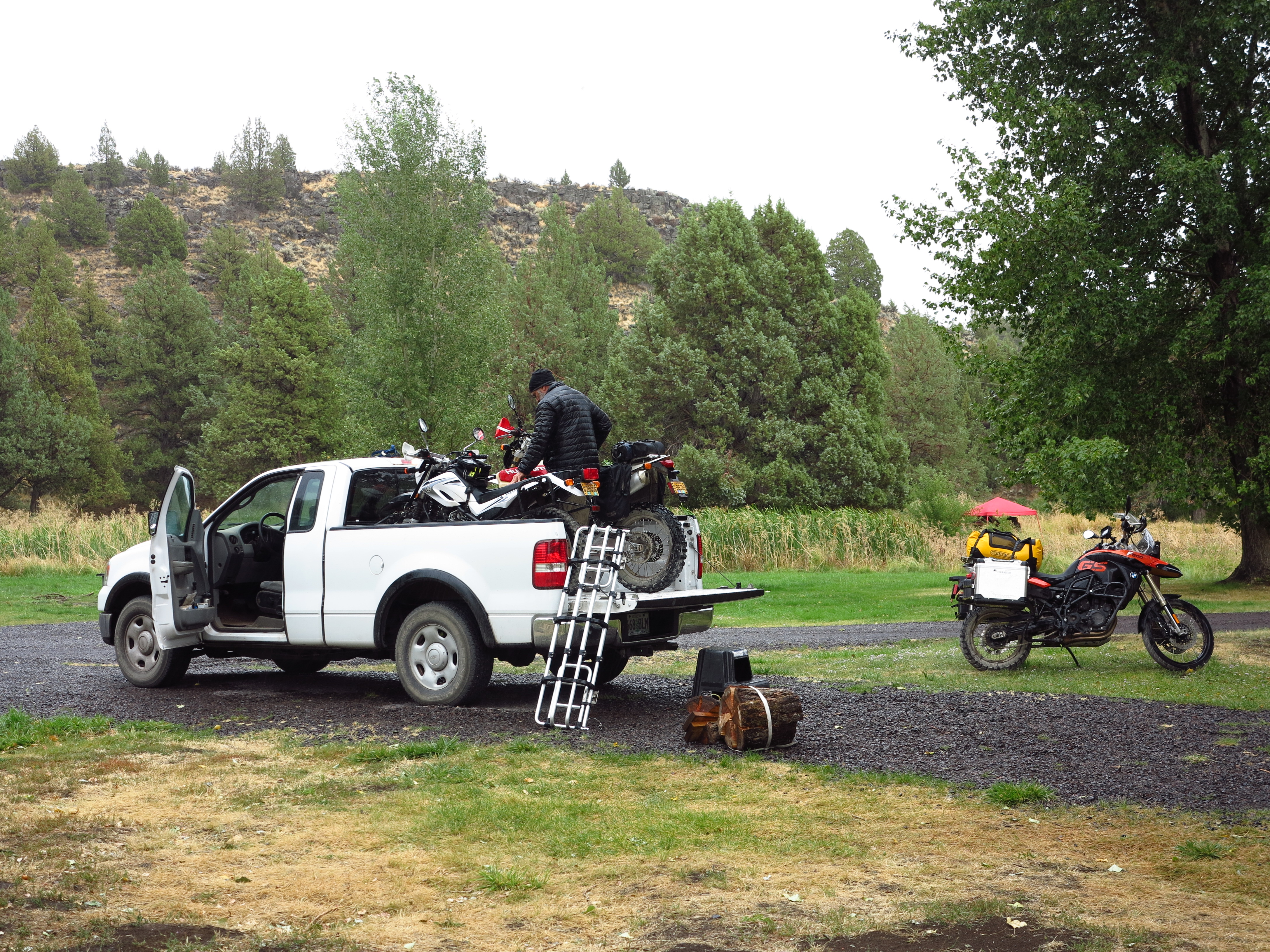
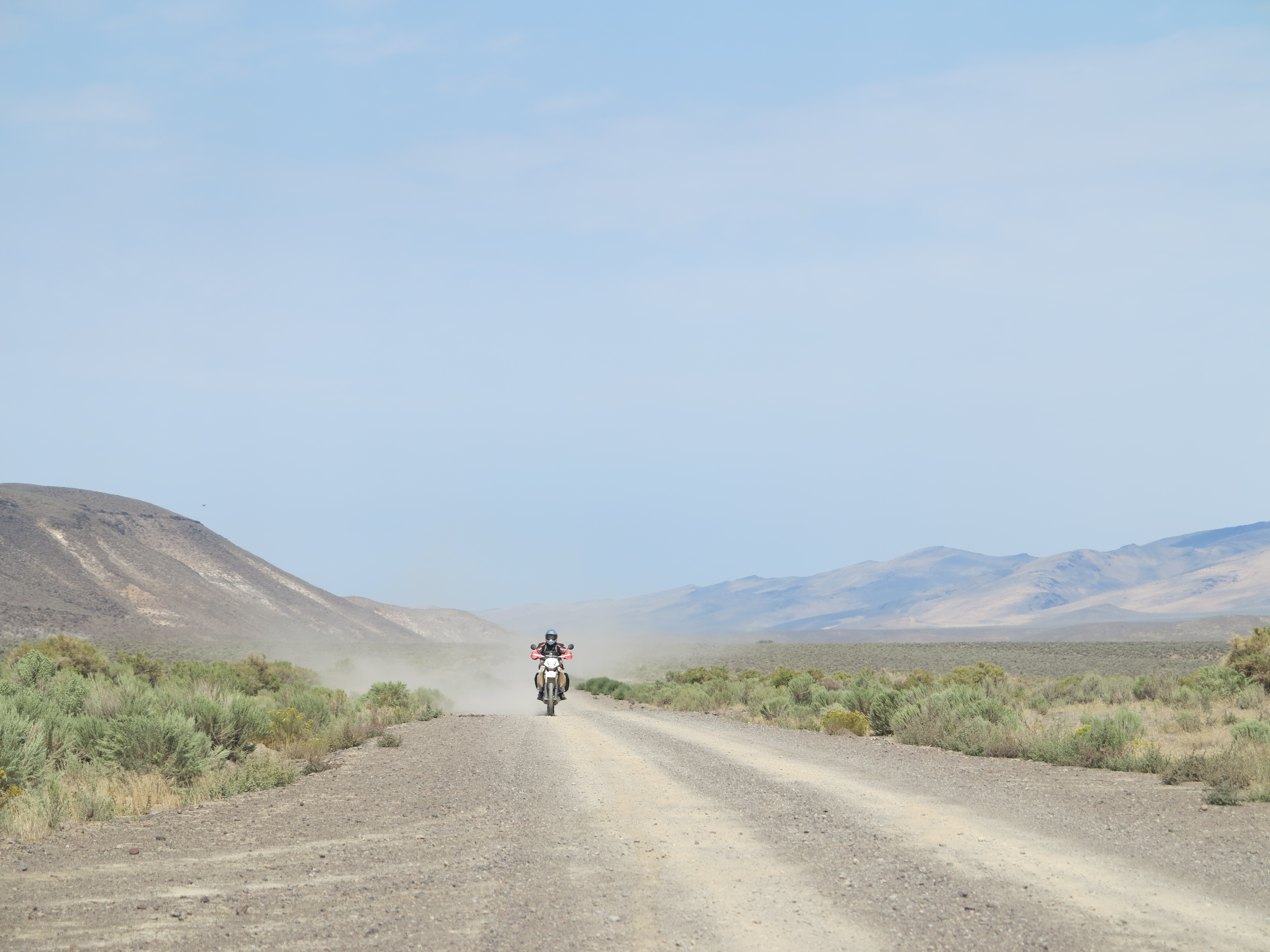
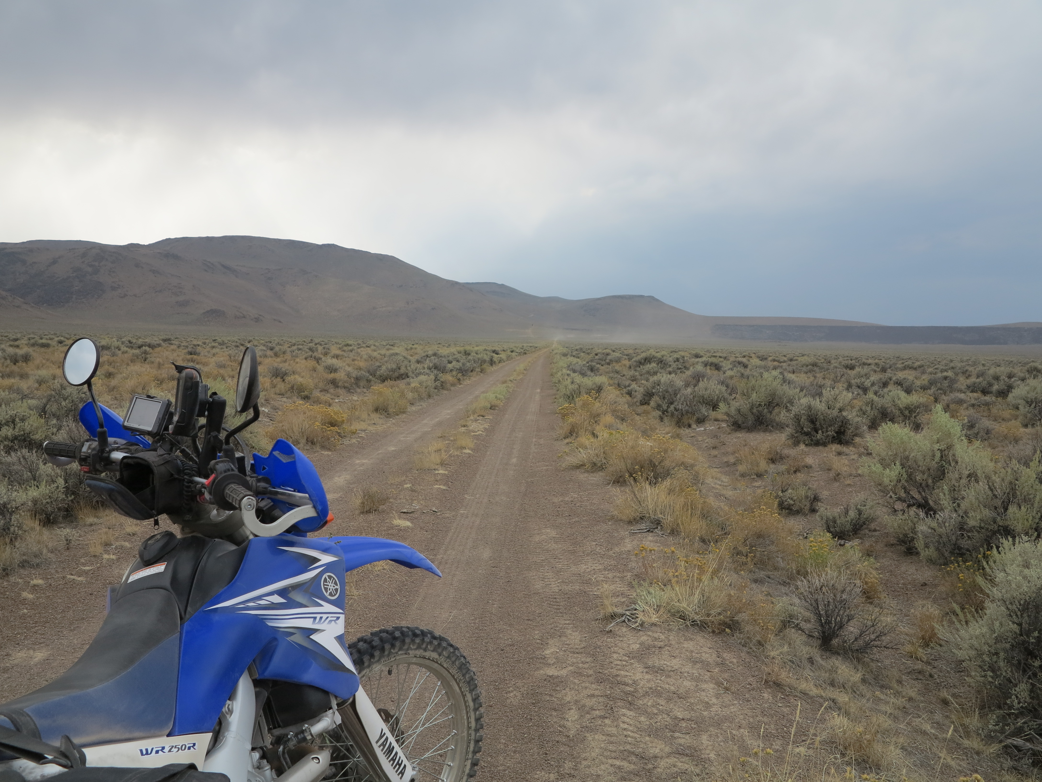
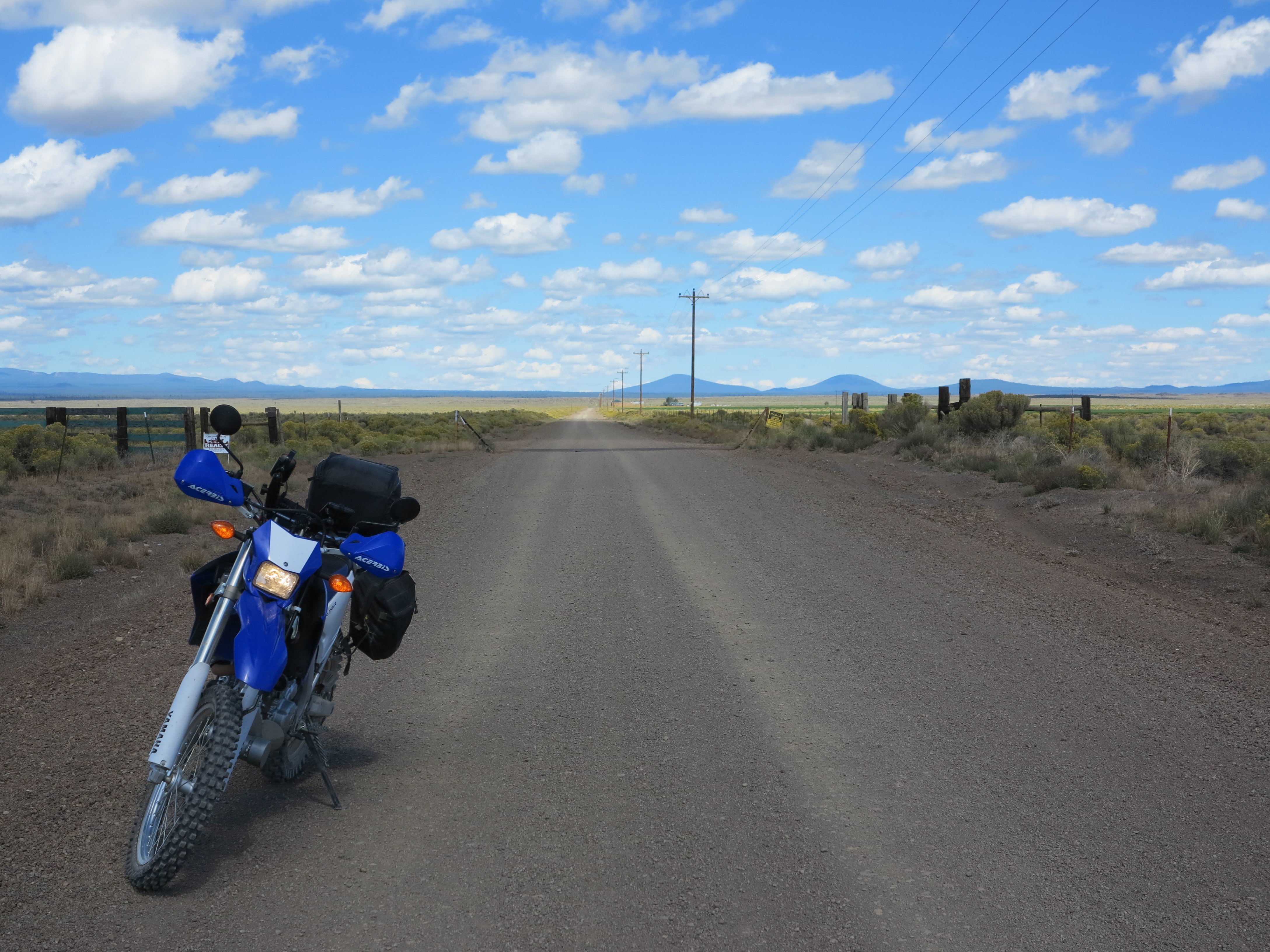
My target for that sunny (the sun sort of came out at some point) and relatively warm Saturday was to go to the KTM dealer and take that bike for a ride. Got my camera ready and set the Tiger 800XC for its maiden voyage of the year. My maiden ride of the year!
Tiger 800 XC set up for the first ride of the year
My bikes were on a battery tender rotation throughout the winter, so the Tiger’s battery had plenty of juice and it was ready to go at first crank. I checked fluids, air pressure on tires, and did an overall review on things. I decided to take this bike, as this would be the one to go in place of the KTM, if I ever went that direction in the future. I got reacquainted with the Tiger, went towards Fern Ridge, taking the long way to get to the KTM Country store, making sure the Tiger’s fluids got a chance to warm up to operating temperature before I would bring the bike back home to who knows when I would be riding it again. After all, this is still winter! When I arrived at the KTM store I learned they had a new arrival, an Orange one, besides the grey demo bike.
Orange 2014 KTM Adventure @ KTM Country
They explained to me that they’ve been getting the KTM 1190 Adventure R model, the one with a 21 inch front wheel and more set up to offroad riding. But those are all pre-sold or sell as soon as they arrive. Besides the demo, at the end of February they had two standards, this Orange one and a gray one (about to arrive) both unsold at that time. The orange bike looks a lot better in person. At least that’s the way I see it. Although I would go for the gray one if I ever went the 1190 route. Also, I would not go for the R model, no need for that, since I’m not going to go motocrossing with such a large bike. The standard should be plenty good, more than enough for gravel and dirt roads.
2014 KTM Adventure Standard
To make this story short, I did not get to ride the demo bike. Staff were busy at the store, one on the back working on a bike and only one in the front, with customers. Since they require a “baby sitter” or chaperone for test rides, at least that’s what the guy in the front told me, I did not get to take the bike for a ride. Maybe if they knew me (0ne of them does) they would let me take it for a ride. Anyway, it simply did not happen this time, I may go back and try again.
So I got back on my Tiger and went back home. I made some 20 to 30 miles in total with the Tiger, enough to get reacquainted with the bike and with riding. The following day, Sunday, the weather forecast indicated a dry day for Eugene and for the coast until late in the afternoon. So that was my plan: take the Ducati for my Pacific Ocean loop.
This post is well past its time, but I just don’t feel I can start posting this year’s rides before properly completing the 2013 riding season. And especially because this last proper ride of 2013 became a relevant one for me when in December I received worrying news from one of my riding friends. I will explain.
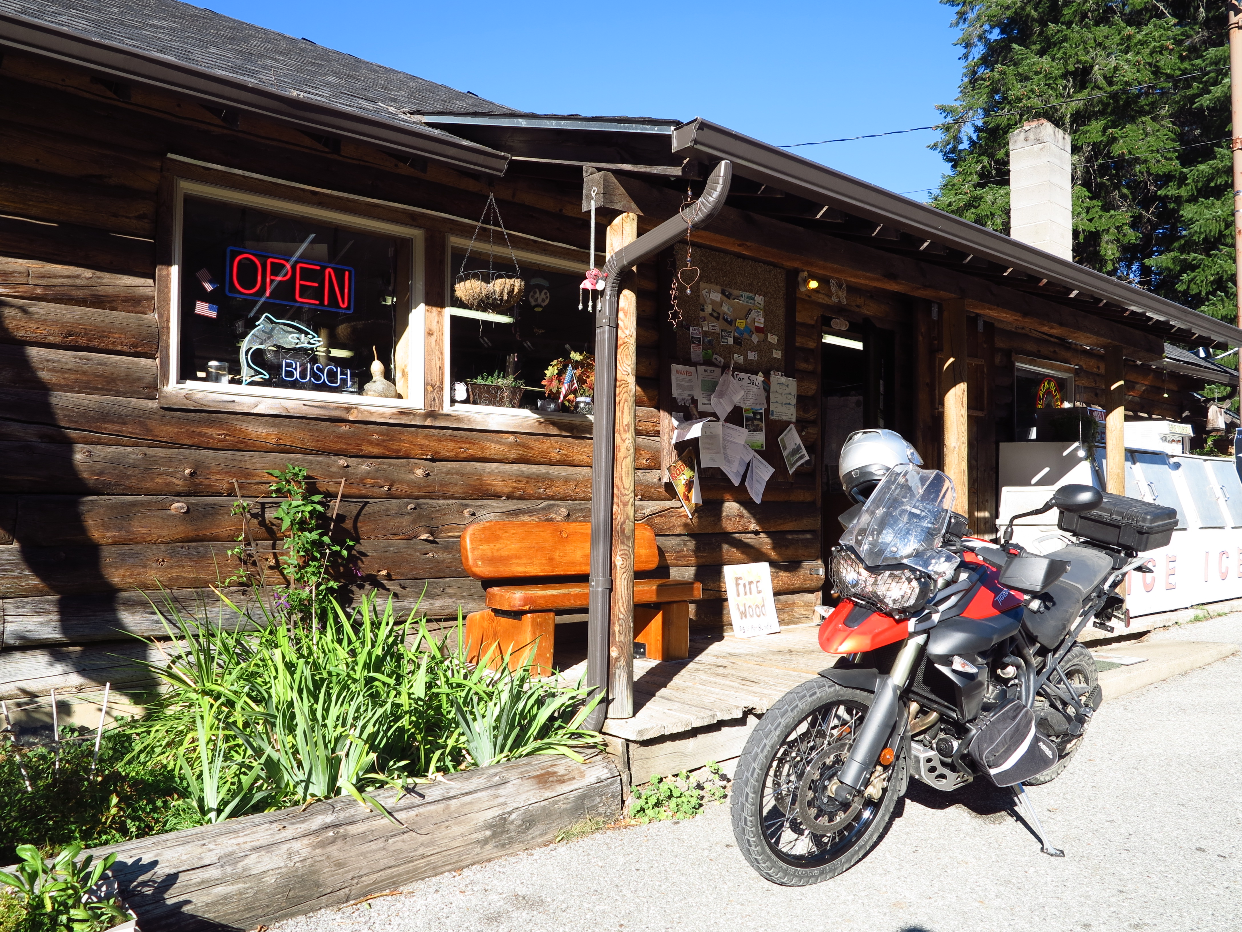
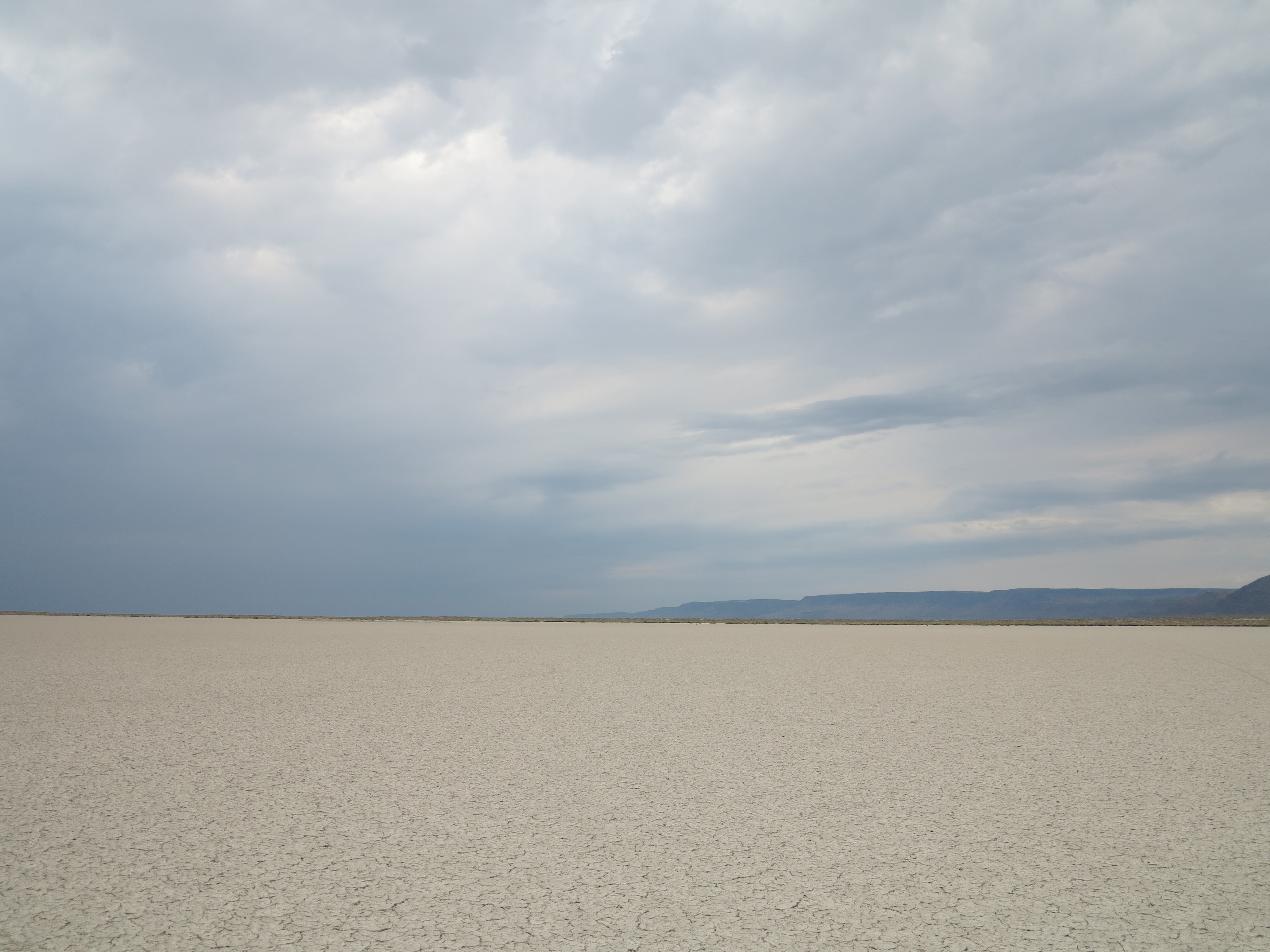
Dry Creek Store, along Hwy 138, East of Steamboat
Travel and weather ended the 2013 season almost abruptly to me. In some winters I never actually stopped riding. But on others the combination of when I’m here and available to ride and when the weather is good have not matched, which was the case of 2013. Isn’t that always the case that we know winter will be here, but we never know when will our last ride of the season be? And doesn’t this actually apply to everything in life?
The Kitchen
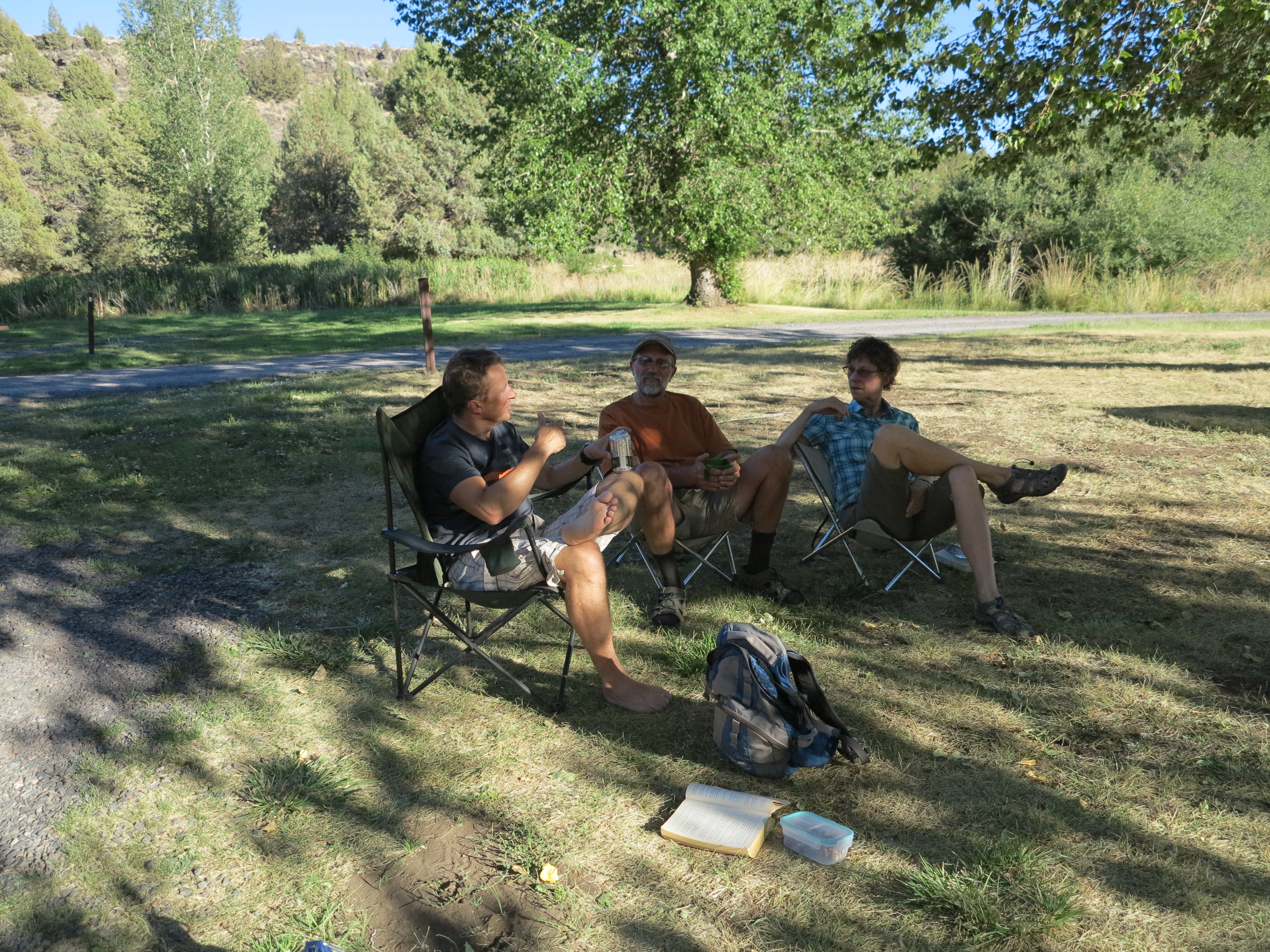
The European Motorcycles of Western Oregon organizes yearly motorcycle rallies. These are well organized events called “Oregon Discovery Rally”. Every year they scout an area and camp site on varied locations across the state and provide breakfast and dinner for participants for 3 days. Meals are pretty good actually! Usually the “headquarters” location is selected so that it offers a good variety of riding terrain and geographic features around it. As is typical, from these headquarters riders self-organize and plan daily rides in smaller groups.
A small group ride on the 2013 Oregon Discovery Rally
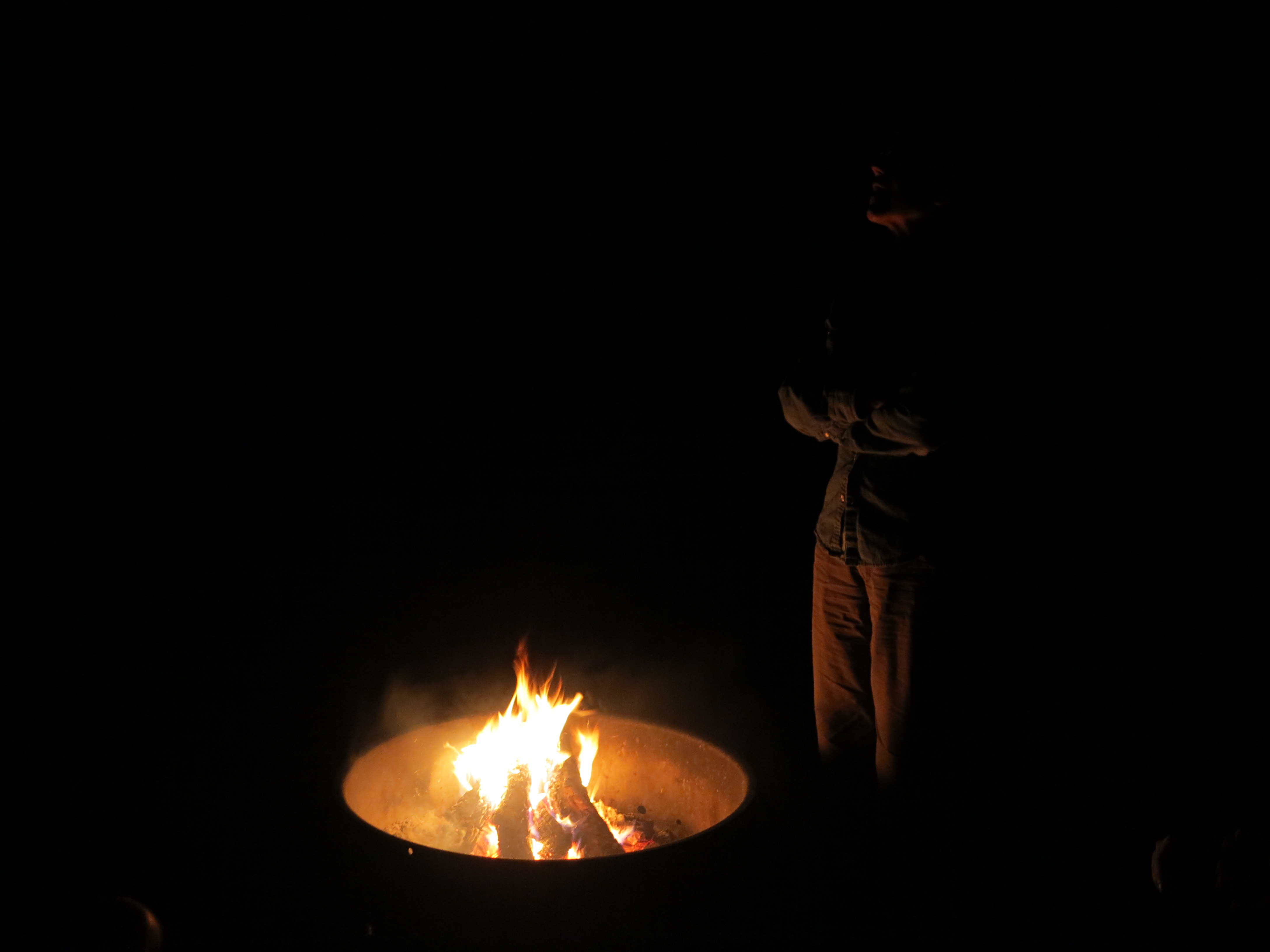
At night, by the campfire, you get to hear stories about where people went, their successes, trials and tribulations, we exchange information so we all learn from each other which helps the planning of the next day’s ride. And it is great to re-live rides, maybe some of us will tell taller stories than others.
I’m not a fan of group rides, especially when it goes on dirt roads. I’ve described here my pet peeves on this already, mostly originating from my dislike from eating dust. But at the same time, it was on one of these rallies, in 2008 in the Ochoco area of the state (Read that report here), that I met a group of riders who have since become, all of them, very dear friends of mine.
Discovery Rally, 2008
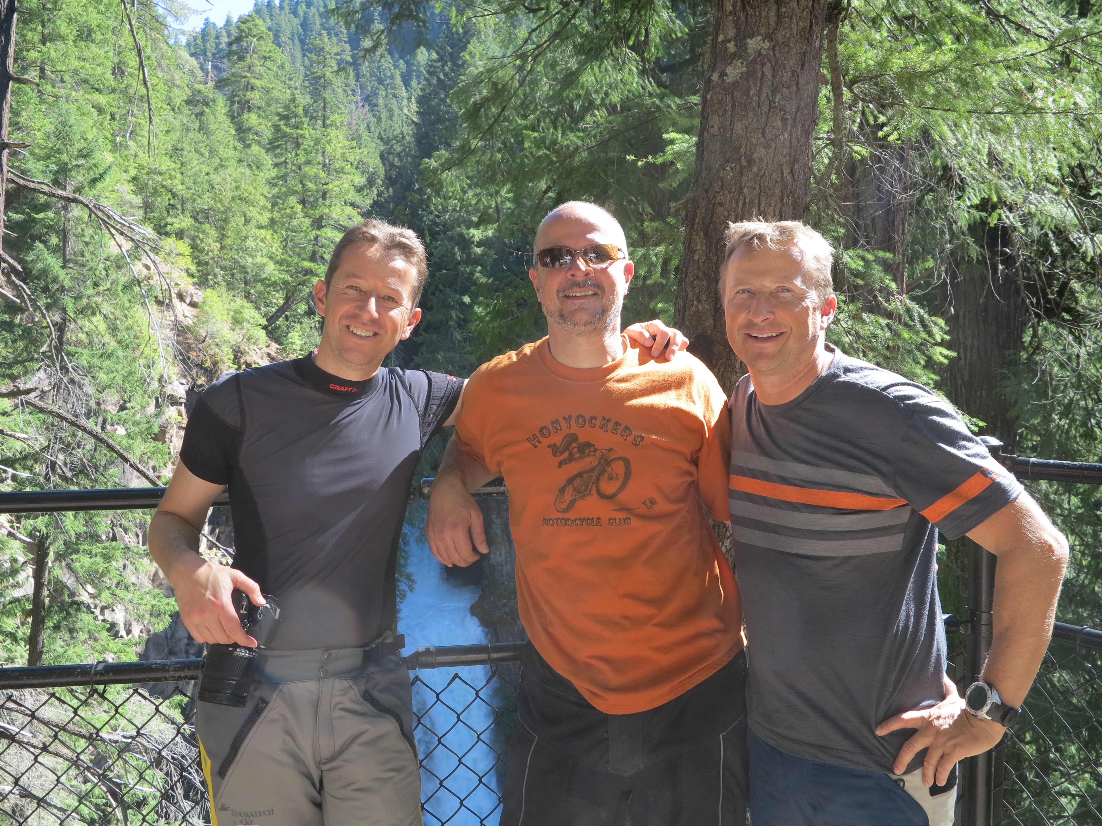
In 2010, not on an Oregon Discovery Rally, I met a couple from Switzerland, Oliver and Monika, who were riding through Eugene. They were picking their bikes up from service at the European Motorcycles of Western Oregon and I happened to be there also picking my BMW Dakar up from service. That evening I had dinner with them. Oliver and Monika became friends with Scott and Madelyn of the ECMOR and also with me, and since then they have been coming here every summer to ride their bikes and also participate in the Oregon Discovery Rally. Eventually Oliver’s brother Christian joined the fold as well.
From left to right: Christian, Monika and Oliver
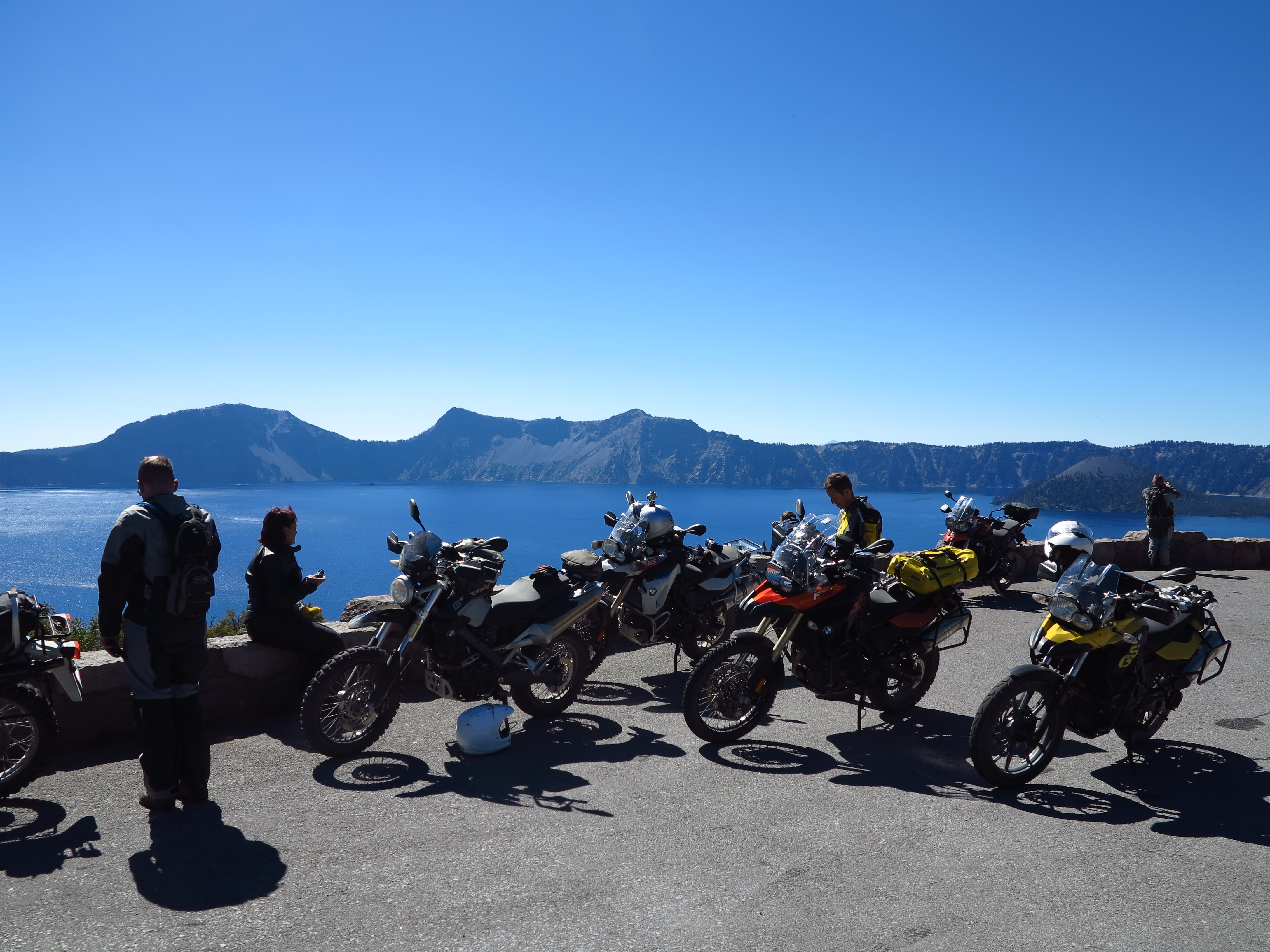
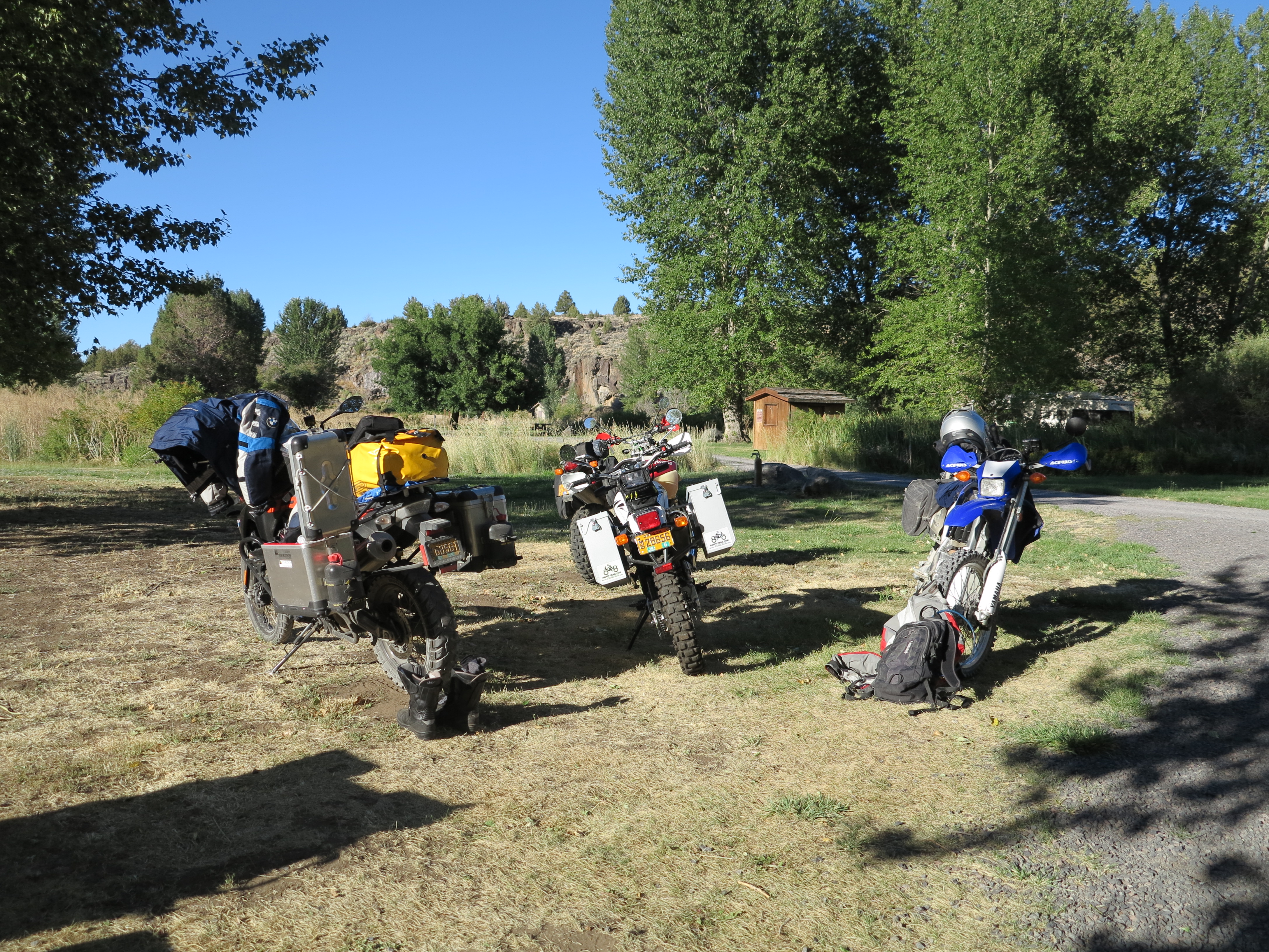
Knowing Oliver, Monika and Christian would be here for the 2013 Rally was an incentive for me to join the Rally. This year’s Oregon Discovery Rally was based out of the Horseshoe Bend, a handful of miles east of the Steamboat Inn, along Hwy 138, where the Umpqua River does a perfect horse shoe bend. Knowing this was going to mostly be a paved roads rally, with some gravel roads on optional rides, I prepared my Tiger 800XC for the event. And the Tiger matches very well their BMW F800GSs and F650GS.
The Tiger 800XC Ready to Roll – September 2013
From my previous posts, you already know Christian had arrived earlier and rode Oliver’s bike and joined us on a trip to the Steens just the week before. When his brother arrived, Christian returned that bike and borrowed another F800GS for the rally. I picked him up where he was staying and together we went towards the Horseshoe Bend campsite. Oliver and Monika would be riding towards the campsite later. We would all be arriving a day before the start of the rally, so we could help the shop crew with the setting up of the campsite kitchen.
Picking Christian up to ride together to the Rally
We stopped in Cottage Grove for lunch.
Lunch in Cottage Grove
From there we went due east along the Row River and eventually took Sharps Creek road to the southeast which would spit us right about the Steamboat on 138. We met a large group of cruiser riders on one of the passes.
Adventure bikes and and Cruisers
This area is nice, it is the route Rod sets for us riders to attend the the Cycle Parts’ (local Triumph Shop) annual Steamboat Inn Lunch Ride.
View from one of the passes on Sharps Creek Rd
We arrived on the campsite earlier than the others, prompting me for a relaxing nap before jumping into action to help set the kitchen up and set up my tent.
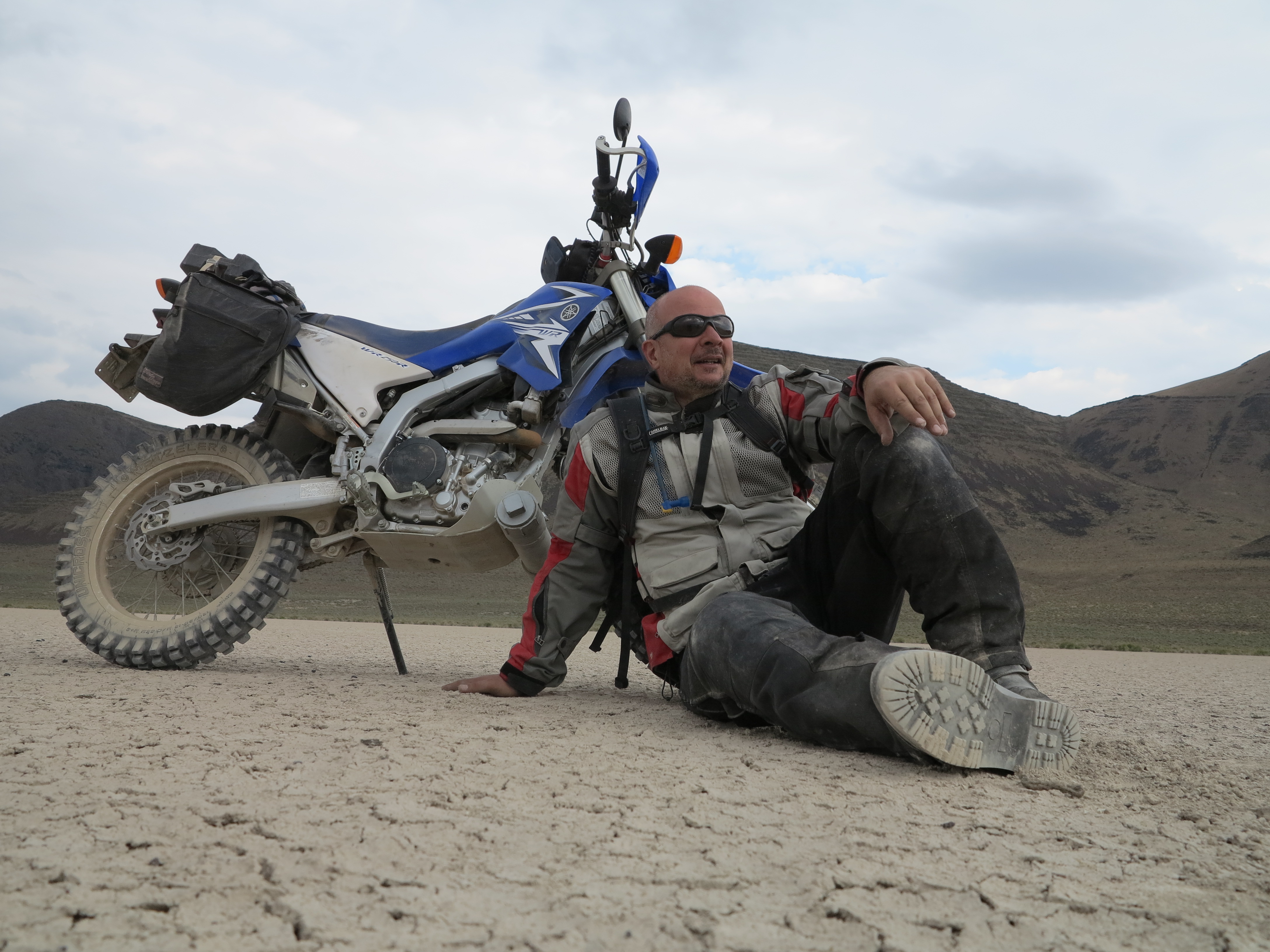
Taking a nice relaxing nap!
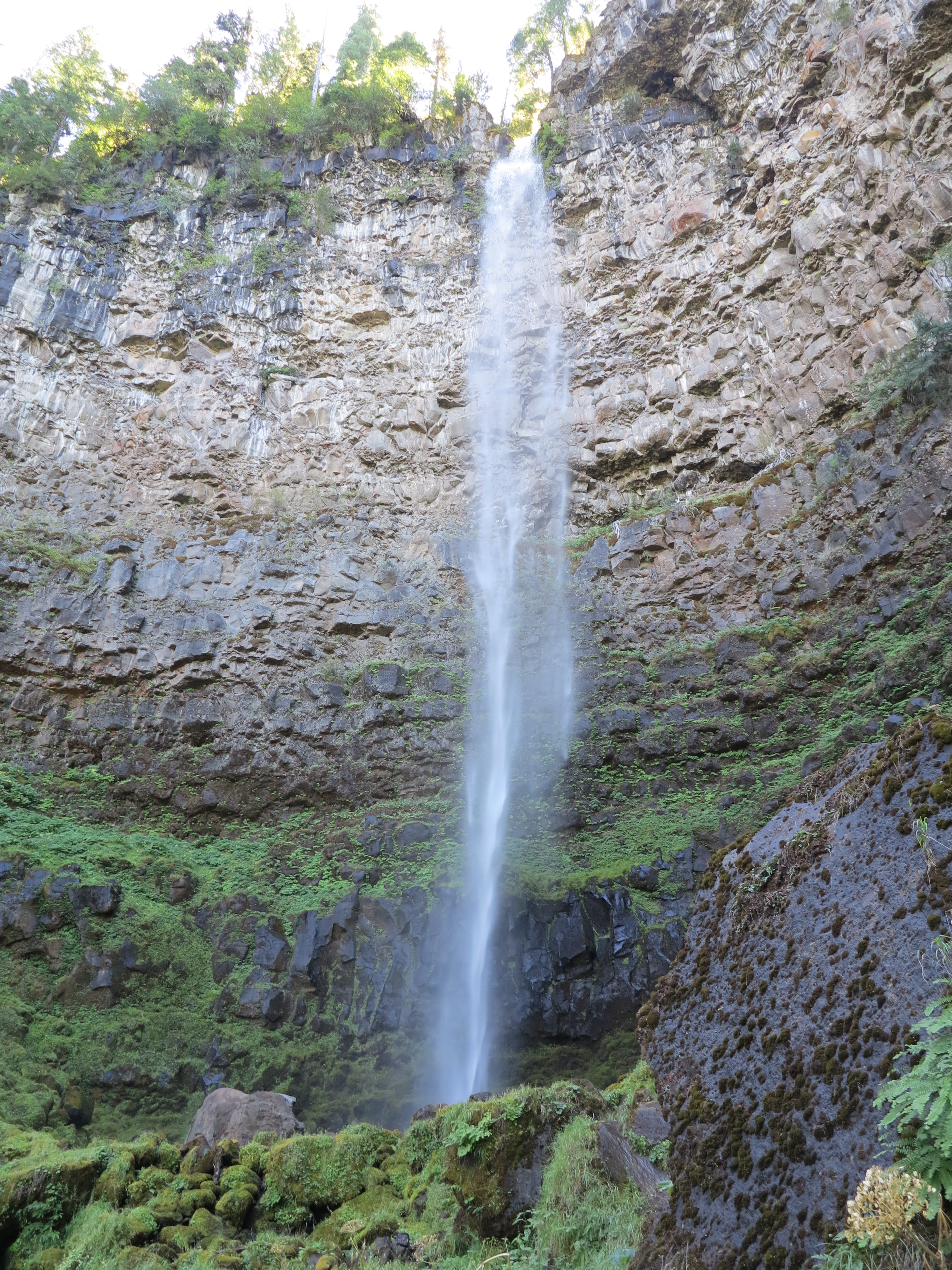
When the crew arrived we quickly set the camp kitchen up. The next day we started our rides in the area, first we made a visit to Watson Falls.
Watson Falls
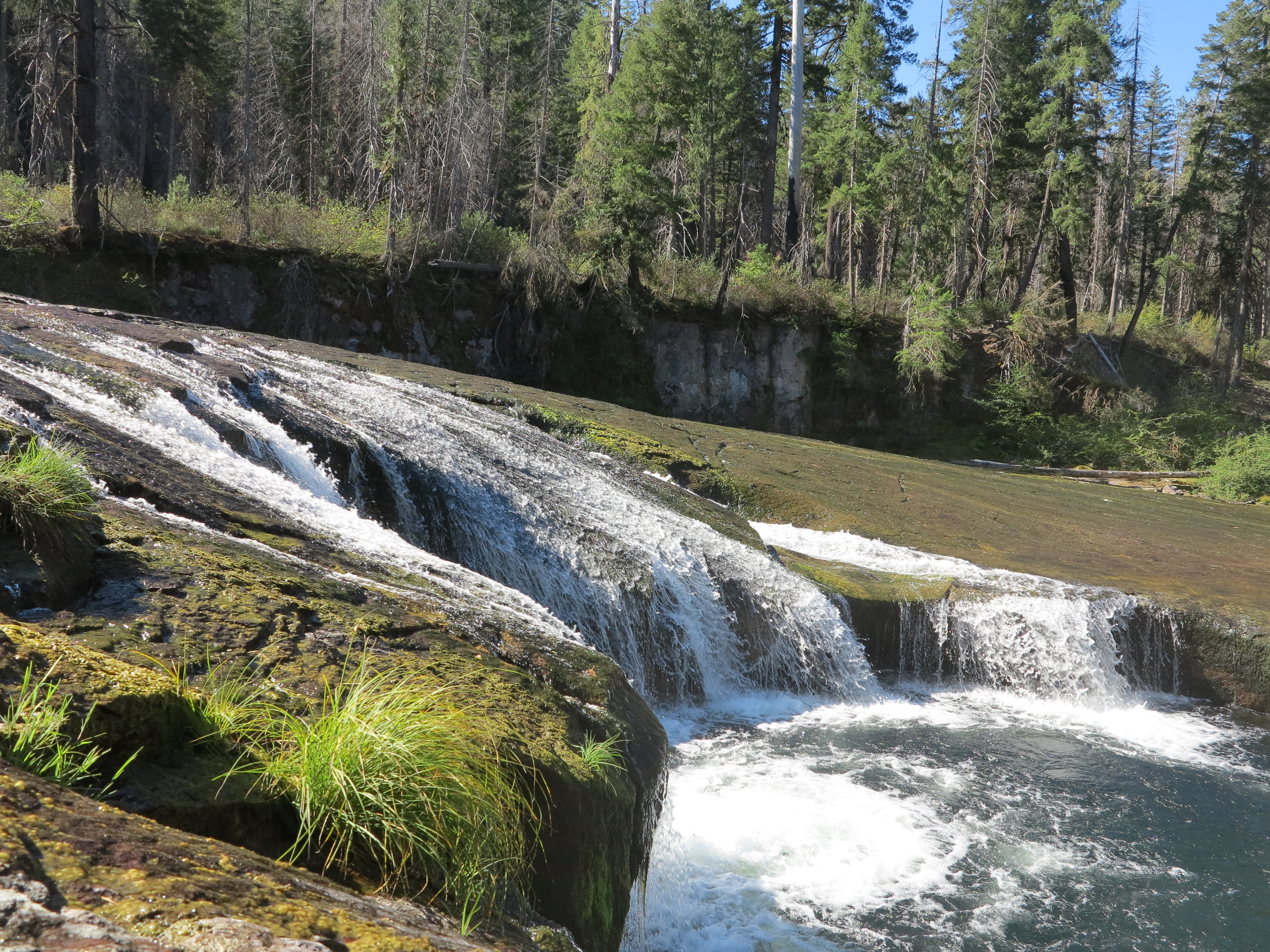
Then on our way back to camp we stopped by the Toketee Falls. This day was the only ride I led while on this trip.
Toketee Falls. Very impressive volume of water.
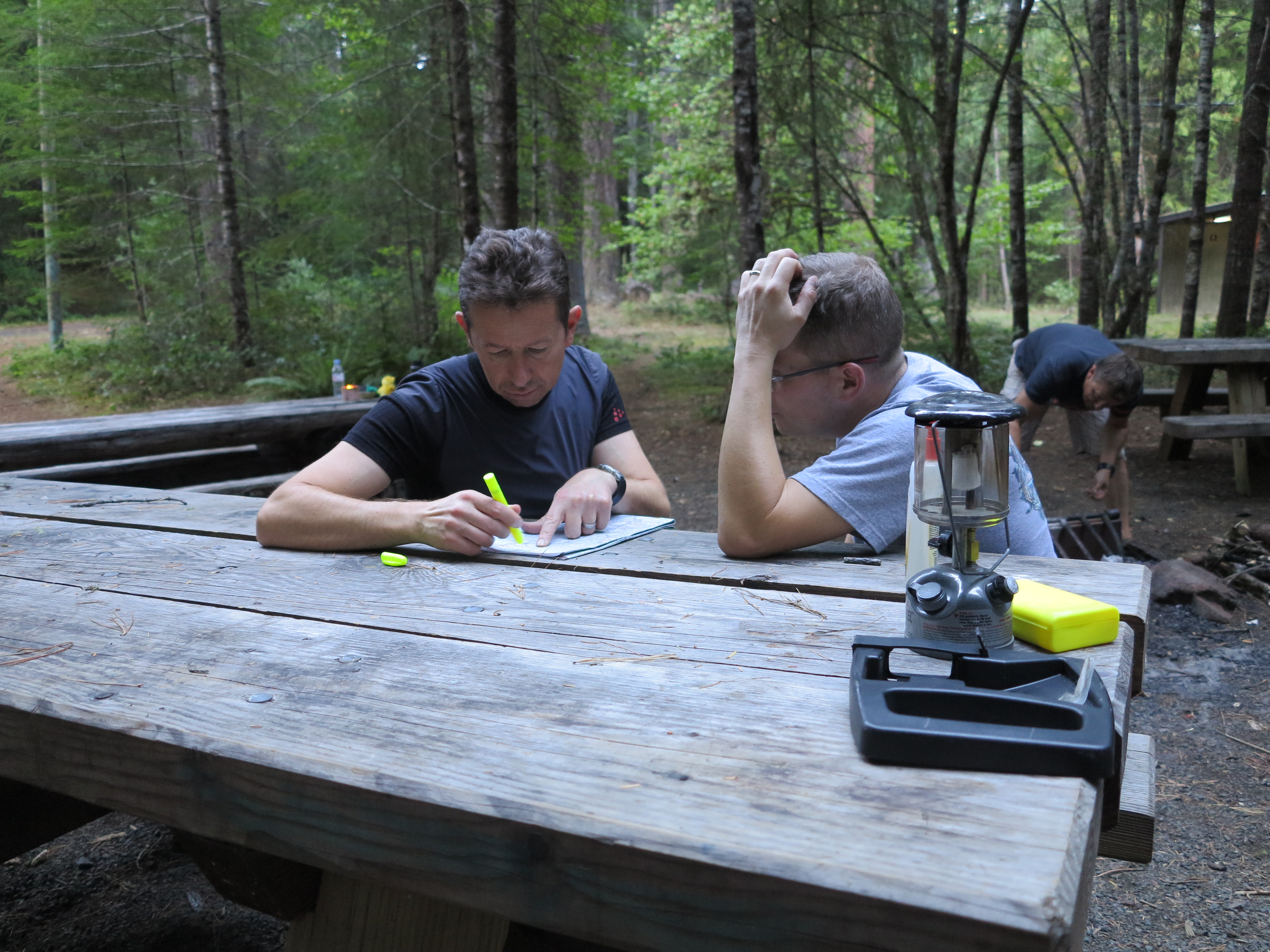
From this time on, Oliver took over the role of route planning. Oliver is very organized and every evening he diligently studied maps, prepared routes and then transferred the information to his GPS. That means from that time on I only relaxed and enjoyed the rides following him and the rest of the gang.
Oliver and Scott, planning the next day’s ride
The next day we took a dirt ride towards the general direction of the Crater Lake.
More water falls.
We stopped by the Natural Bridge on the Rogue River, where the entire river goes under volcanic rock for a 100 yards or so. The photo below depicts the river when the water shows up from under the rock.
Rogue River coming out from under a natural rock bridge
The following day our group went to Crater Lake, Oliver (with the red helmet) ahead as always.
Crater Lake Park Entrance
The Crater Lake is always great for photographs.
The Tiger is back at the Crater Lake
It was as if I was visiting my Uncle Benito and my friend Francis. Both passed away in 2013. My uncle died in April, when I was on a trip to Crater Lake. Francis died in early May, and his connection to Crater Lake was because of his pride of the deep blue color of the Mediterranean by the Straight of Messina, more precisely in Mortelle where his Sicilian home was located. The deep blue waters of the Crater Lake will always remind me of him.
The Deep Blue Waters in Crater Lake
We went around the Crater Lake, stopping by the various look out places.
One of the many stops around Crater Lake
Mount Thielsen?
Mount Thielsen on the background
Just about this time a wasp entered my helmet through the open visor and found its way between the helmet and my sun glasses and stung me. I’m allergic to most bee stings, so the reaction soon started to take place. Thankfully its venom was not too strong, I was sort of fine, despite a seriously swollen face and some discomfort.
Mount Thielsen
So I continued the ride with everyone, exploring other areas surrounding the Crater Lake.
Volcanic Spires on Pinnacle Valley
At some point I decided it was better to abort this ride and go back to camp and rest, I was afraid of further effects from the wasp sting. Scott and Kendrick decided to baby sit me on my way back to camp, following my bike closely, making sure I was not going to collapse or something. Thanks guys! I should get my EpiPen (Epinephrine auto-injector) prescription filled.
Overall, it was a great location for the Rally. We could not cover all the different attractions in the area. But on evenings, while exchanging information with other groups of riders, we learned of areas we had missed. There is always a next time.
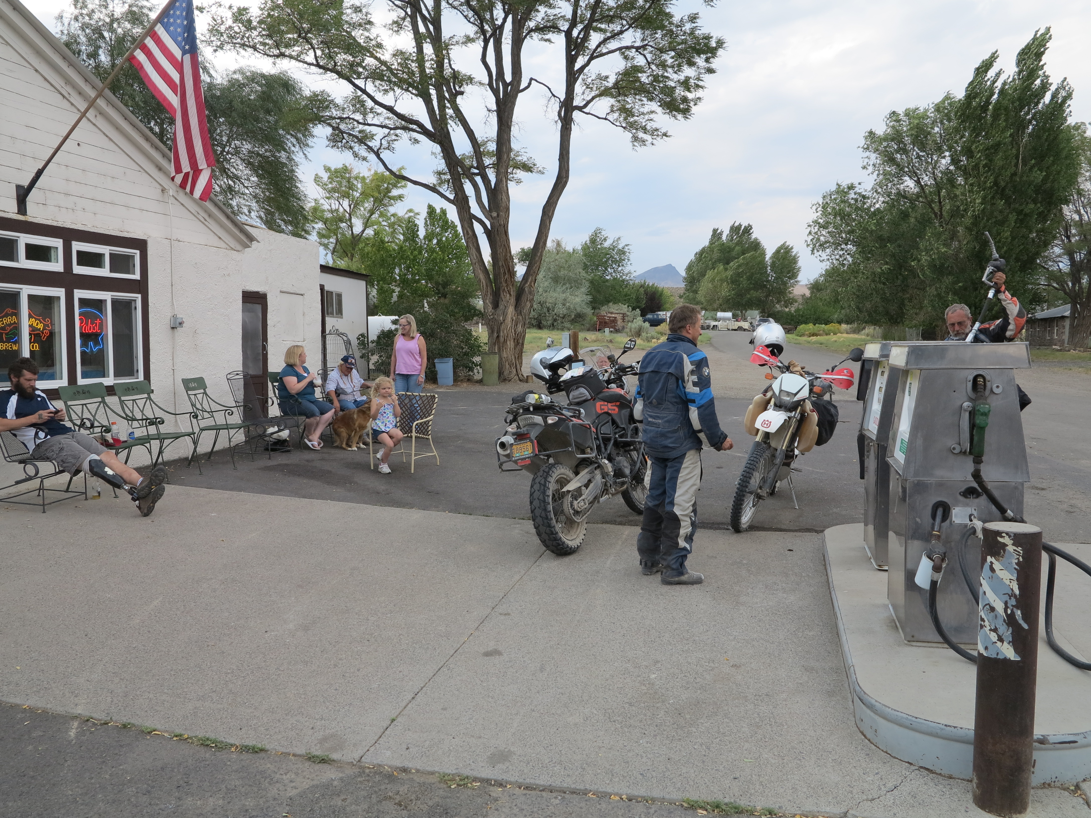
Daily Ritual: Fueling the bikes at the Dry Creek store.
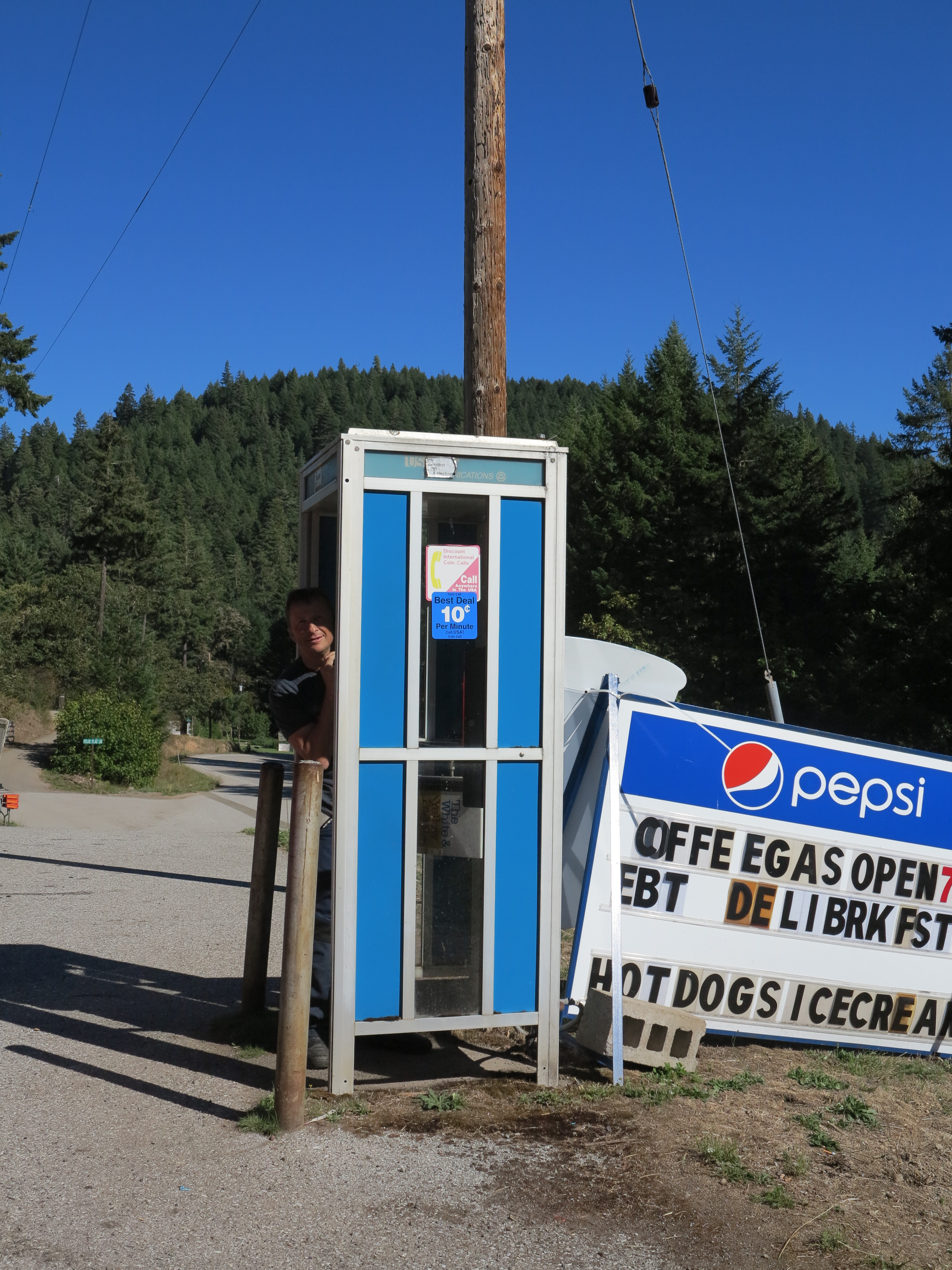
Phone home!
Another daily ritual: Christian trying to call his wife back in Switzerland.
Impromptu Sandwich.
Wild black berries by the road.
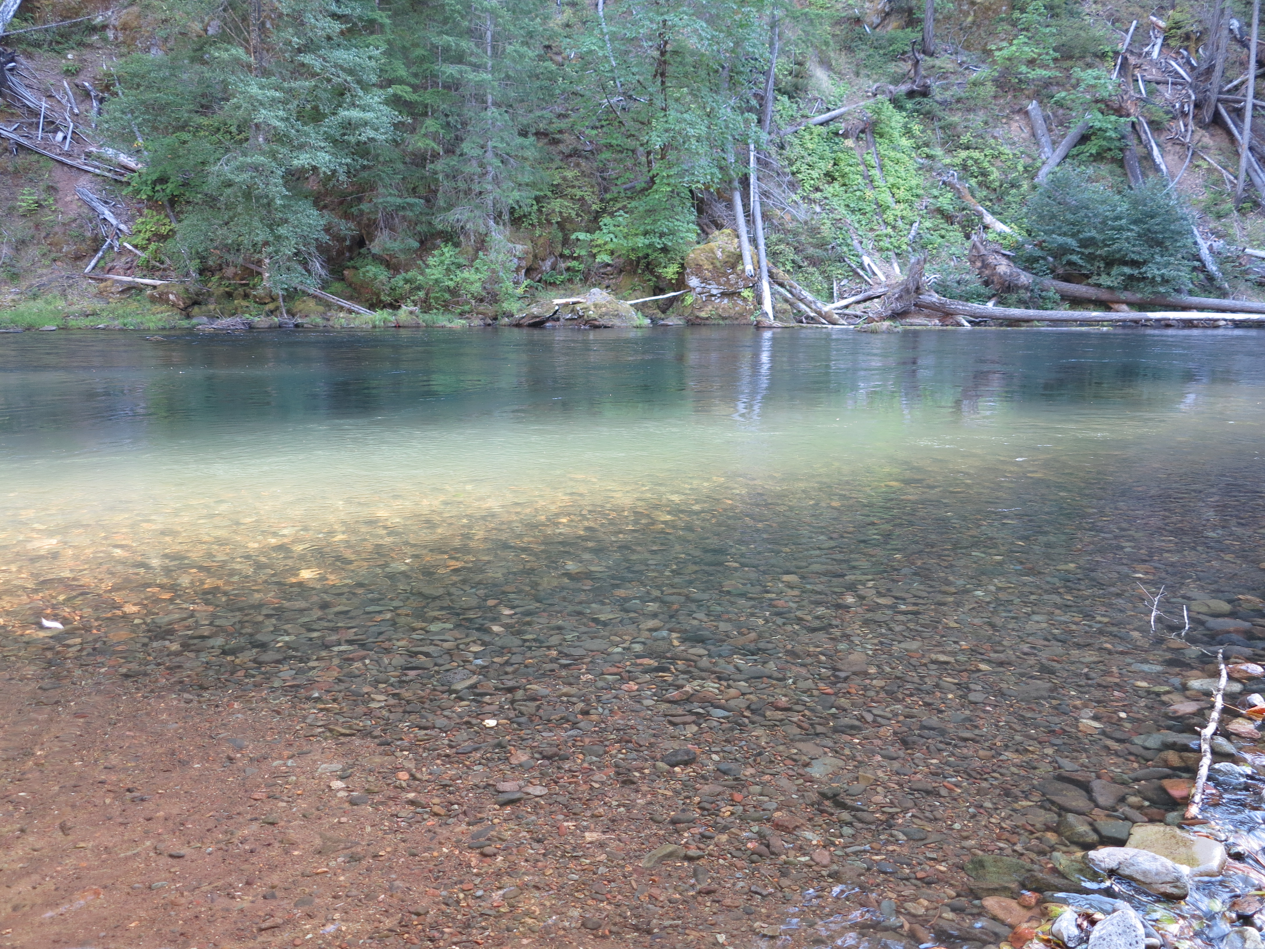
Very cold water, by my standards.
Another daily ritual: Everyday, after the ride, Oliver, Monika, Christian and I would walk down to the Umpqua for a very cold but energizing swim.
Ice cream anyone?
Very civilized riding. Included ice cream stops.
But what made this trip important, in retrospective, is that by late December I learned Oliver was diagnosed with Multiple Myeloma, something he discovered after suffering from renal problems for a little while. It is a blood cancer, generally thought to be incurable but highly treatable and remission possible. The bad news is that he will not be riding in 2014, which made me look back at the 2013 ride and associate a more special meaning to it. The good news is that Oliver is reacting positively to the treatment. Although he can’t travel in 2014, it looks like he will be back to ride with us in 2015.
Left to right: Oliver, Cesar and Christian, September 2013
I’m considering Oliver’s situation as just a blip on the radar, as remission is not an impossible scenario to his condition, and with treatments getting better and better the prognosis becomes more and more positive, and therefore I look forward to riding with him in the future. But it serves me as a reminder. We will all go one day, one way or the other. Every moment counts, and to me it is the best incentive to always see the best on everyone and everything. I’ve learned to never take anything or anyone for granted, but I’m crawling in terms of always making it happen in the moment.
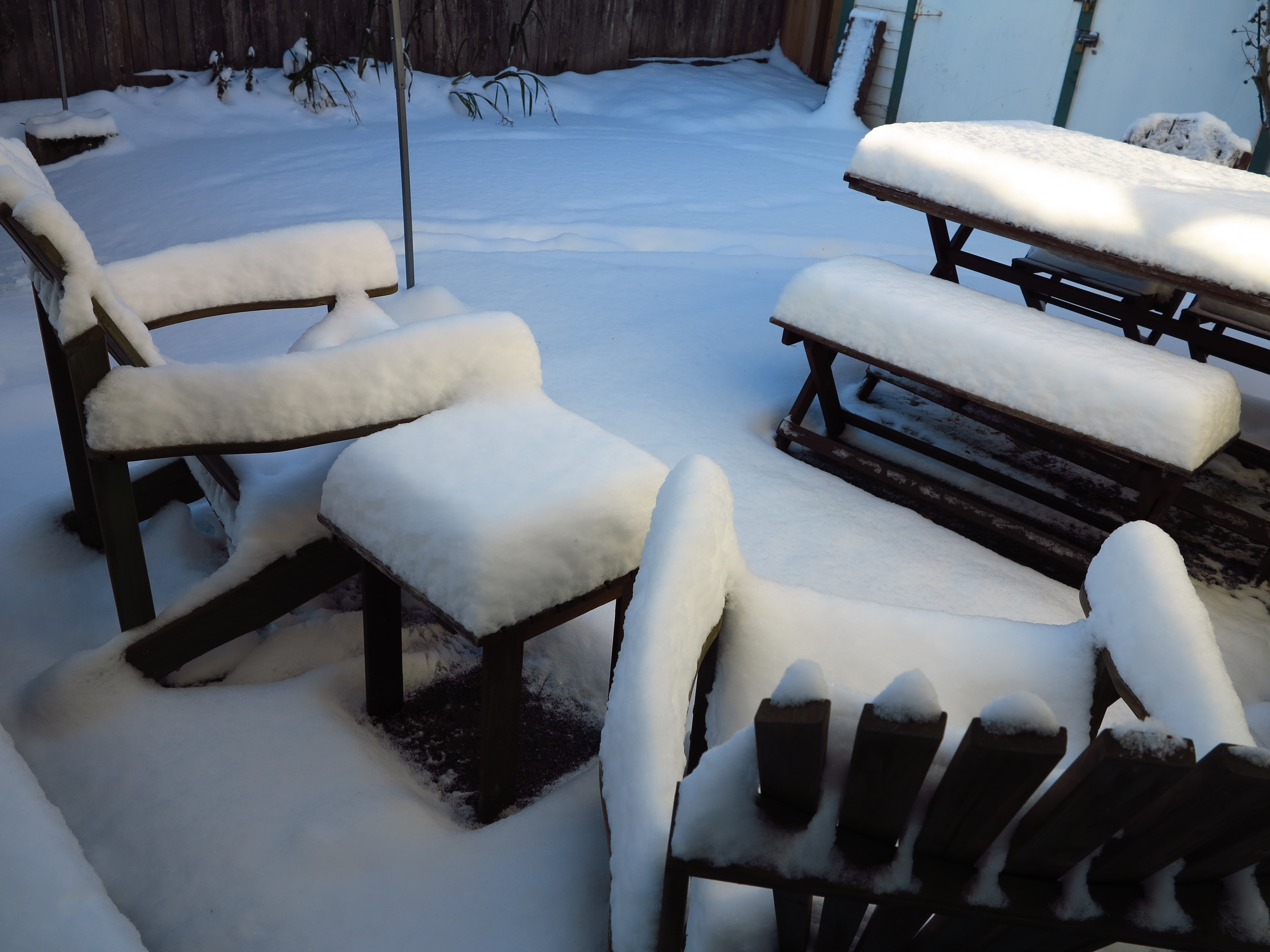
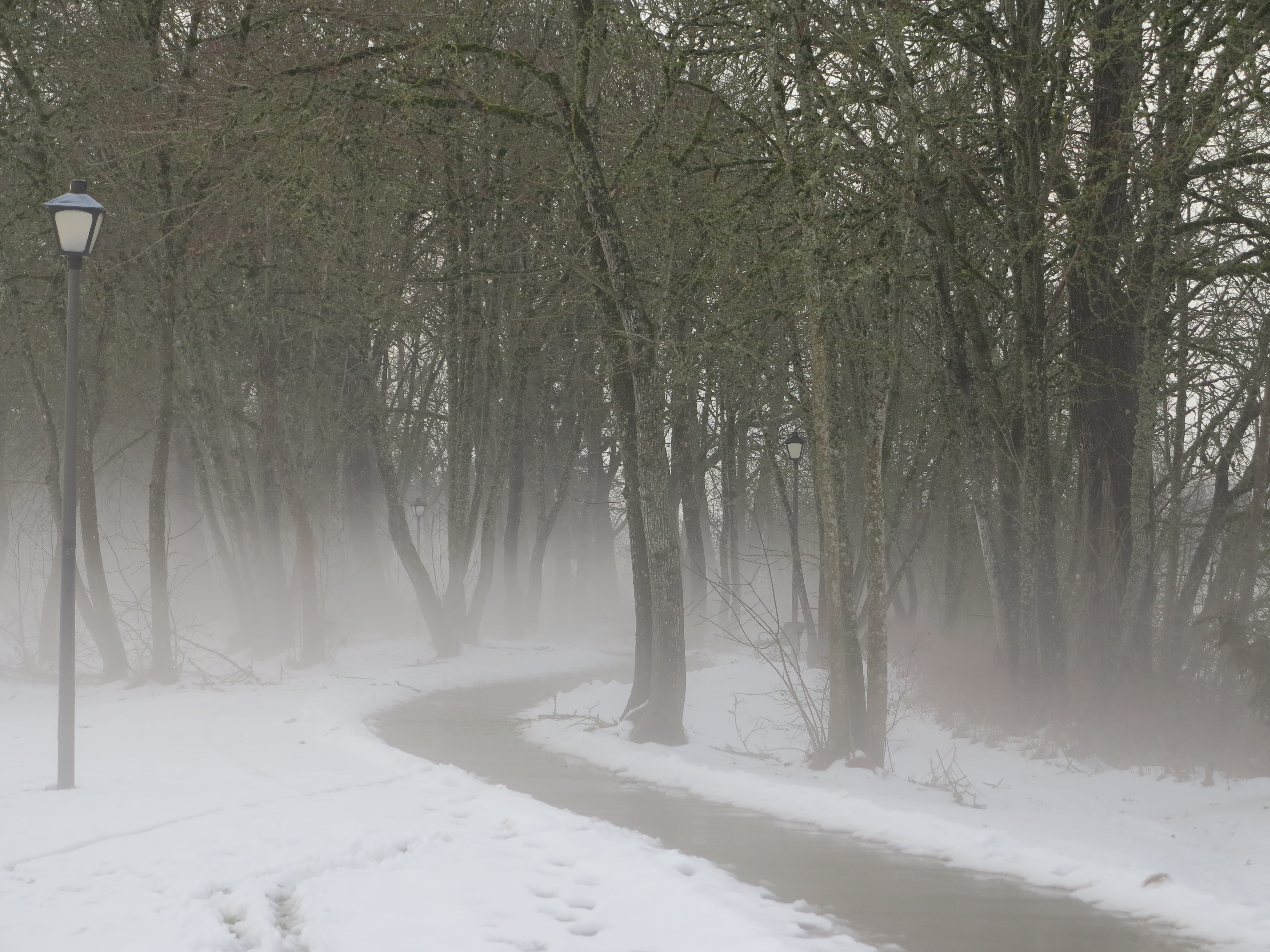
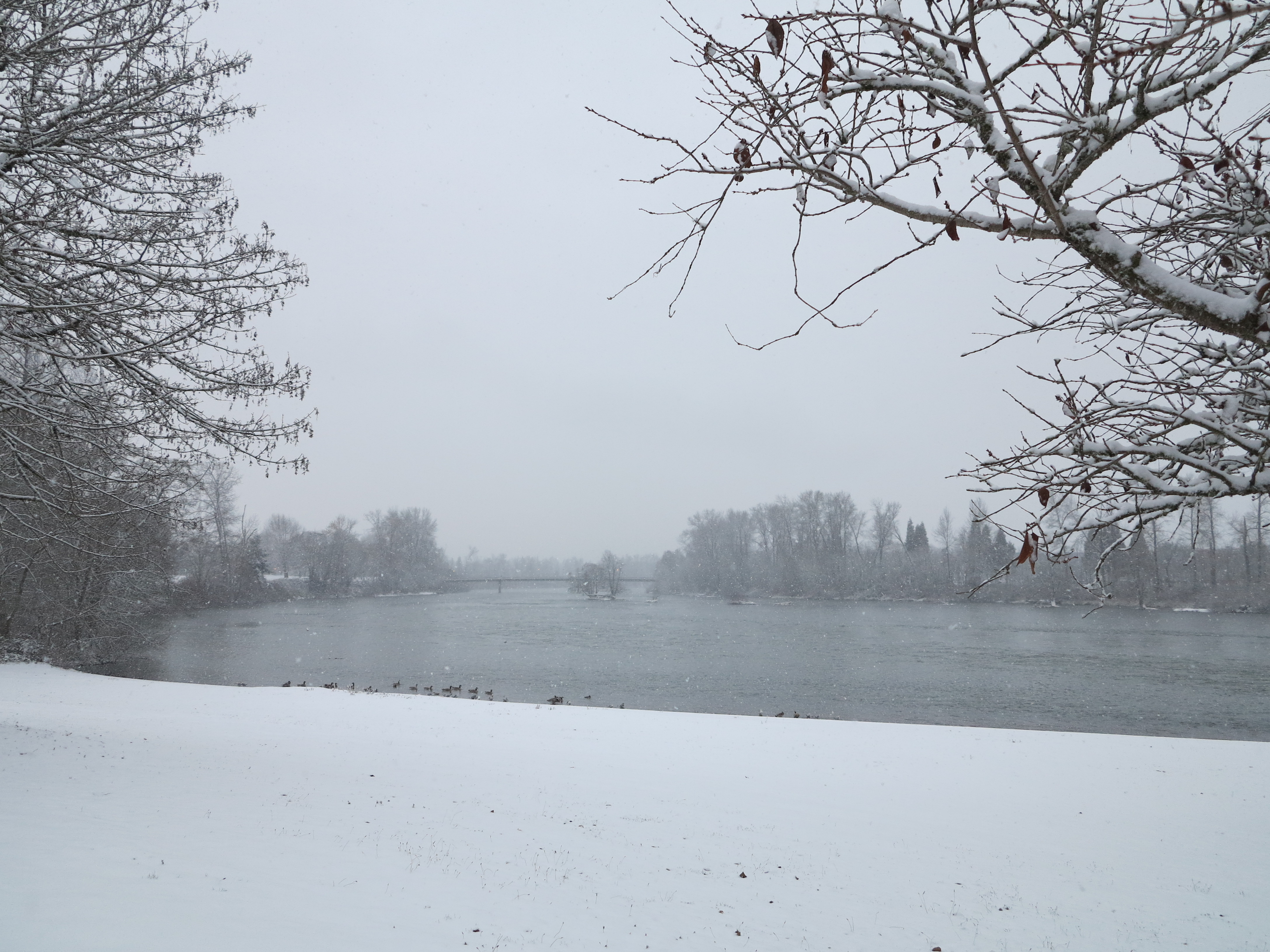
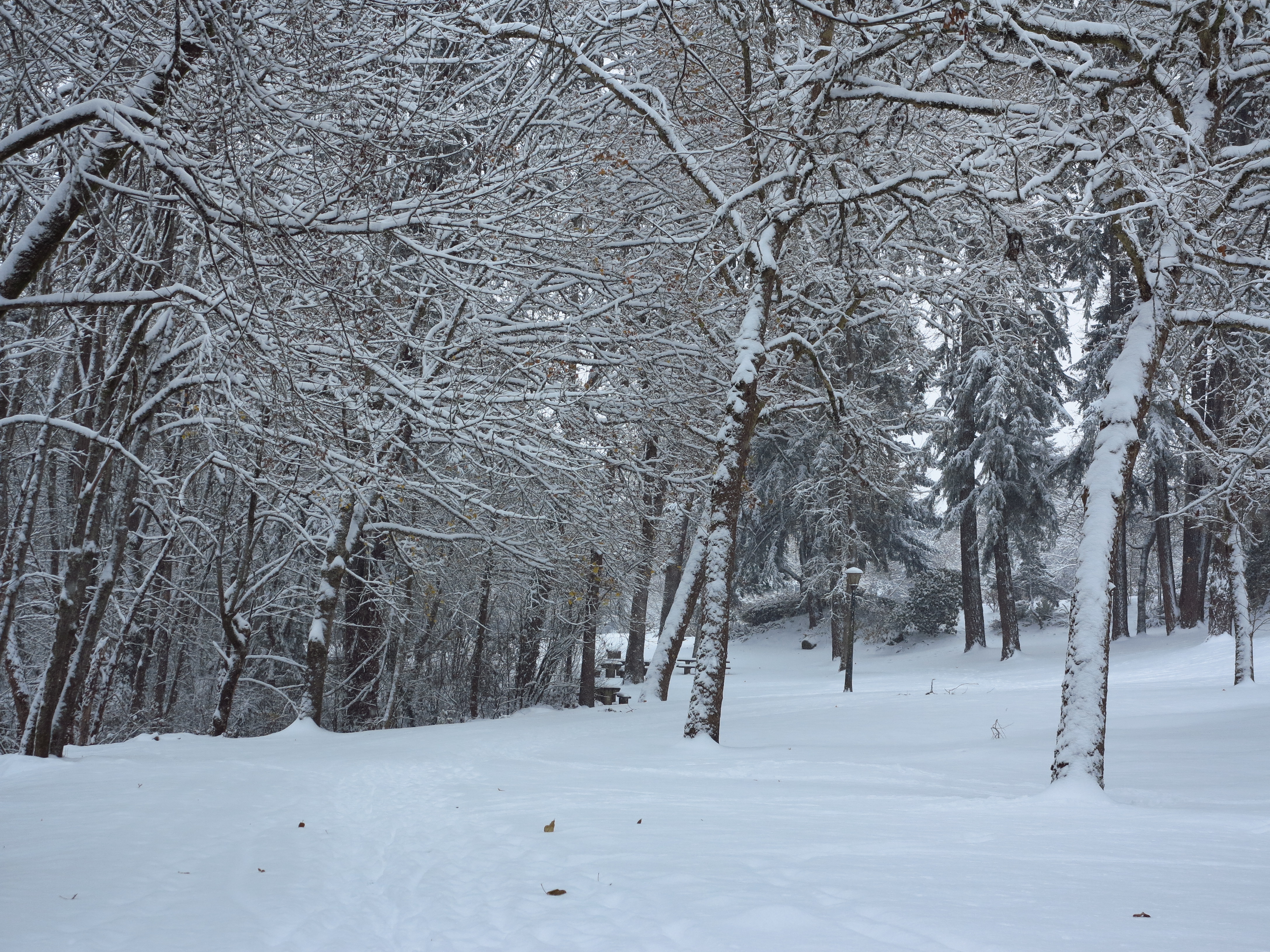
We’re not out of the woods yet, I know, but it is March and Spring’s official start is just around the corner. Around here the last few winters have been dryer and colder than usual, summers warmer, fall rains starting earlier in September. Is this attributable to global warming? Call what you will, things seem to have changed. Just last December we had the “15-year” snow storm in Eugene, affectionately nicknamed the Snowcalypse.
The beginning of the December 2013 Snowcalypse. It was more than 6 inches of snow when it was all done.
It is a clever nickname when we know “apocalypse”, translated literally from Greek, means disclosure of knowledge. Was it something about that storm we should know about? A sign of things to come? We don’t want to really know what is going on, right? Let’s go find in the history of the region examples of similar weather patterns and rest our consciousness.
December 2013 Snowcalypse
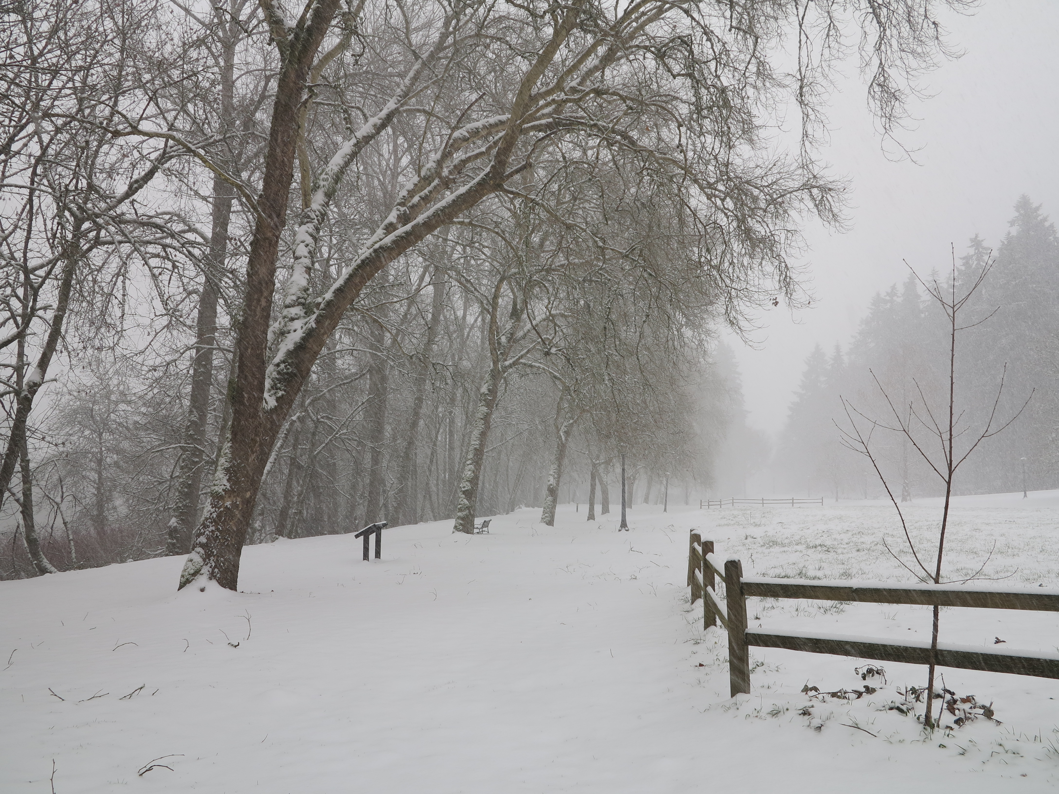
And then in February we got another “15 year” storm. Should it be then called the 60-day storm? Snowcalypse II?
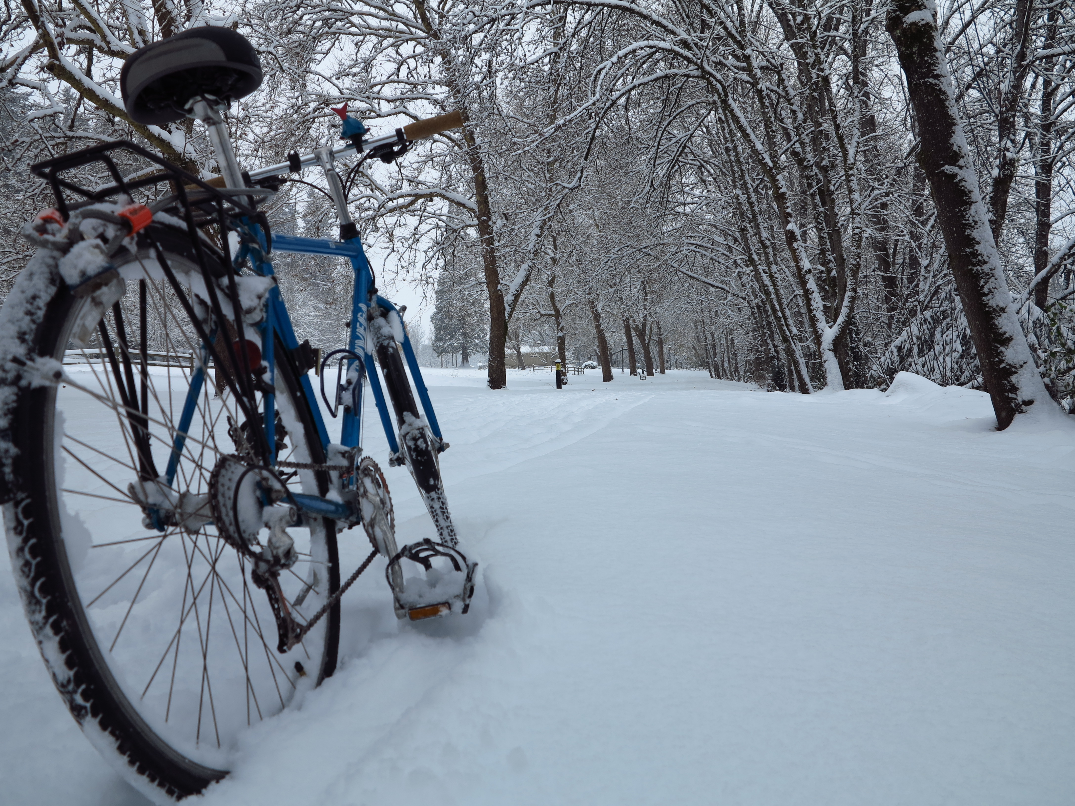
The February 2014 Snowcalypse II (or the 60-day storm)
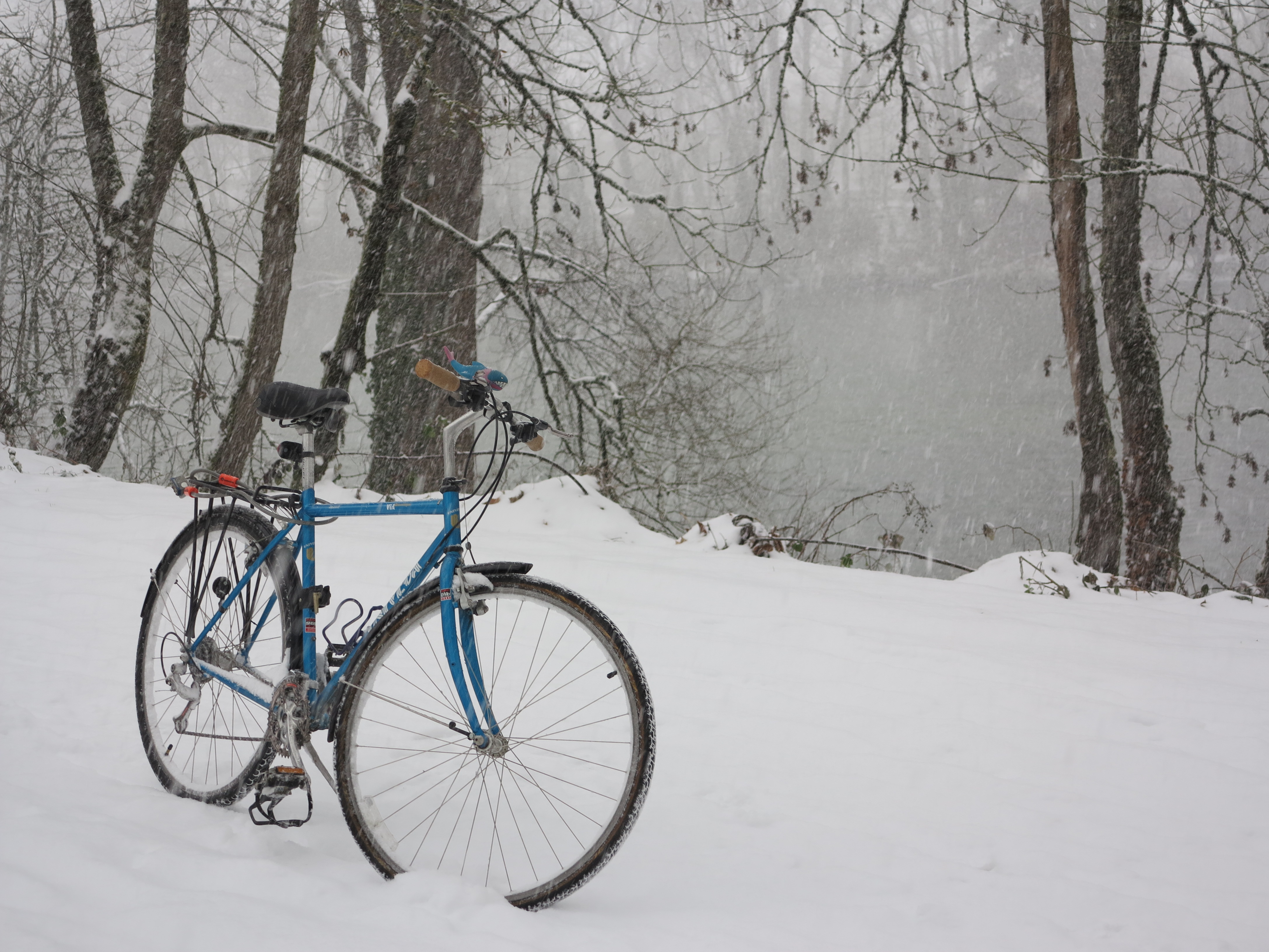
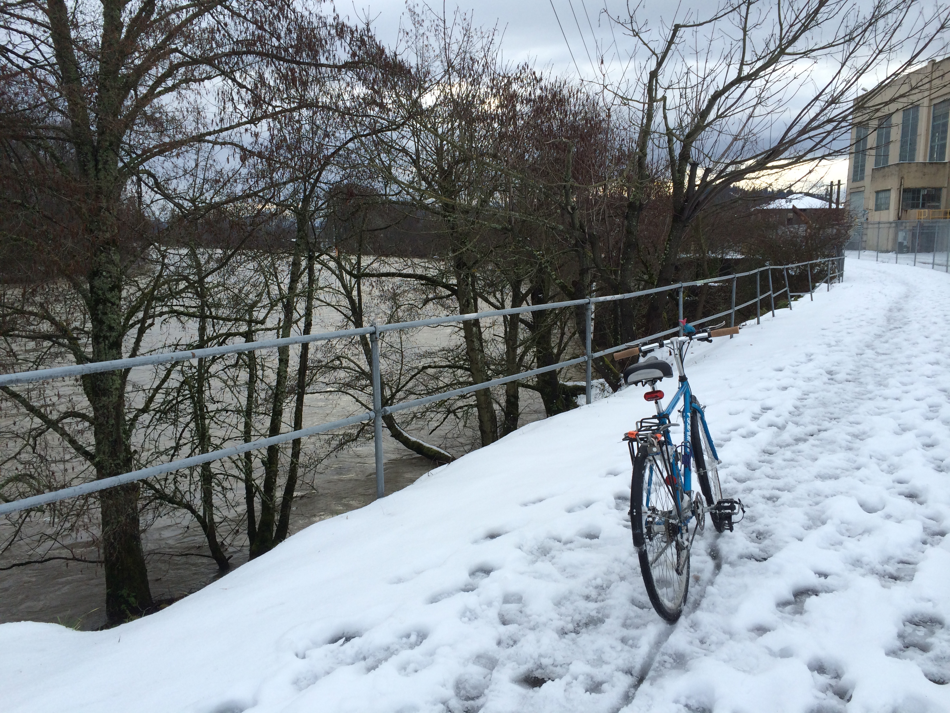
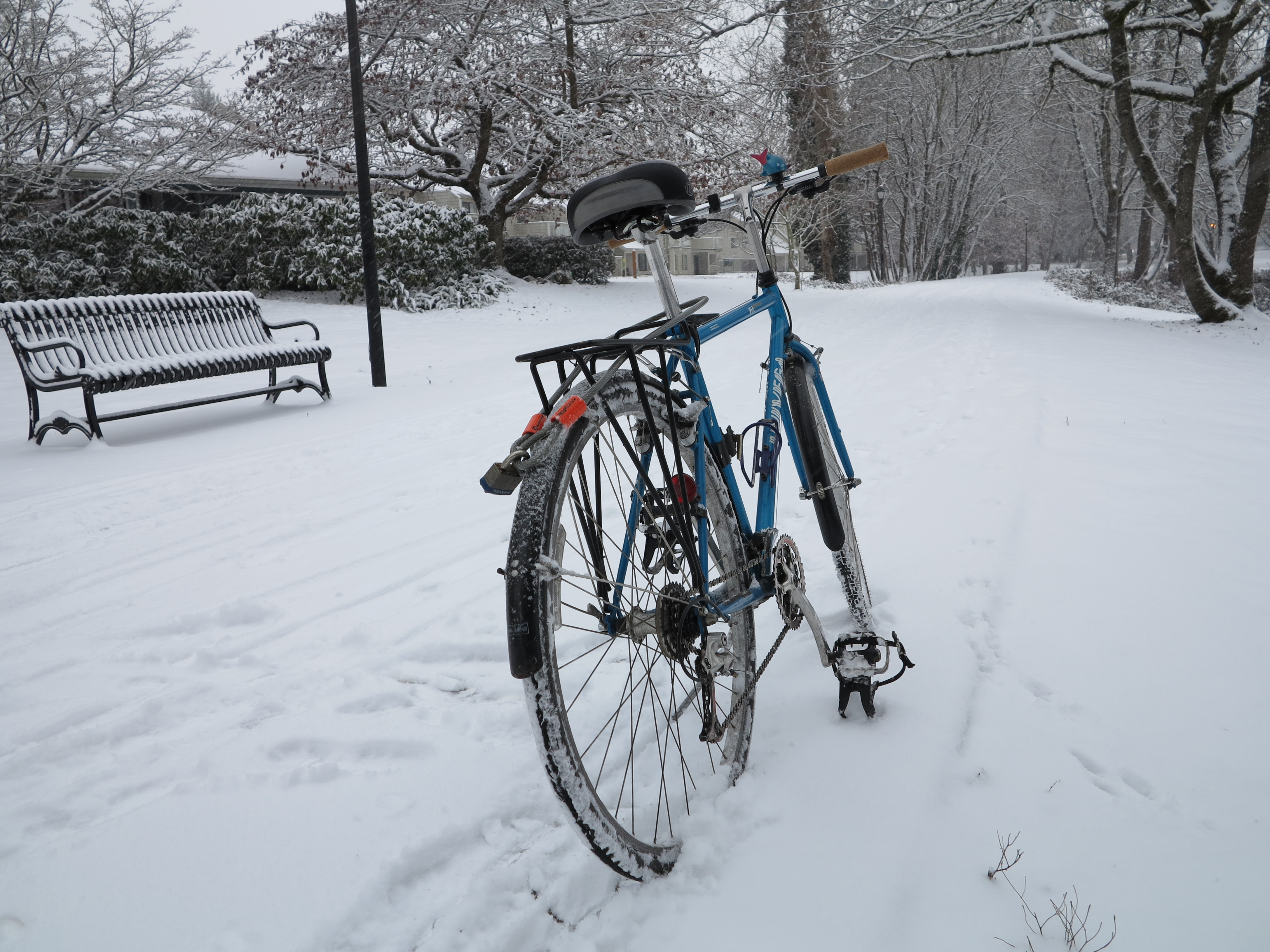
Anyway, life goes on and I have to go to work every day, so I had some fun with the snow storms as I continued with my quest to reduce my carbon footprint, snow storm or not, rain or shine, I go by bicycle to work. The walk and bus alternative was out of consideration, riding in the snow is a lot more fun.
The bicycle and the snowstorm, February 2014
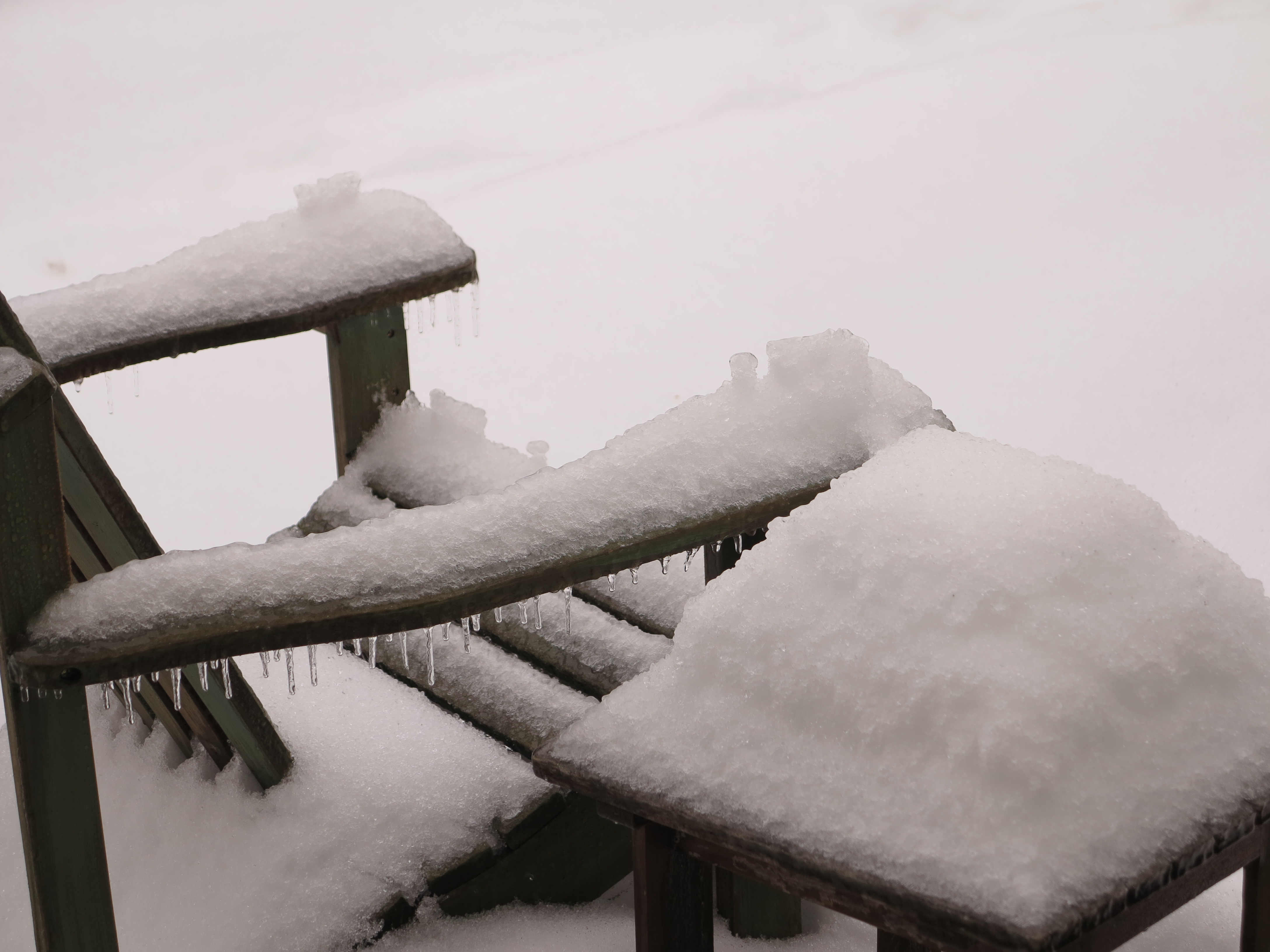
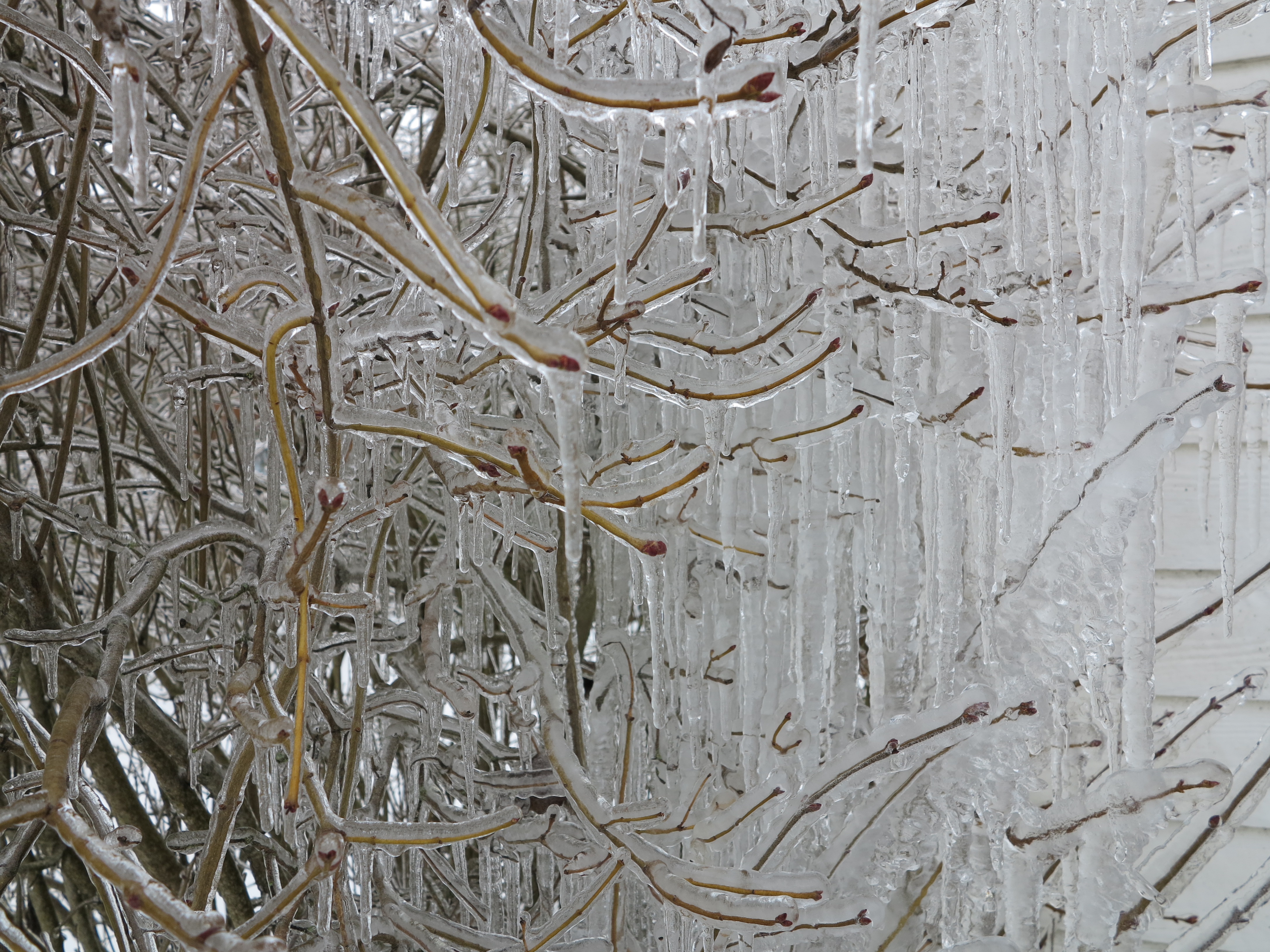
But this latest snow storm brought more extreme scenarios with it. It was wetter snow, then it got cold, then a few days later there was an ice rain.
Snow, then ice, then cold. February 2014
After the ice storm, electricity went out for several hours. With no power I had a great evening semi isolated from the world, slept in the couch in front of the wood stove, had a nice dinner of freeze-dried food “cooked” (boiled the water to prepare the food) with the Jetboil, charged my smart phone in the car’s 12V outlet, but mostly enjoyed no computer access, and the silence afforded by no car traffic and muted appliances. And when it finally rained and the mess got cleared, several days had passed. To summarize, we got some beautiful views of snow and ice…
Ice “water fall” from a snow clogged gutter
.
.The long melting process
.
I still live on the wrong side of the tracks
.
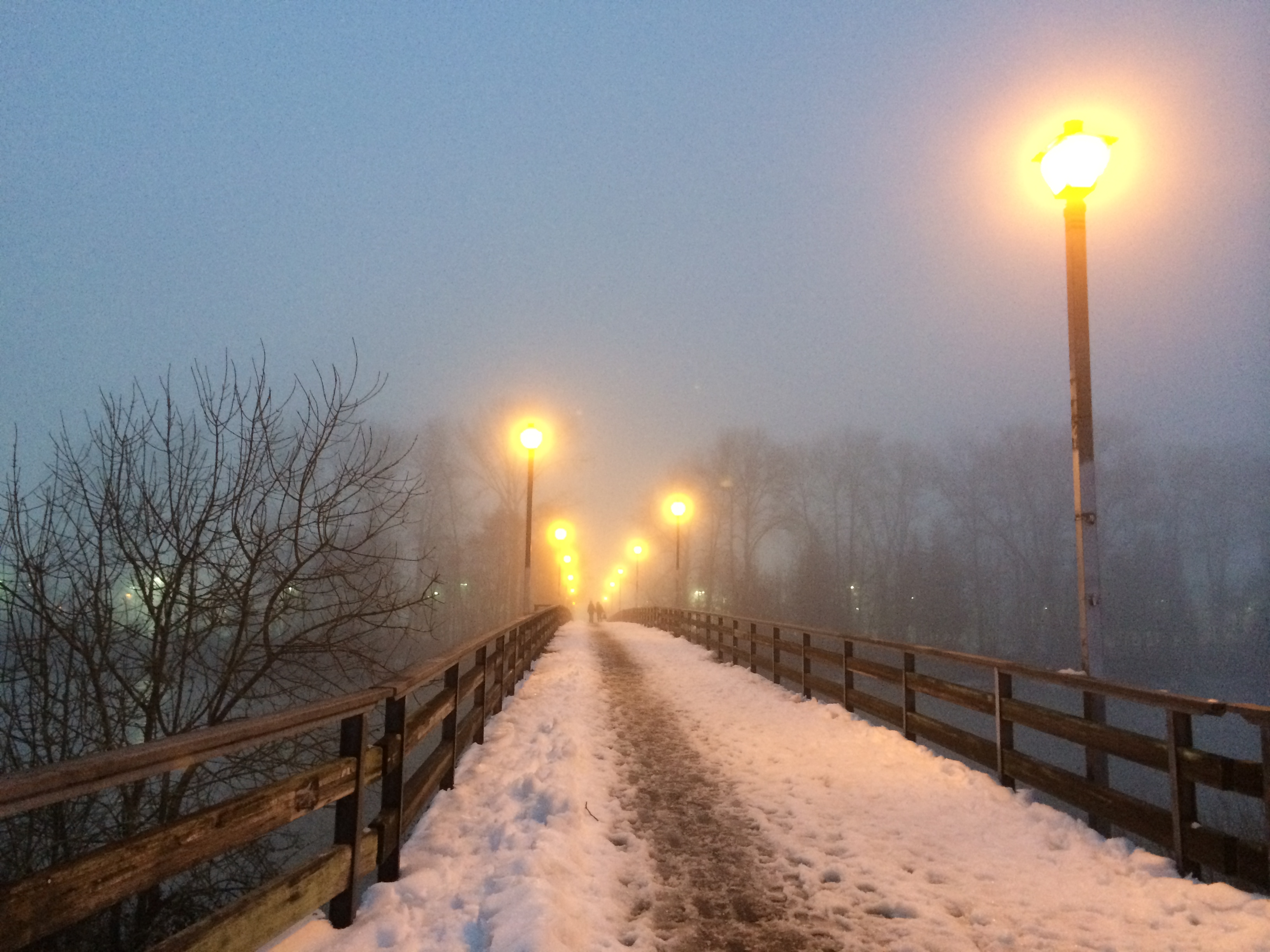
Pedestrian bridge over Willamette River
.
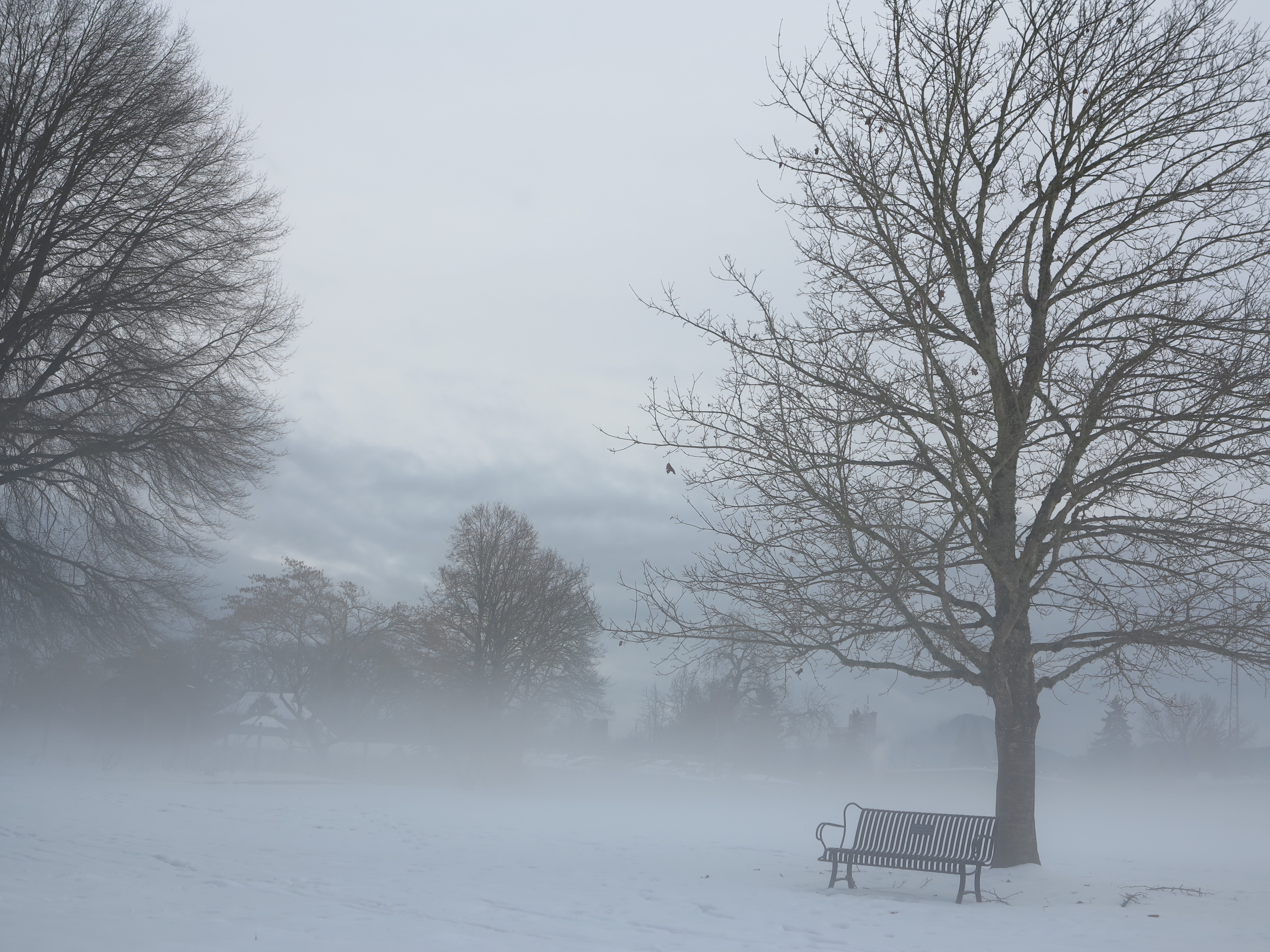
Beautiful views
.
In some areas the bike path was cleared
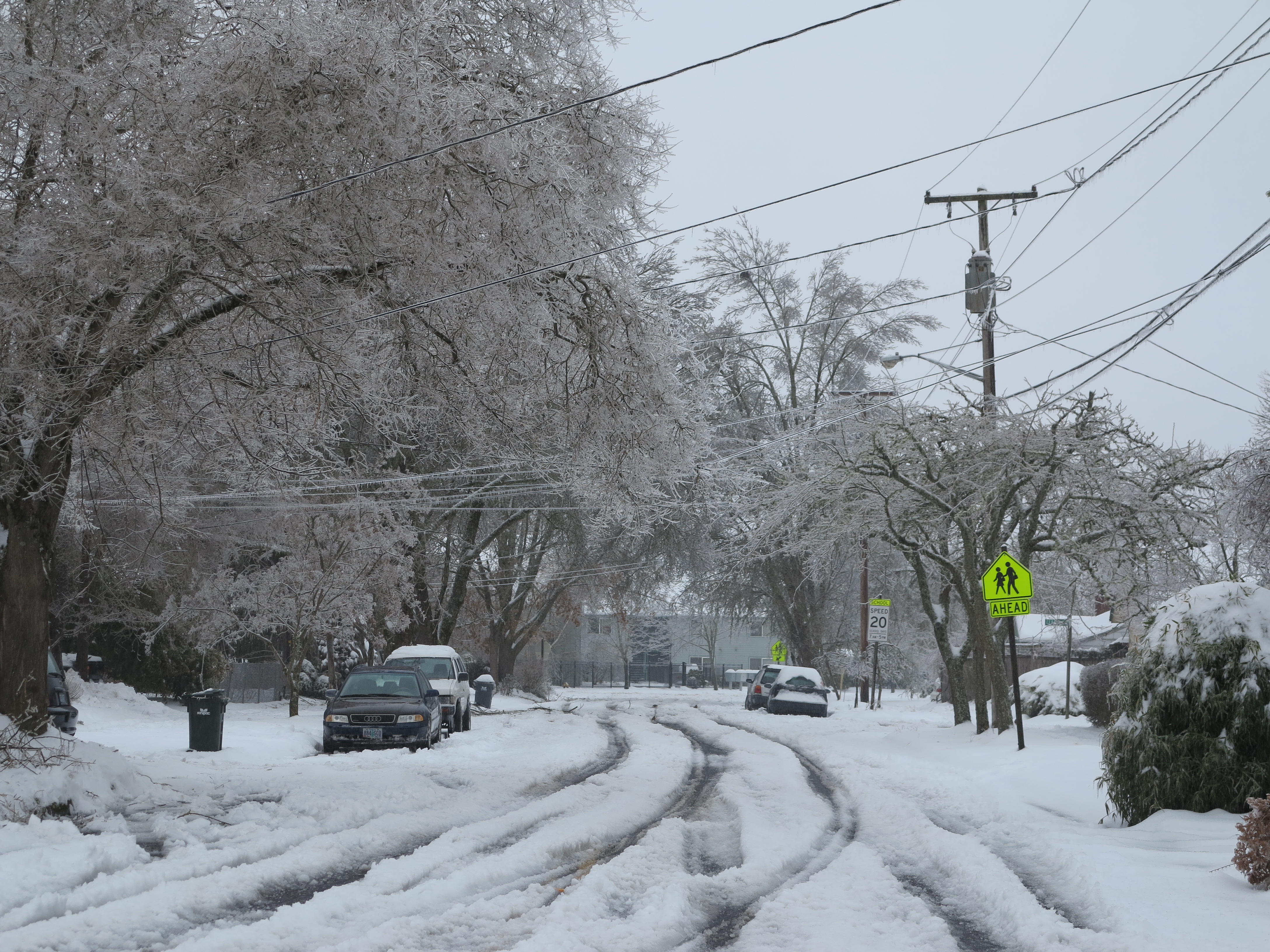
The University canceled its non-essential activities for a couple of days, something very rare to happen around these parts, and all along I continued to commute to work by bicycle. The storm started Thursday evening, escalated with more snow by Friday. I rode my bicycle back home Friday on the roads, with cars, since the paths were too deep in snow. The ice-storm happened on Saturday. By far, the worse day for riding my bicycle was the following Monday, when the snow was hardened by some ice and then rain on top of it. Traction was poor enough that I had to walk the bike on several areas. It was quite the work out.
Most difficult day to ride my bicycle to work.
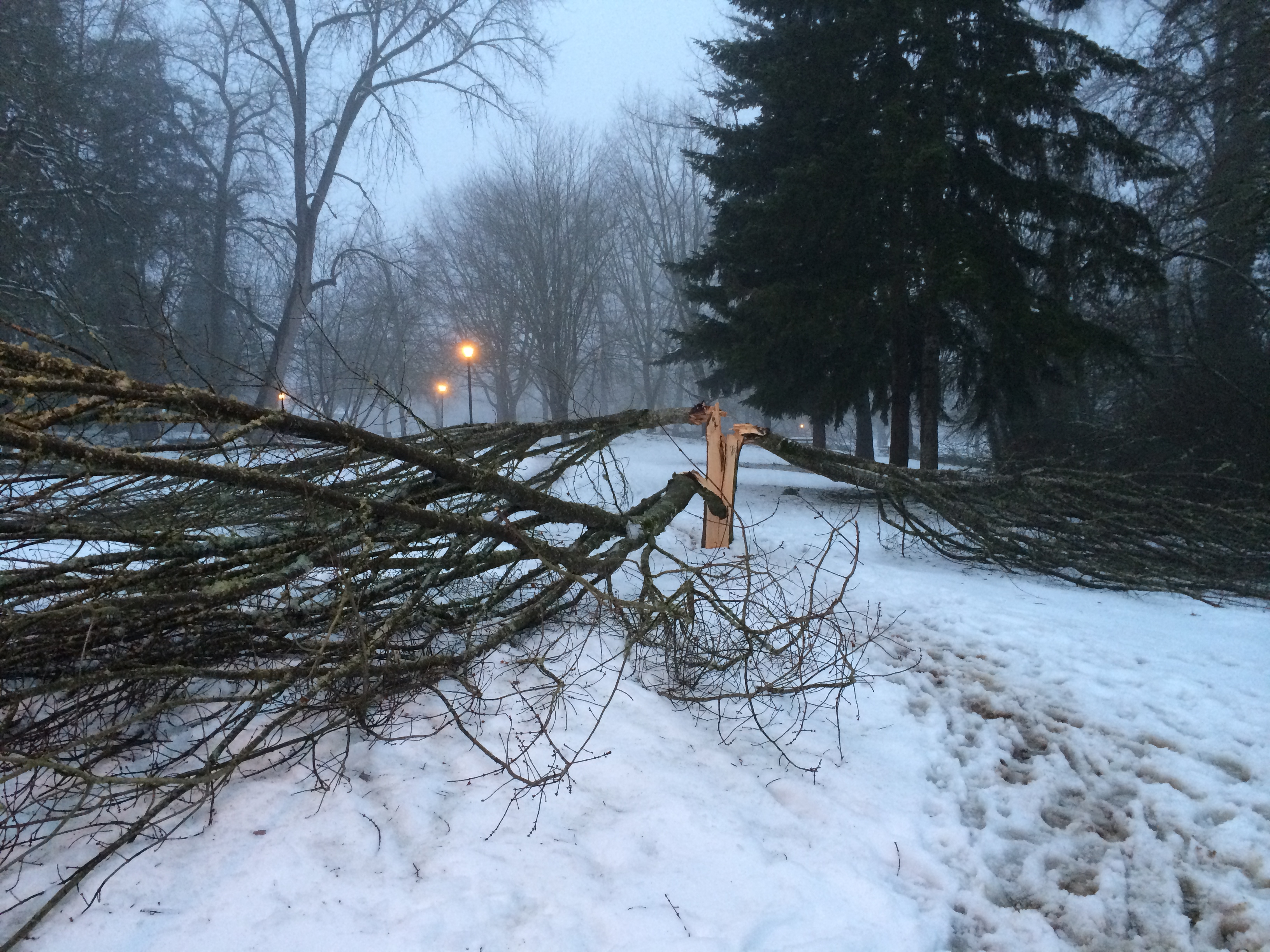
But it was not all fun and games. The trees took a tremendous beating. The unusual aspects of the storm, with heavy wet snow, following by ice, weighted branches of trees throughout the area. Many trees were heavily damaged.
This is just one of the many trees damaged by the February 2014 snow storm
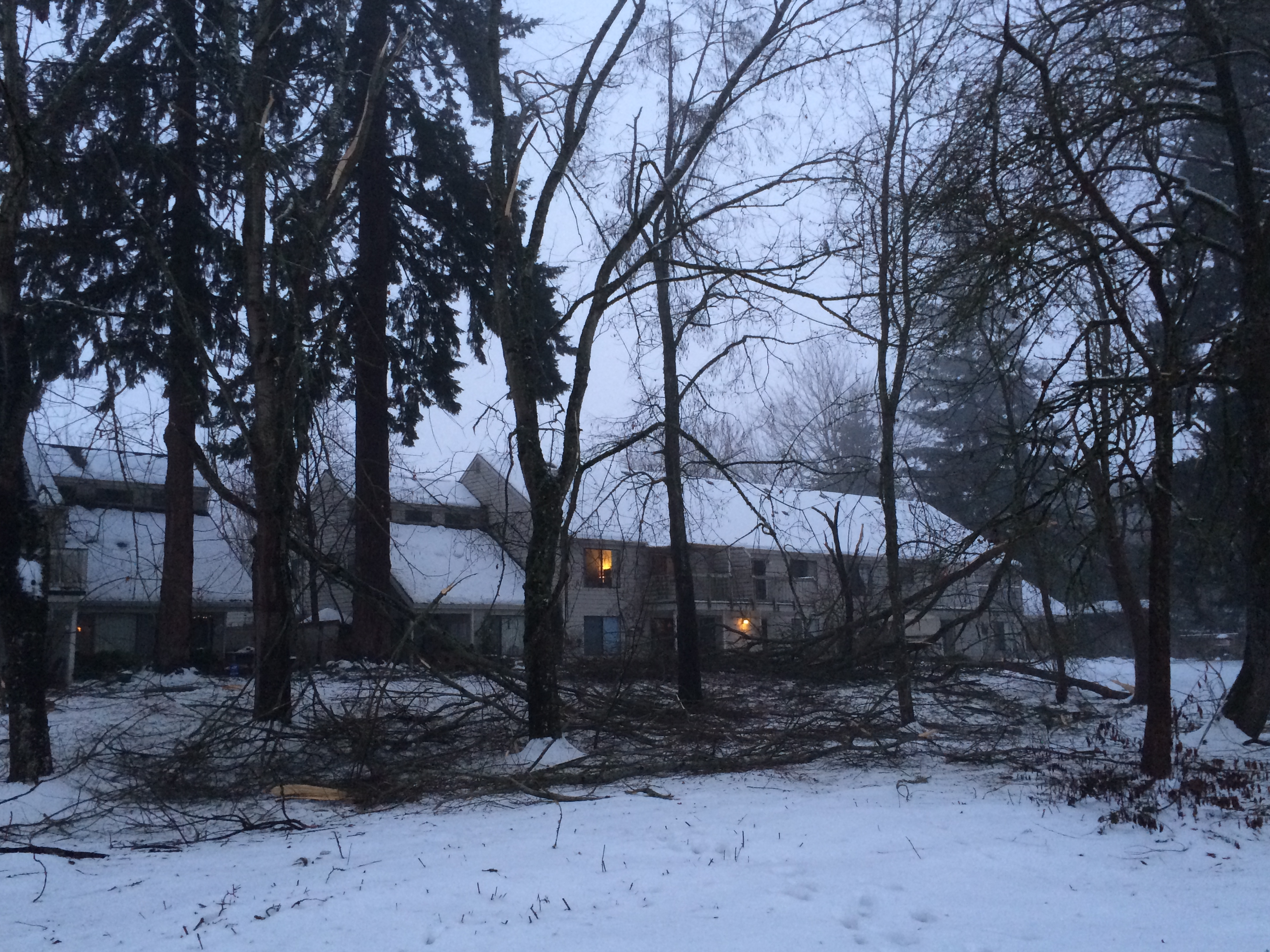
Other trees had minor damage only, but the damage was pervasive.
Minor tree branches on the ground, throughout the area.
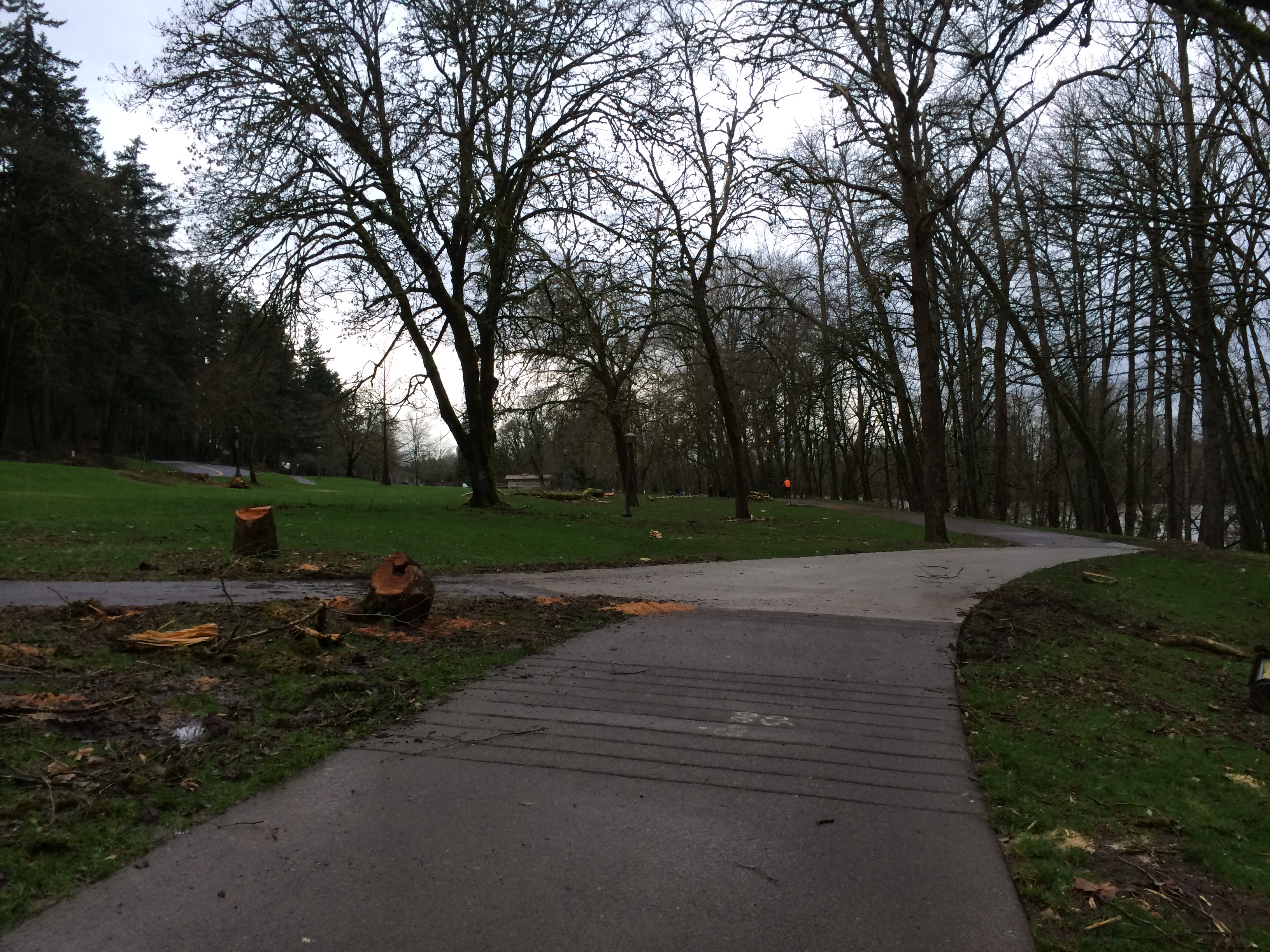
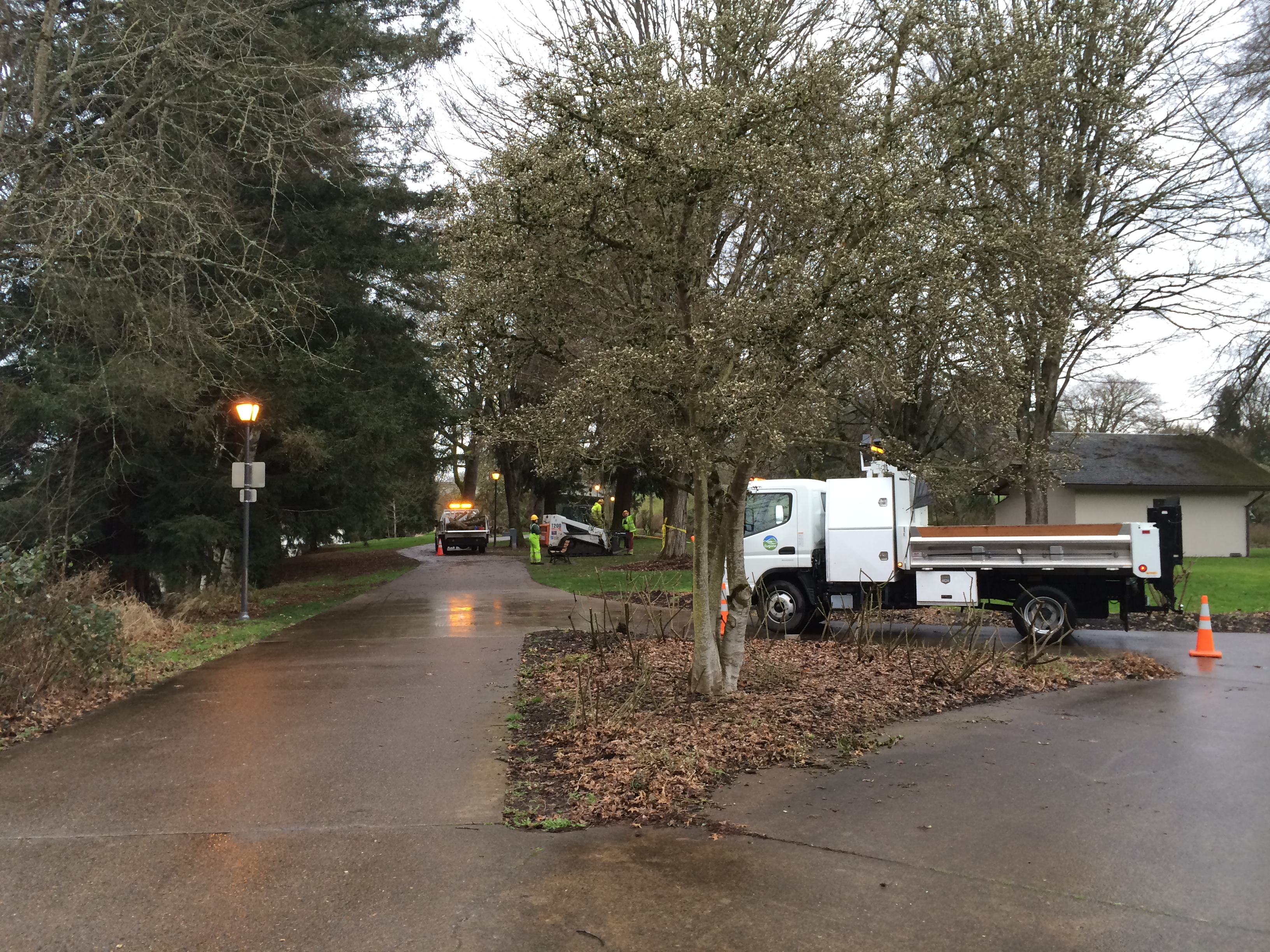
It took a couple of weeks for arborists to clear the area of fallen branches and damaged trees.
Several heavily damaged trees were cut
.
Crews cleaning up the trails
Well, that is all in the past, part of our history now. But it perhaps is our new history (can history be “new”?). On the other hand, Spring is just around the corner and I will soon selfishly indulge in my motorcycle riding. As I publish this, I have already gone riding twice. Before I post my first rides of the year l will post one remaining, unreported ride from last year.
I like to complete my stories, and this report of my September 2013 trip to the Steens Mountain got side tracked and I never wrote its last chapter. Among other stories already published after my last 2013 Steens post, I had started writing about that United Airlines press release of November and got over my head trying to make sense of what I was trying to convey. It reminded me of the penurious times I spent as a graduate student. Distractions also came from trips to Brazil, then Hawaii, then there was the general laziness from the end of year break and celebrations. Time to get back on track! Therefore I decided to put the United story aside and take care of the riding stories that have been waiting to be completed.
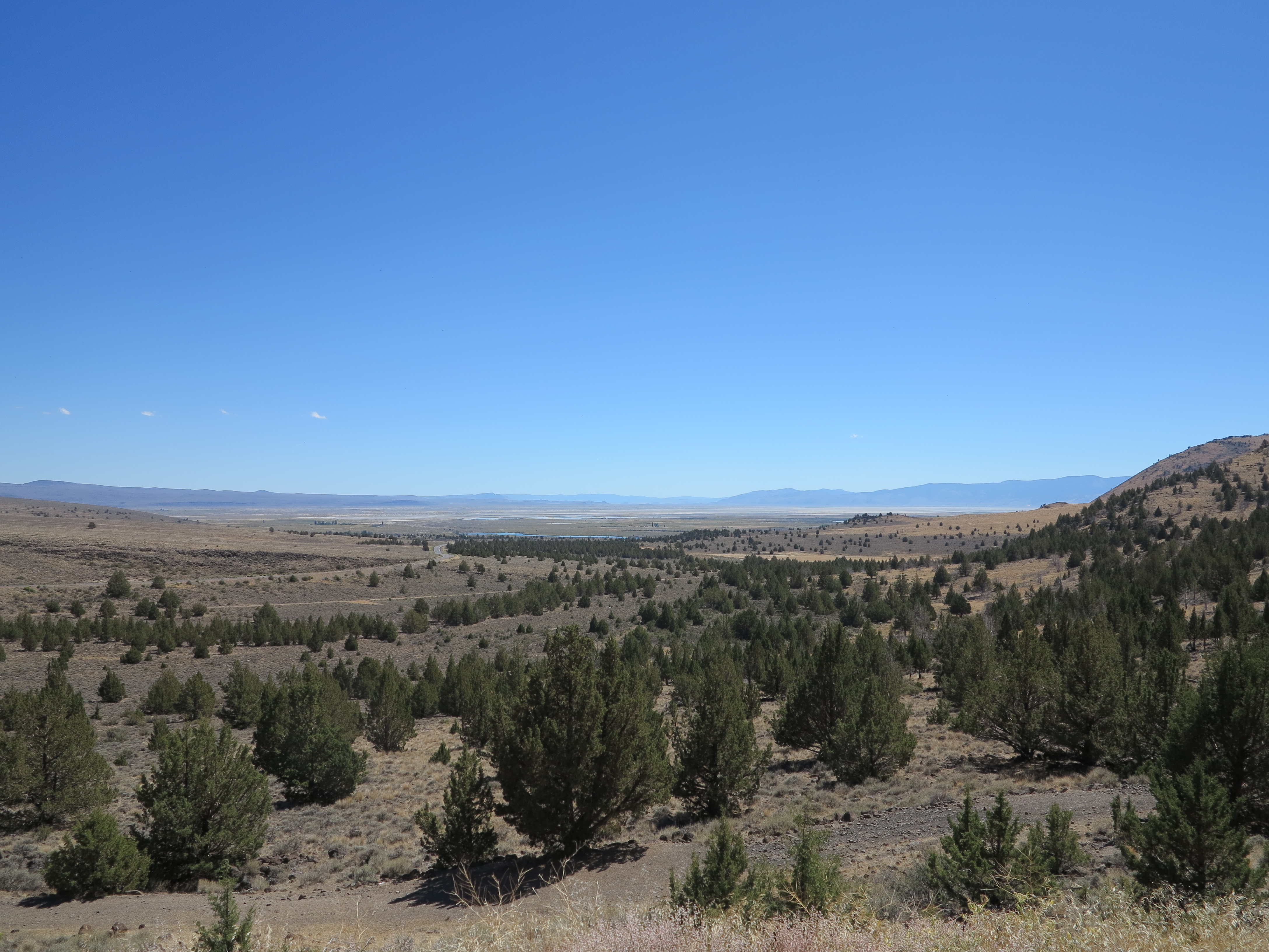
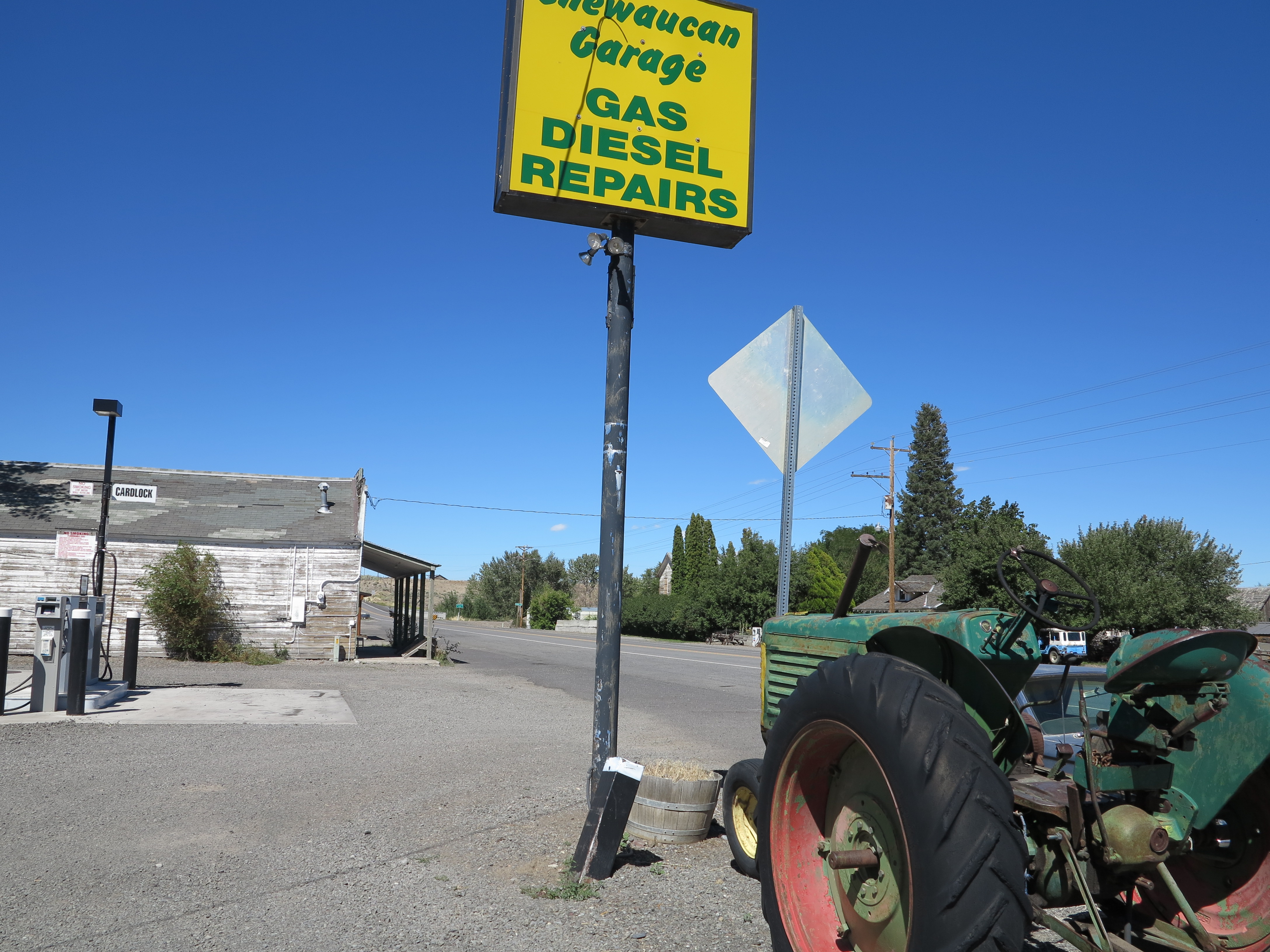
Chewacan River at the Marsters campground, near Paisley
On my last post about this trip, I reported we had camped in the Marsters Campground near Paisley on our way back from the Steens. Here is where the story continues.
I woke up in the morning and as I was setting the bike up I noticed the bark busters were getting lose on the bar ends. This bike is great, but it really shakes everything and anything lose on long road rides. But then, this is all the maintenance this bike needs besides oil changes, air filter cleaning, and tire changes every now and then.
Time to tighten some fasteners
We had breakfast at the same restaurant in Paisley. Looking at these sunny pictures of September last year, and I’m already dreaming of good riding days again.
Sunny days… Paisley in September, 2013
We split our ways here. Doug and Annie went their way. Chris and I found our way back north. We would be riding together for a while, then I was going home and back to work, Chris would continue riding for a couple more days before returning to Eugene, timing to arrive in Eugene just before his brother arrived from Switzerland to reclaim the bike (the F800GS belongs to Oliver, Chris’ brother). We decided to ride the dirt roads on the range of mountains, called Winter Ridge, that parallels Hwy 31st, south to north, alongside the length of Summer Lake. The ridge starts just north of Paisley, climbs steeply from there. Very quickly we already had a panoramic view of this small town.
Paisley viewed from the south end of the Winter Ridge. September 2013
We continued north, encountering some hamburgers and steaks along the way. The roads were very smooth gravel. Besides the cattle, I also saw a big cat crossing the road just in front of me at high speed. I had my GoPro camera rolling, and I reviewed the footage many times, including in slow motion, and have not been able to see the animal yet. Need a frame by frame editor to see it. It was likely a mountain lion, a big one.
Cattle on the road
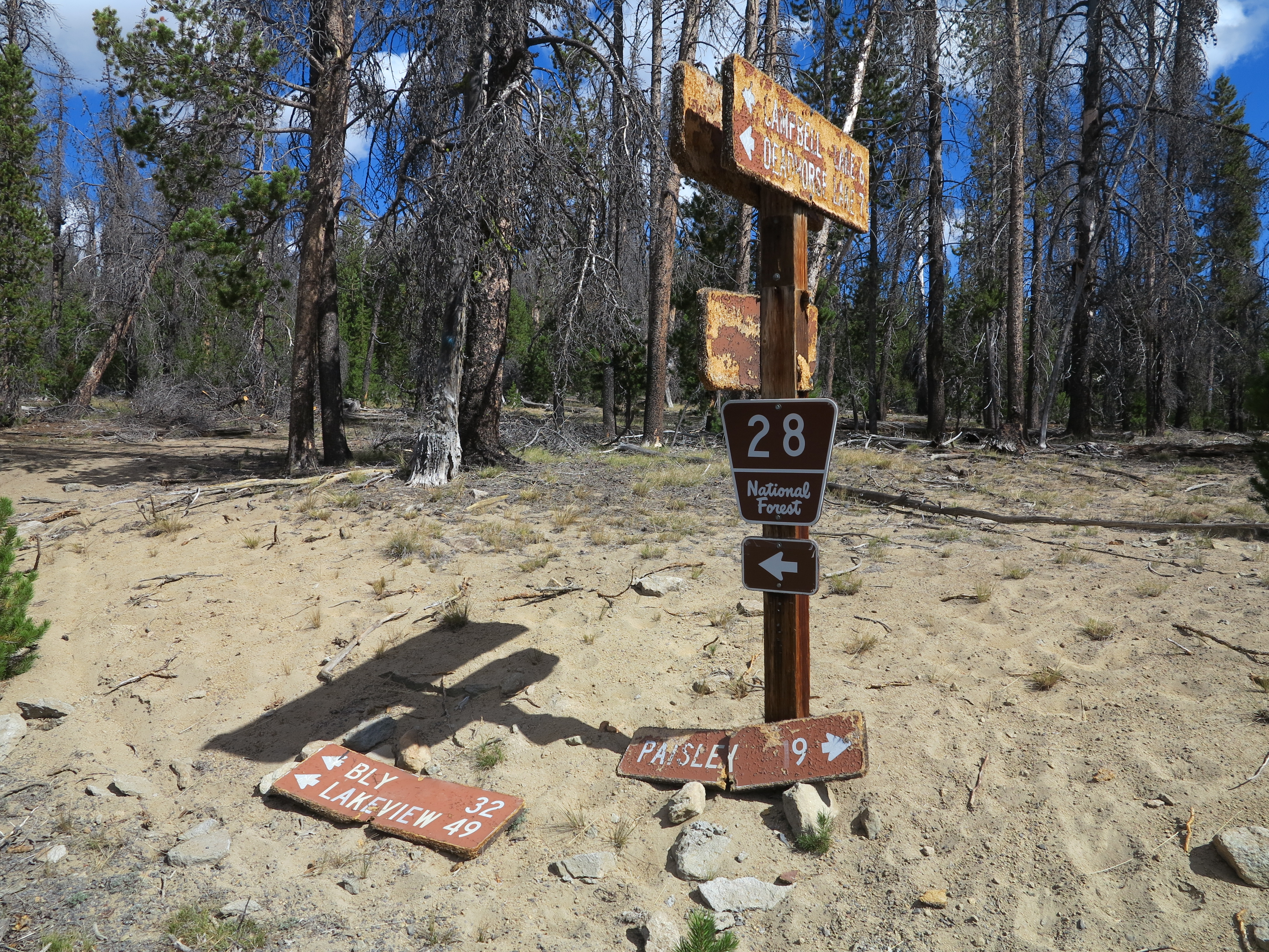
Road signs need some help.
Road signs
We eventually ran into Doug and Annie, as they were also exploring the area. After a few more miles made it to the Fremont view point.
Fremont viewpoint, Summer Lake on the background looking like a dust bowl
Summer Lake was a dust bowl.
Looking to the south, from Fremont Viewpoint, September 2013
Looking to the north.
Looking north from the Fremont Viewpoint
The bikes: very good, trouble-free machines.
Great machines.
We continued, going down the Winter Ridge at its north end to join Hwy 31.
Going north, and down from the Winter Ridge
Once on Hwy 31 we made a bee-line to Silver Springs. We found some shade under the roof of a former gas station.
Silver Springs, September 2013
We had some refreshments, and met the last of the people still on their way out from the Burning Man event. It was here that Chris and I said our goodbyes. He would continue west. I went north from there, following Hwy 31 to 97 to 58 on my way home.
Silver Springs
The machine made it home once again.
Back Home, September 2013
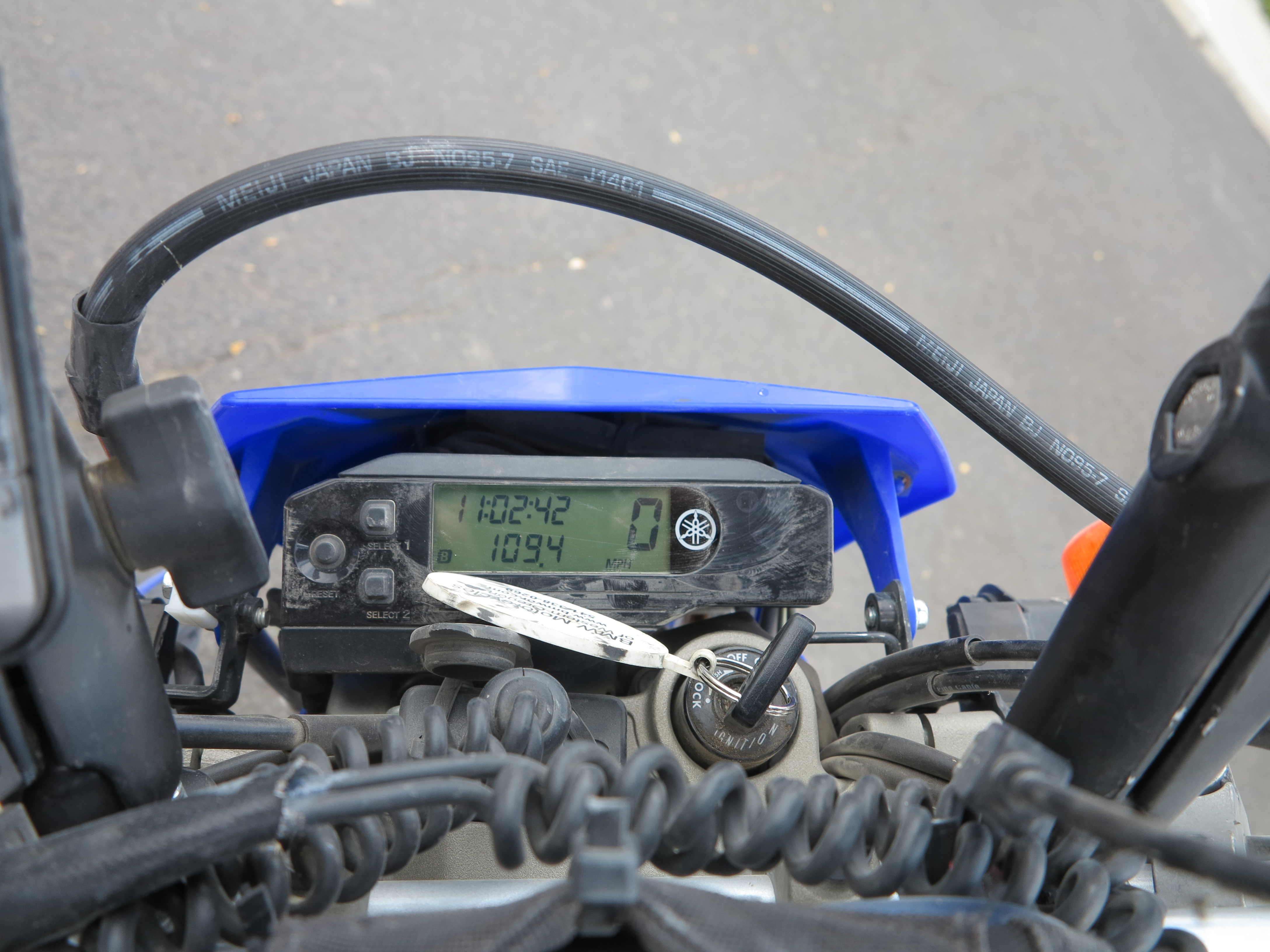
This machine has been flawless. The total distance for this trip was 1,112 miles (the Nuvi shows less miles, and it probably was because it always took longer then the Oregon to acquire satellites on cold starts). And the bike has 7,118 miles on the clock.
1,112 miles.
And the tires, my third set for the rears, well, they probably can last another 1,000 miles or so.
Tires, good for another 1,000 miles, not more than that.
Overall, I continued to be impressed with this little machine. This bikes allows me to ride at speeds on dirt roads, speeds I can’t match when I’m riding larger bikes such as my Tiger 800XC. But at the same time I would like if it did a bit better on pavement or on those gravel highway roads. When winds blow perpendicular to or direct against my direction of travel the little machine struggles. I don’t like trucking or trailering bikes much, I’ve done it in the past a couple of times. It is really nice to ride all the way to the riding spots and back and be more self-sufficient, even with the challenges imposed by the little bike.
The bike, light loads on this trip
For this trip I was not completely self-sufficient as Doug carried on his truck my tent and other camping supplies. I only carried the essentials: tools, spare tubes, extra gasoline, and basic survival supplies (food, water, and cold/rain gear for an overnight stay on the side of the road, should I run into mechanical problems). This made my trip to and from the campsite more fun in terms of the motorcycle’s performance, carrying less of a load.
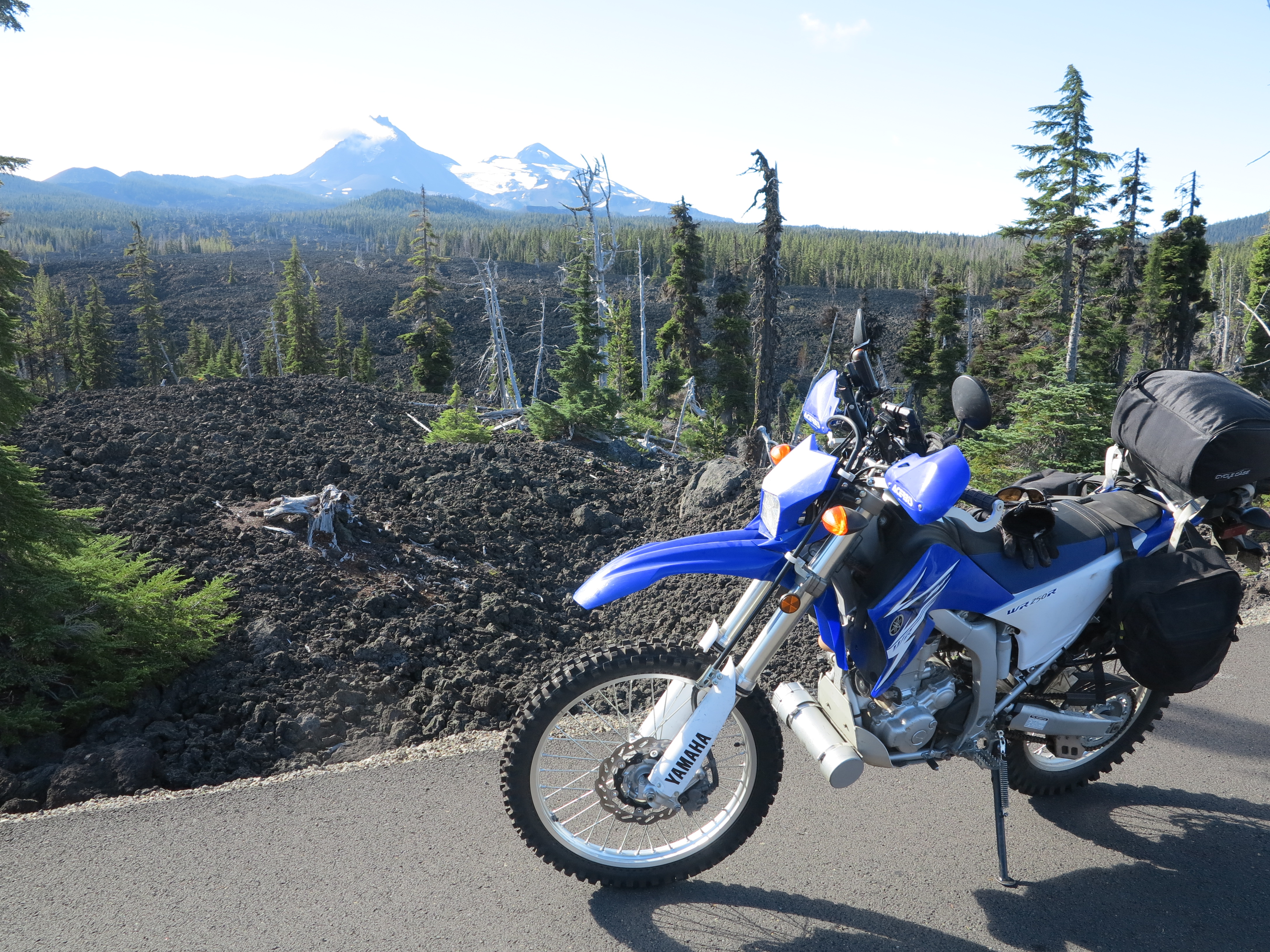
The WR250R and the F800GS. Hogback Road, September 2013
Overall, I was also very impressed by the F800GS. It went everywhere my WR250R went. Although a bit slower, but it was steady and trouble free. Credit goes to Chris’ excellent riding skills, of course. But still, we took some unmaintained side tracks off the Steens Loop and the F800GS did not miss a beat through rocks, sand and ruts. Overall, I left wandering how much better it is than my Tiger 800XC.
Meanwhile, I’m already planning my return to the Steens this coming Summer. Stay tuned.
I haven’t driven a car to work since April of this year. Since then, rain or shine, I’ve been between two options for commuting to work: walk to downtown and take the free-of-charge rapid transit bus to the University; or ride my bicycle on the bike path, which goes along the river for the 3.5 miles from my house to my office. But today I woke up to snow.
Snow in the Willamette valley. December 6th, 2013
So what to do? Of course, let’s take the bicycle. The snow is an obvious challenge, I would not pass the opportunity to ride my bicycle to work in these conditions, where everything will be more interesting, from the ride itself to the landscapes along the way.
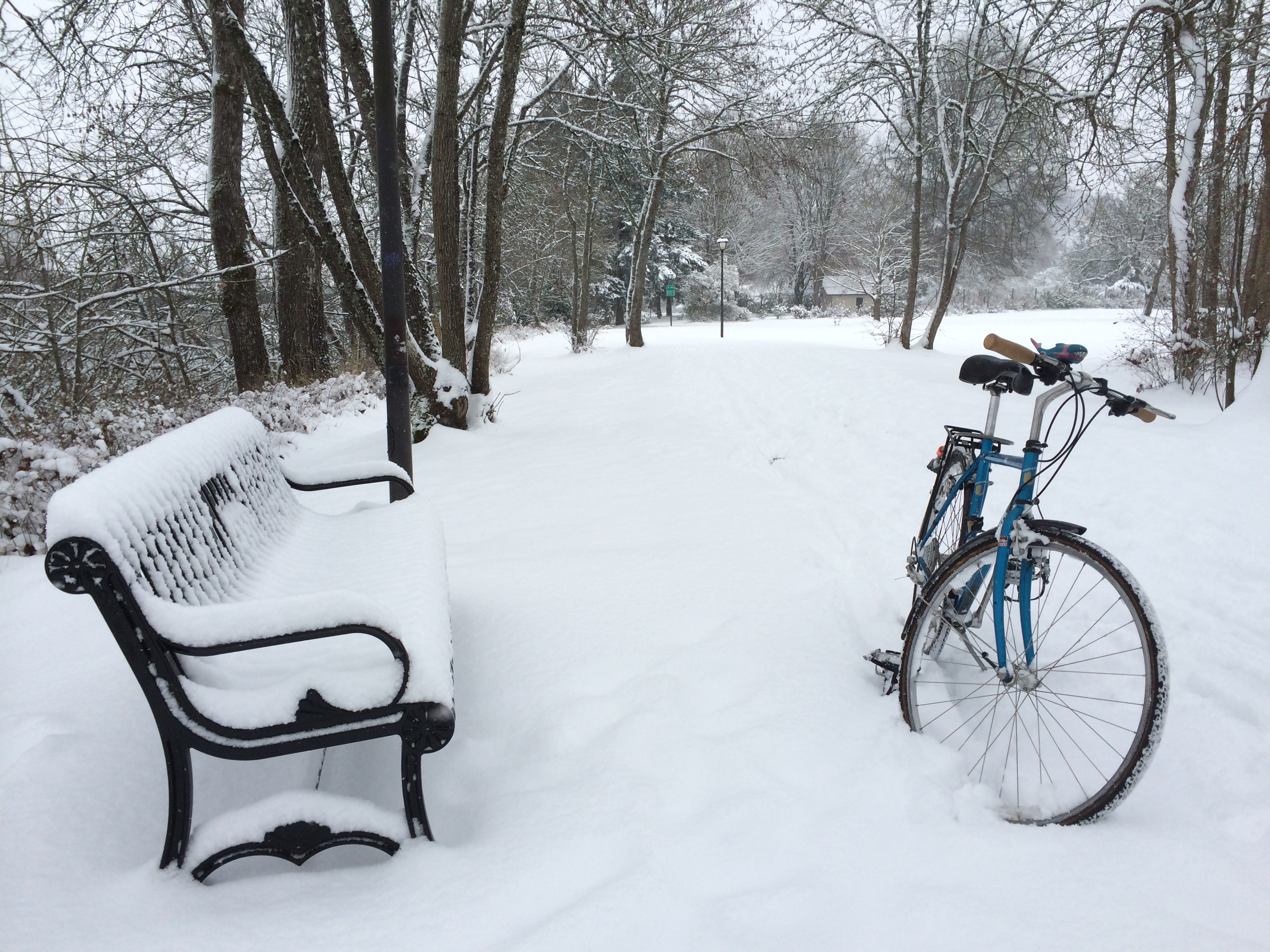
The bicycle and the snow in the bike path. December 6th, 2013
And the bicycle was easier to navigate in the snow than motorcycles are, by a great margin. A few slides here and there, but overall good traction. As long as I kept it going and avoided sudden moves, the bike was really steady, tracked very straight, nothing like the narrow tires carving their way in the snow.
The path had about 3-5 inches of snow.
It was great out there and I was alone for the most part, making it an even better experience. What a contrast from just a couple of days ago when I was in Brazil, in the warmth of the beginning of the south hemisphere’s summer. I got back here and was complaining of the below freezing temperatures upon my arrival. And to make matters worse I had found two frozen spigots outside the house. I’m glad those Styrofoam faucet boxes really work, I bought two yesterday night, installed them at about 7pm, and this morning both spigots were unfrozen.
Faucet cover, works very well!
Anyway, here I am, in the snow and enjoying it. I don’t mind the cold when there is snow with it.
A good measure of beautiful.
In Eugene it only snows once or twice a year. So I was enjoying this unique opportunity to see the river, the trees, the bike path all framed by fresh snow. I even videoed a small section of the ride on my way to work. Instead of the sounds of a motorcycle’s motor and power slides you get the huffing and puffing of an almost out of shape bicycle rider after a two week vacation in the tropics. So I added music to the video.
The snow never relented as the day progressed. I was looking out of the window in my office and wondering… Eventually the University sent an alert informing us it is suspended non-essential services. Meanwhile the snow had been piling up higher on the ground. How difficult would my way back home be?
More snow!
It was more challenging than the way in. It took me some 45 minutes to do something I usually do in 10-15 minutes. But I found some people walking on the trail with their cameras, enjoying a day off (most public schools were closed, other offices probably closed as well). And ALL of them smiled at me, something you don’t see on a regular day, where everyone is on their own world. And some people mentioned something about my courage for riding in these conditions. Yes, it was a treacherous ride on the way back home. But that made it special.
It got deeper, more than 5 inches of snow now, it appears
The huffing and puffing got faster, and I was spinning in low gear. I had to stop and walk on the few climbs when the bike lost traction. But for the most time, it was just good enough, and traction was less than in the morning but I could definitely move forward, although slower.
I made it. In the end, it was quite the adventure! And quite a workout.
Very close to home
I’ve heard of several accidents in town, hopefully no one got hurt. And I hope in the end, everyone simply added an interesting chapter to their lives.
My next post will be about United, the airlines with the friendly skies, another intermission to my regular posts. Then I go back to my regular motorcycle programming, where I have one more post to write to complete the Steens Mountain trip. And I have another motorcycle post with a multi-day ride with the Tiger Triumph before my summer riding season ended. Stay tuned.
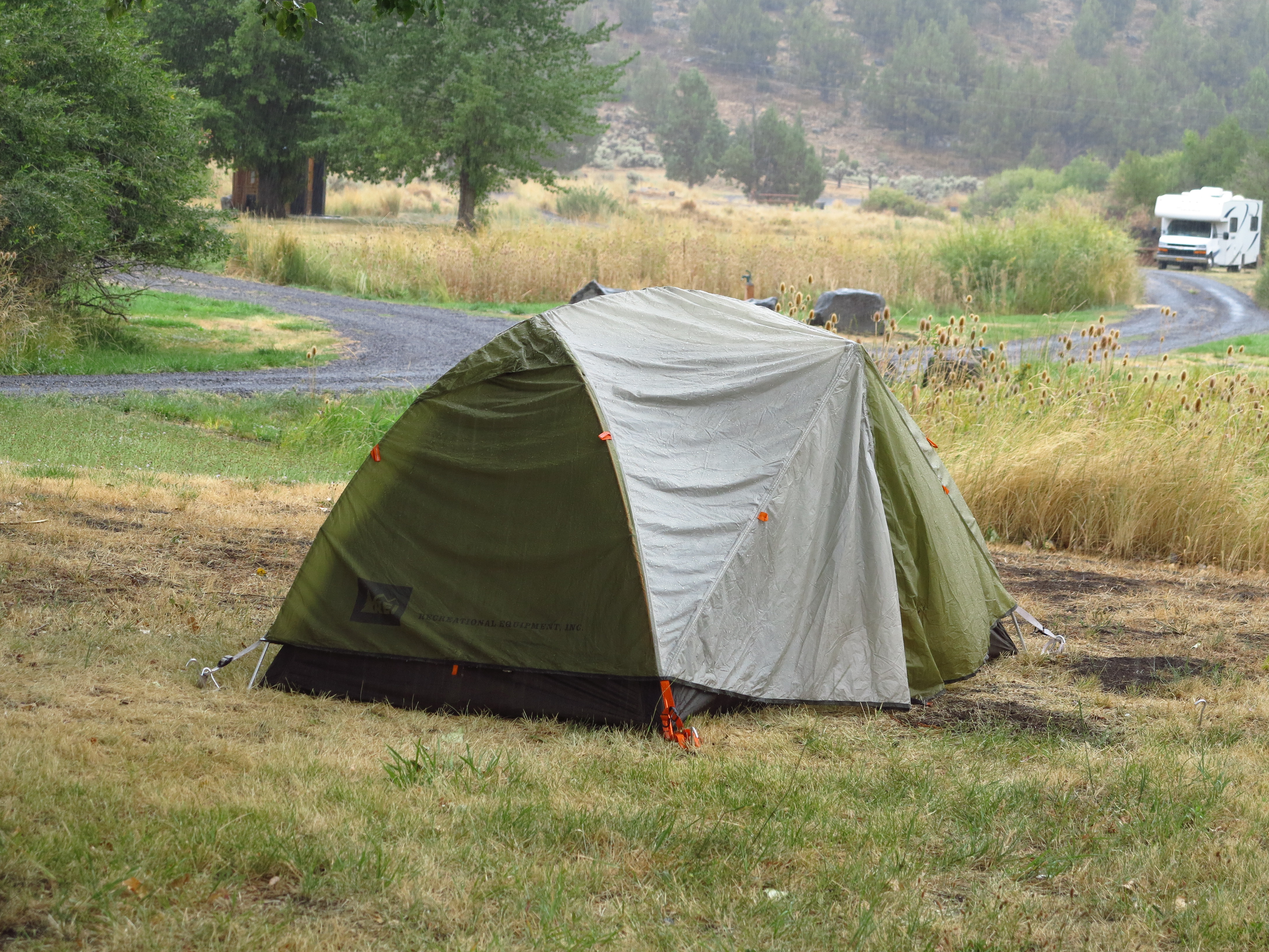
Our plan for the third day in the Steens Mountain area was to ride the Trout Creek Mountain loop. I had ridden the Trout Creek Loop for the first time in 2010, great roads, great views, and I was looking forward to another go on that loop. Kyle and Jared, who had arrived just the evening before, would do the Steens Mountain Loop and from there they would go home. Right after breakfast Kyle and Jared left for the Steens Mountain Loop. And then it started to rain.
My tent and the storm. September 2nd, 2013
It was quite a miserable scenario. It rained in very similar fashion to what happened in 2010 when we were there. Rain was in the forecast, so we were half ready for it. That is, we knew it was coming, but we were hoping forecasters were wrong. September 2013 repeats September 2010.
Real rain.
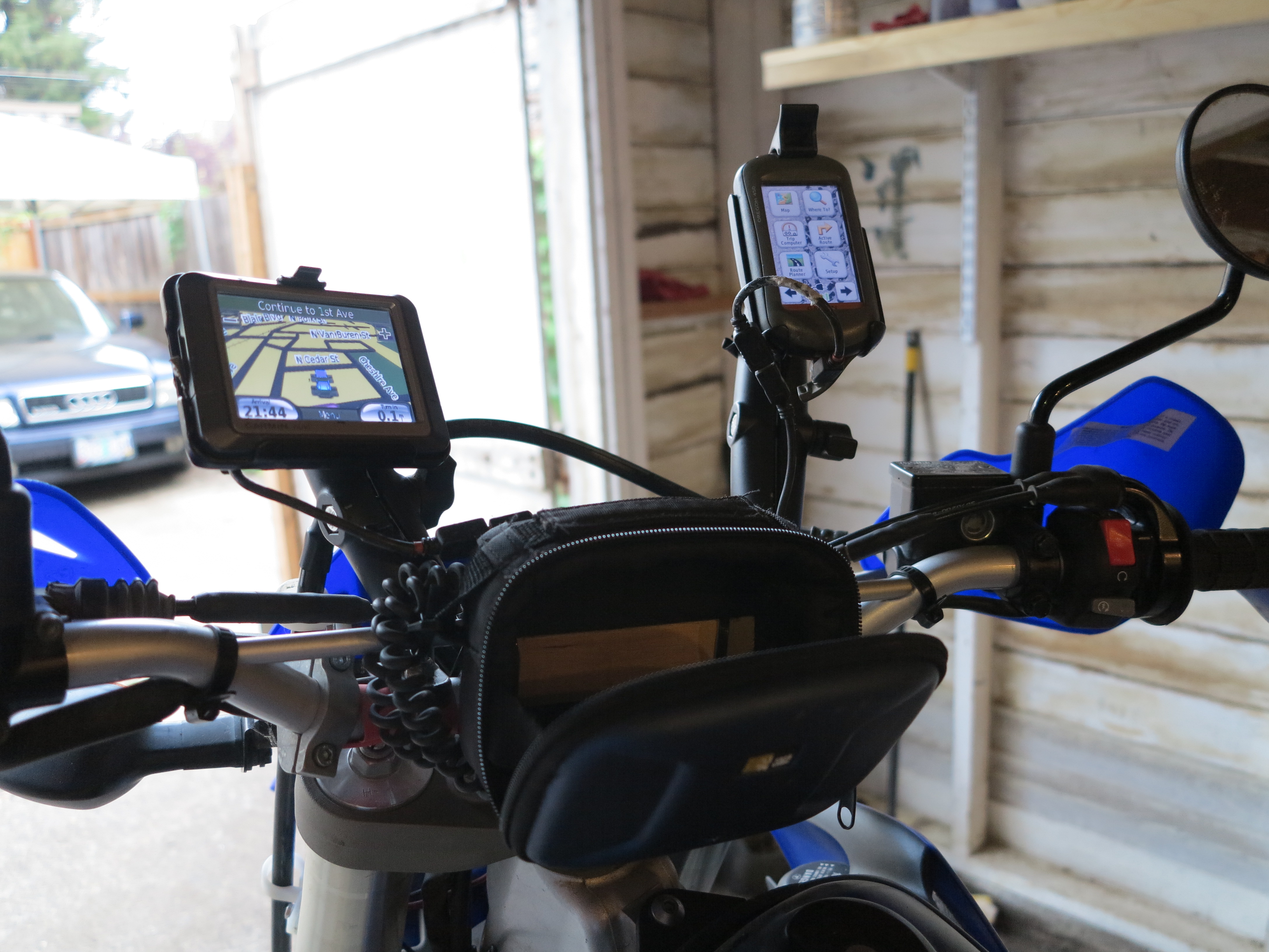
I checked the weather stations, and it indicated rain would clear during the day. I moved my bike under a tree, and even there it got wet as the rain intensified and rain water started going through the leaves. My plan was to wait and see… hoping to have a go at the Trout Creek Loop anyway. I look at the picture above, my old Nuvi 260, a cheap, no thrills, not-water proof, car GPS, and I have to smile. That thing has been used on all my motorcycles since 2007, it has thousands of miles of significant abuse. It has been in the rain, it has been at speed on dusty dirt and gravel roads. And it hasn’t missed a beat.
The little Yamaha under a tree. Water was coming down. September 2nd, 2013
I put my camera in the pelican box, protected the other electronics as well. And then we started the debates. Doug, as you would expect (if you’ve read my other posts) did not want to deal with the rain. Trout Creek Mountain is high ground, all roads, except for the main roads to get there, are on high ground and I would guess one area with a potential problem was the cross of the Trout Creek. I figure we would try it, and if we get there and find the creek flooded, we turn around. I had in my mind the images of the landscapes I would be seeing, the clouds framing the horizon, rain making the desert come alive in bright colors contrasting with gray skies. But of course, Doug had nothing to do with it. He started packing and we helped him load his and Annie’s bikes on the truck.
Running away from the rain
In 2010, when rain developed, it was in the middle of a four day stay and we knew it would clear after a day of rain. So we did not lift camp. I went riding, Doug and the guys had burgers in Fields Station, it was all good. Now in 2013 it was a different story. It rained in our last day, so Doug decided to lift camp and go home. My problem is that I was relying on Doug to carry my tent and camping supplies. I did not have the luggage systems to carry all of that with me in the small WR250R. That meant game over for my Trout Creek Mountain Loop. I should had known better. Well, I know better. So I’m the only one to blame for missing out on the Trout Creek Mountain Loop adventure.
All camping gear packed and ready to be loaded on the truck
Meanwhile, Christian was ready for whatever we decided. When it comes to riding he is as relaxed a guy as I’ve ever come across! His only concern was about packing his tent and gear while it was raining and everything was wet. But we packed everything wet as they were. And in probably less than 30 minutes we had our tents and camping gear packed, the truck loaded and Christian’s BMW F800GS and my WR250R ready to go.
We all decided for a Plan B: instead of going home we would ride/drive east towards Summer Lake, where weather prediction indicated it would be dry, camp there, and the next day go home. Doug and Annie would take the truck and Christian and I would ride our bikes there and meet in the afternoon. I thought it was a good compromise. And we would remain as a group, which was a good thing, after all.
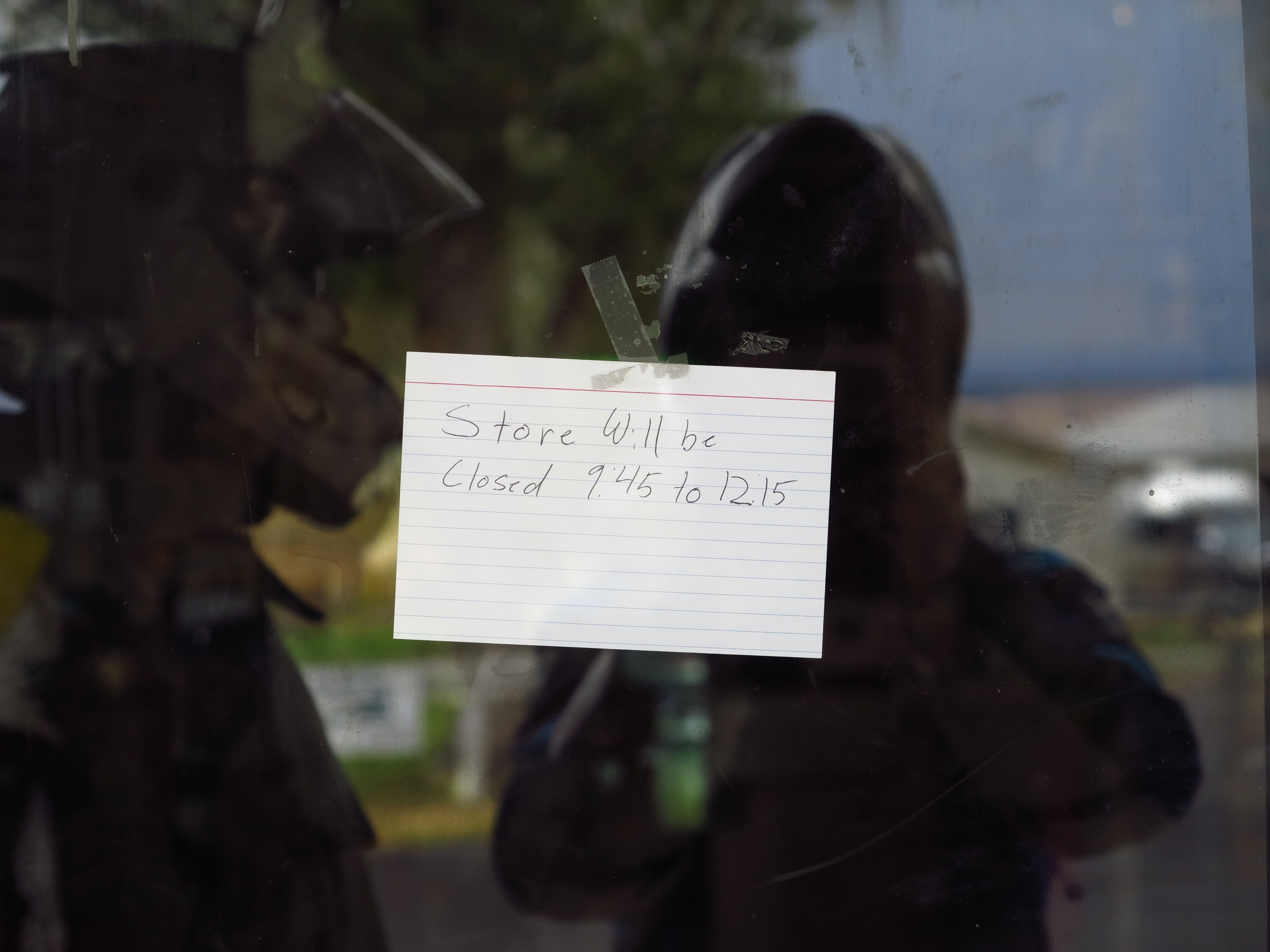
Back to the Frenchglen Mercantile for gas
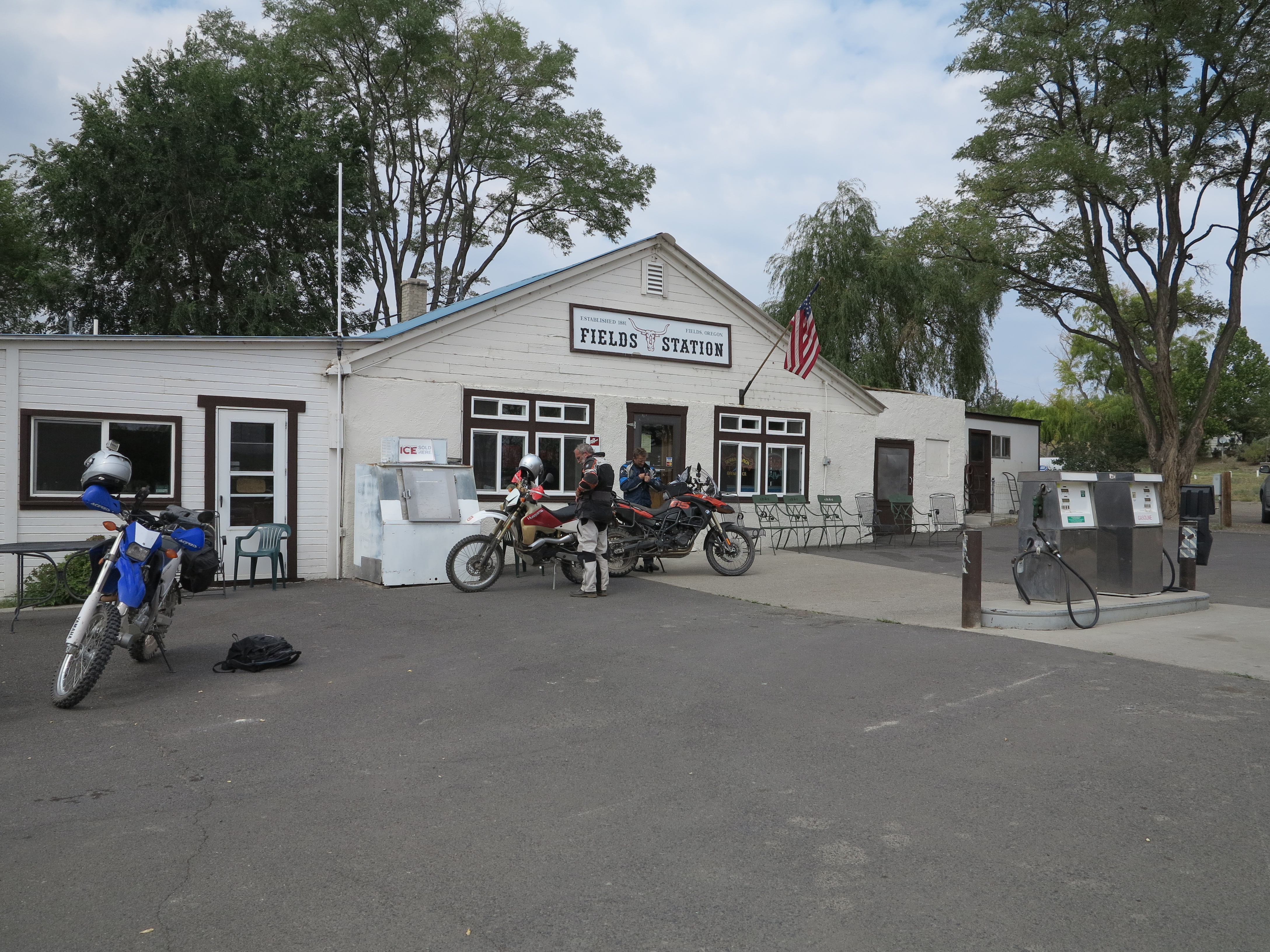
So we put the plan into action. Christian and I rode to Frenchglen for fuel for the F800GS (I had filled up my tank with left over non-ethanol fuel Doug had brought). Here in the desert, for one thing services are far and between and for another you can’t always rely on services being available as indicated, and mostly will close at about 4:30 in the afternoon and also may require cash only for fuel. As an example, when we got to the store we saw the sign at the door, it was closed for a couple of hours. If you are in real need for fuel you will need to wait until they open, or ride to Fields, 50 or so miles south, hoping Fields Station will be open. It is part of the experience.
Frenchglen Mercantile closed for a few hours
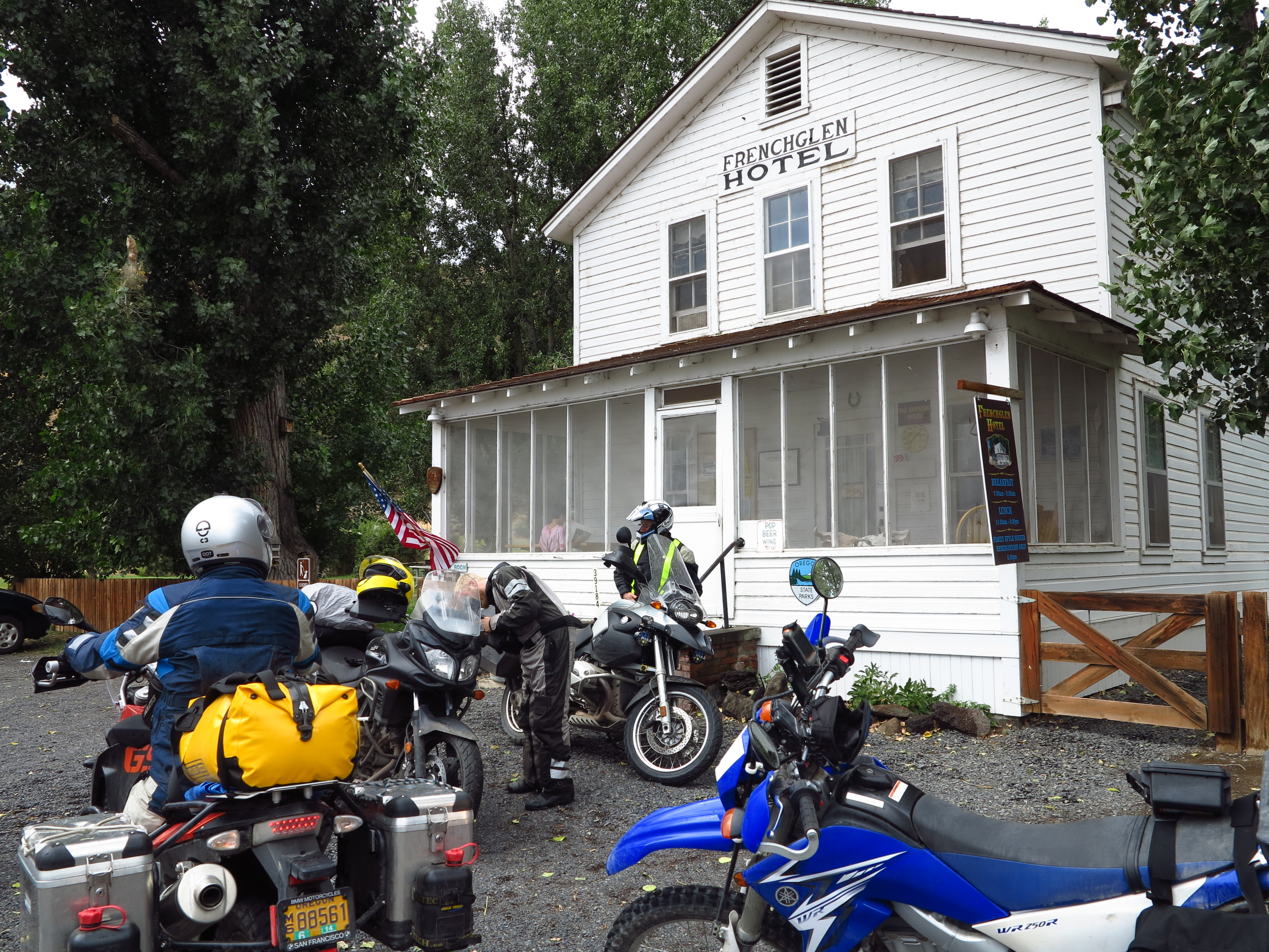
In our case, Christian had filled the tank the day before in Fields, had ridden about 60 miles since then, so he had a little more than three gallons, which is enough fuel to make it to Plush, our next destination, or even Paisley our final destination. And I had an extra gallon of gasoline on my bike, just in case. We were good. As we were leaving town, we ran into Kyle and Jared, who had stopped at the Frenchglen Hotel for a cup of coffee after returning from the Steens Loop.
Kyle and Jared after they had a cup of coffee
They reported their encounter with the rain storm on top of the Steens. But it was all good. Except they needed a cup of coffee to warm up before continuing on their way home via Burns, to the north. Actually, after all the fuss about the rain, all the fears about flash floods, the mud, and the walls of water that would engulf us… well, the rain was practically gone. Here we are, leaving this beautiful area under just sprinkles of rain, under skies that were gradually turning clear. We said our good byes to Kyle and Jared and found our way south towards Rock Creek Road where we made a right turn towards the west.
Going west on Rock Creek Rd. September 2nd, 2013
The plan was to go towards Plush for fuel and from there towards Paisley, and the Summer Hot Springs. Back on this road, back with my dreams of Patagonia. But it is quite a big difference riding these roads with someone else. Everything has pros and cons. It is safer, you have company, you can talk at stops. But it is more difficult to get in that mind set of the solitary horse rider depicted so prominently in the poems of the Argentinean Gaucho poet Atahualpa Yupanki.
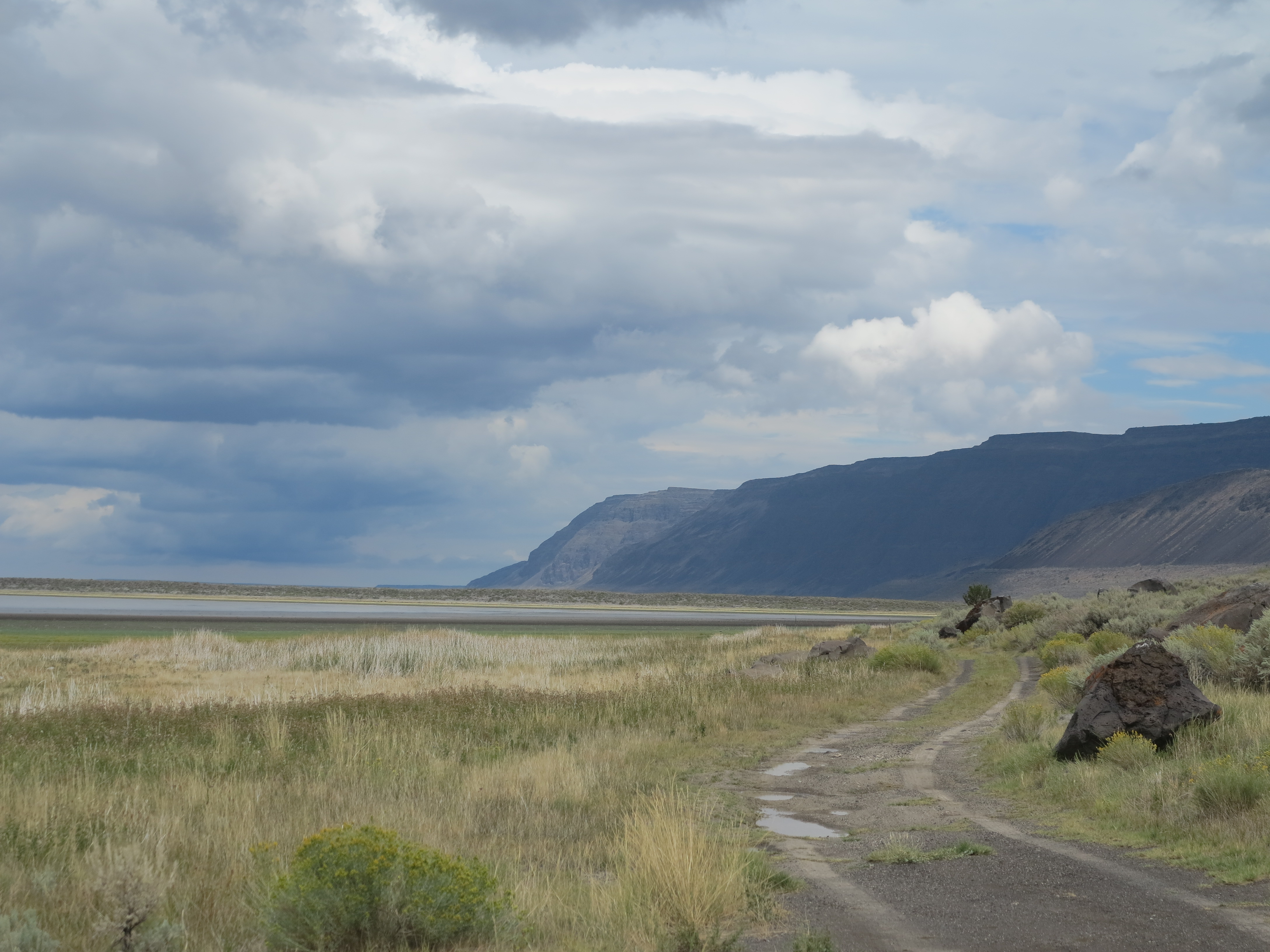
Hart Mountains straight ahead
Looking back (photo below), that was our last view of the Steens Mountain area. You can barely trace the outline of the Steens Mountain on the horizon, as the last traces of rain still enveloped the area. But you can already see a patch of sun on the mountains in the horizon. I will be back!
Looking back, towards the Steens Mountain area
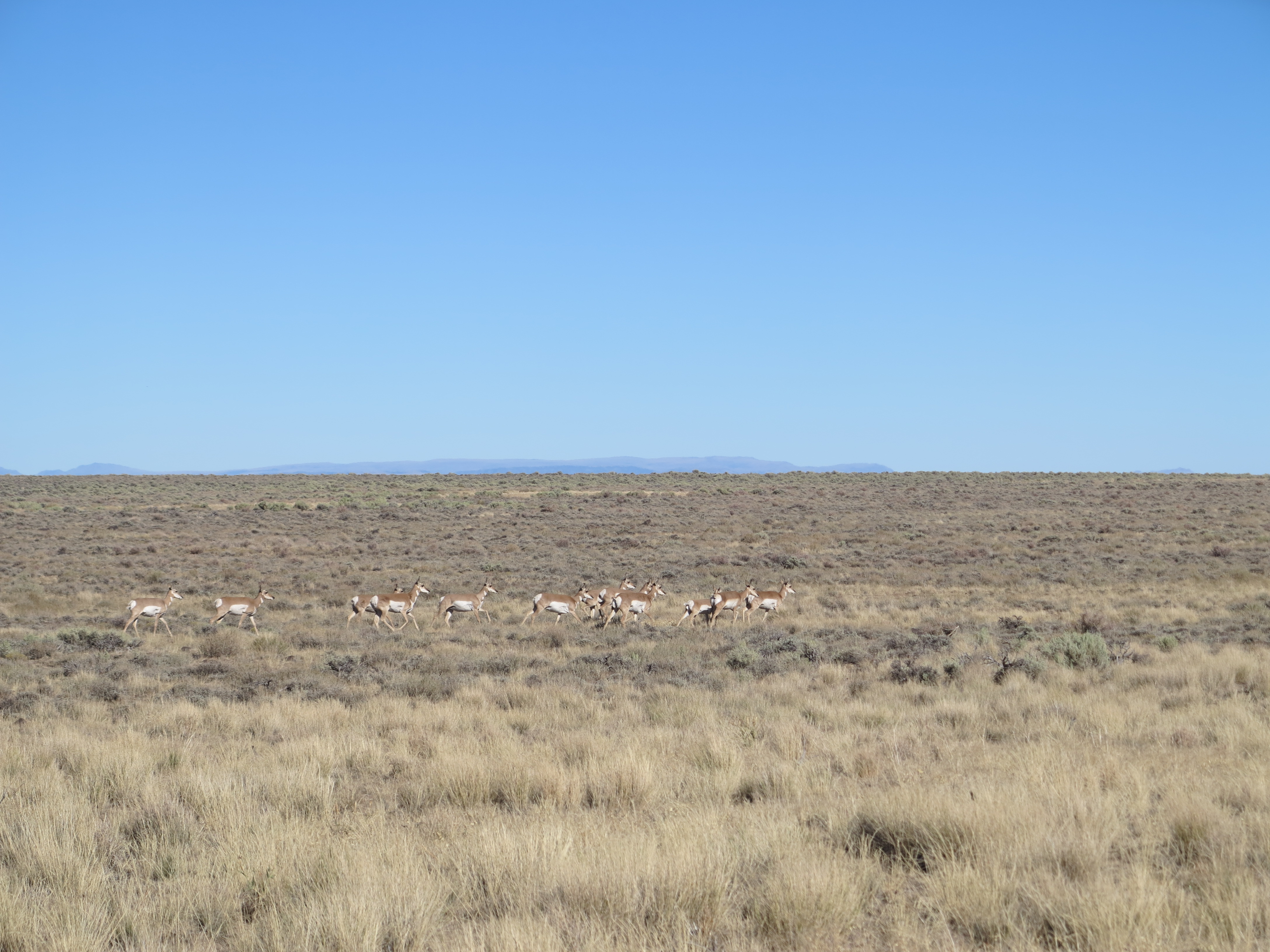
We see some antelope as we approach the Antelope Refuge headquarters. Every time I’ve been on this road I’ve seen antelope.
Antelope and the Antelope Refuge headquarters on the background
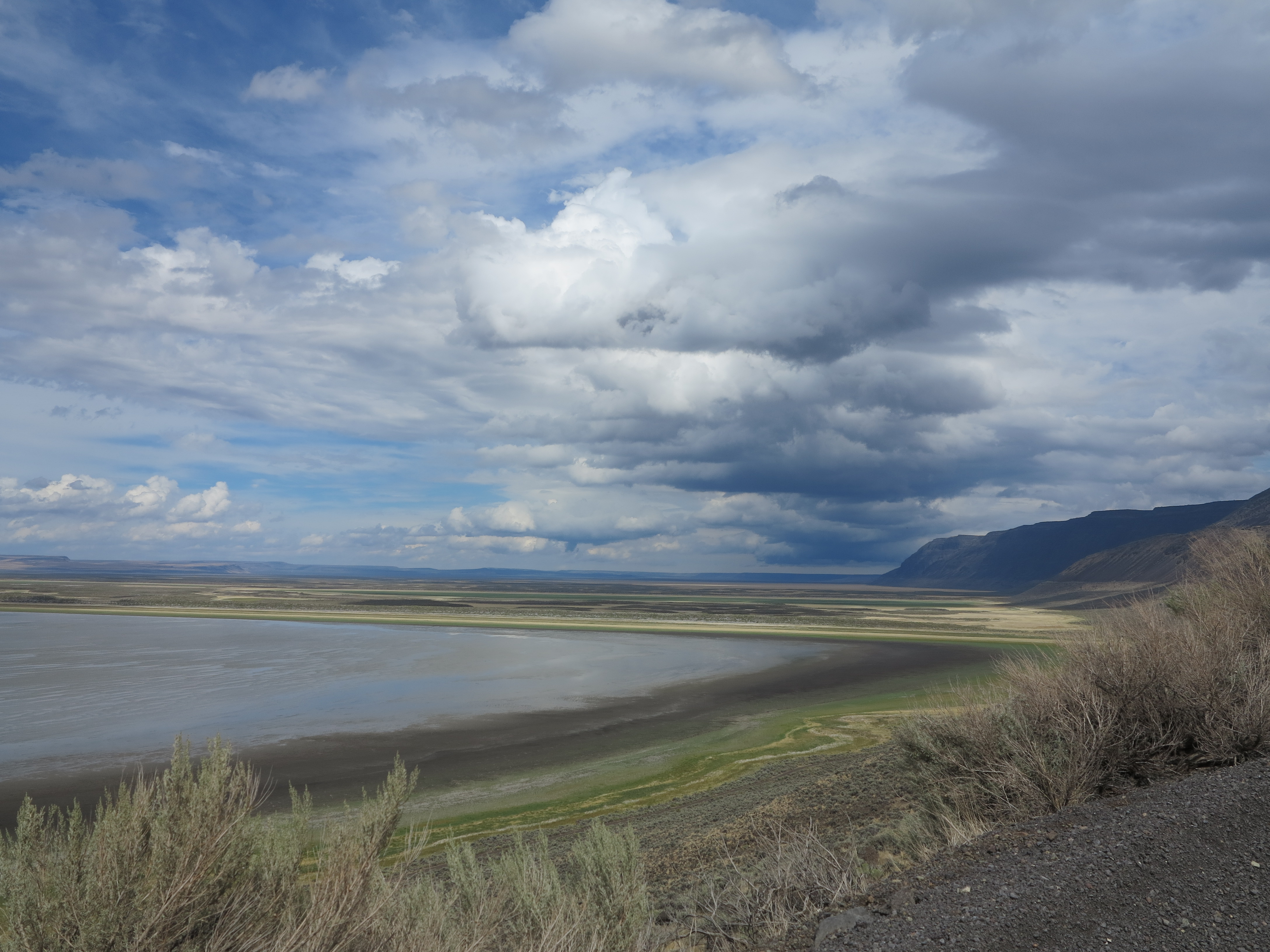
On the other side of the Hart Mountains there is the view of the Warner Valley and Lakes. All framed by the nice cloud formations, left overs from the rain as the weather pattern was still moving away.
Beautiful skies, beautiful vistas
But it was also getting hot and the rain was definitely gone by now. Time to get rid of the cold and the rain layers on our riding suits.
Getting rid of the cold and rain layers of clothing
The colors were fantastic.
Nice colors
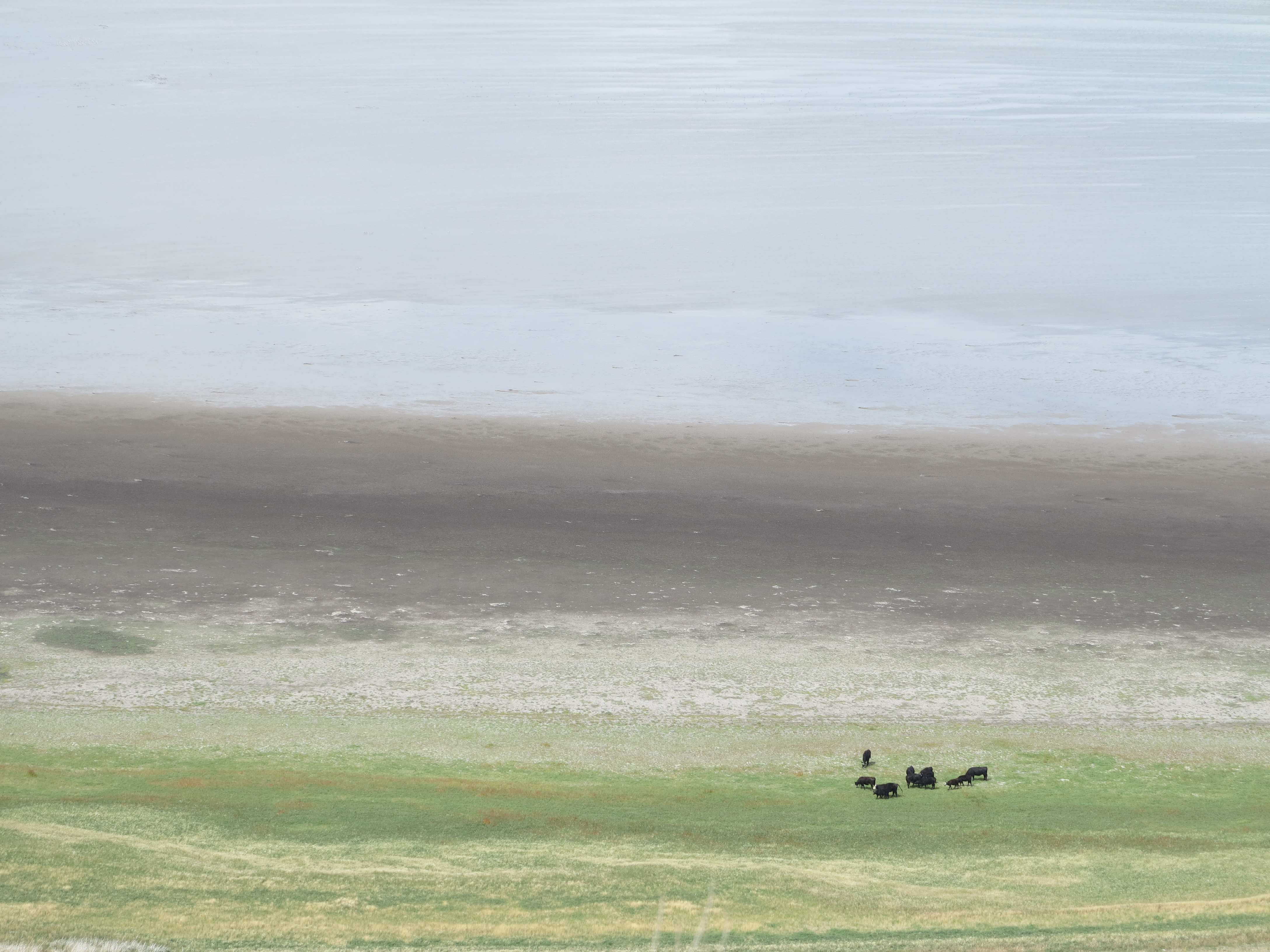
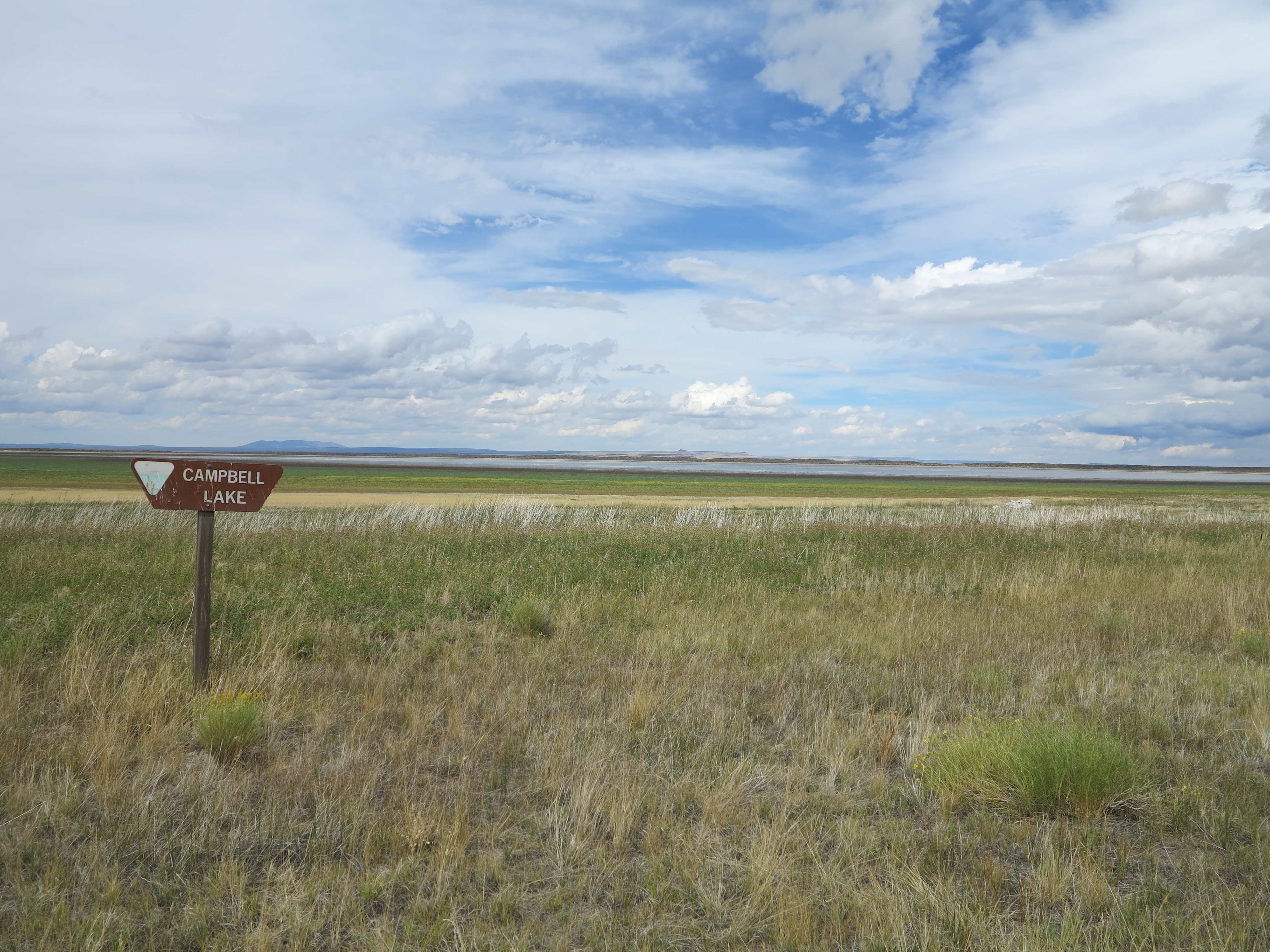
Some black Angus enjoying lush greens on the edge of the Campbell Lake.
Campbell Lake
We decided to take a side road and check Campbell Lake.
Campbell Lake
You can see some signs of the rain that hit the area earlier in the day.
Campbell Lake
We turned around and got back towards Plush. We stopped at the Warner Wetlands view point. It was a quick stop.
Warner Wetlands
We continued, and soon we were in the outskirts of Plush. Nice view of horses on an old homestead, Hart Mountains on the back. It is a beautiful area. Last time I had been here was in 2006, on my first trip to the Steens.
Horses just outside Plush, OR.
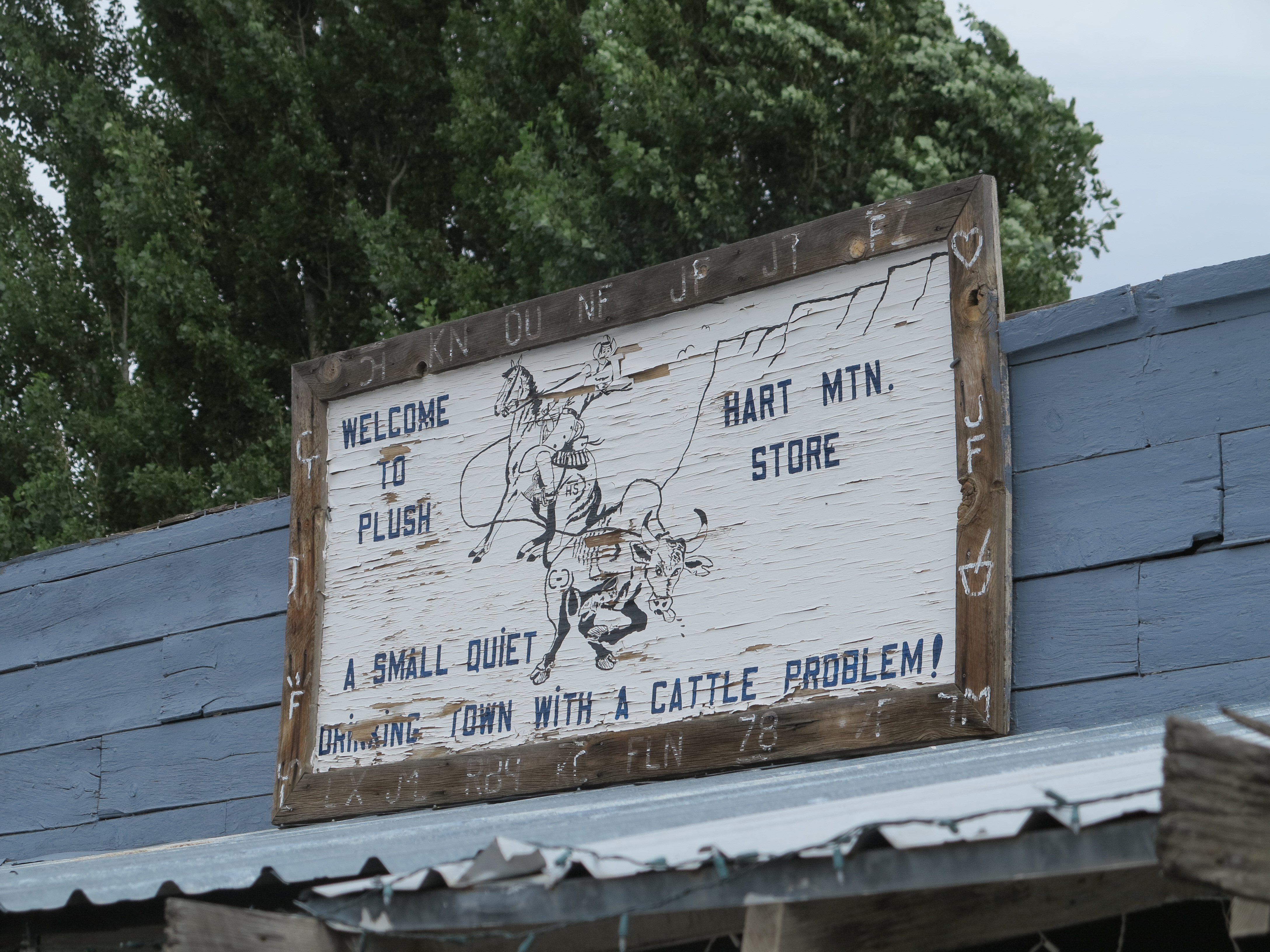
We found our way to downtown Plush, and the famous Hart Mountain store.
Hart Mountain Store, Plush, OR
We filled the tanks of the bikes and had hamburgers for lunch.
Fuel and Hamburgers in Plush, OR
Christian spotted hummingbirds feasting on flowers just on the side of our table. Nice picture! There were at least three of them. And these little birds are feisty and territorial, only one was at the flowers most of the time, the other two were being chased away every now and then.
The humming bird in the Hart Mountain store. Photo courtesy Christian Abächerli
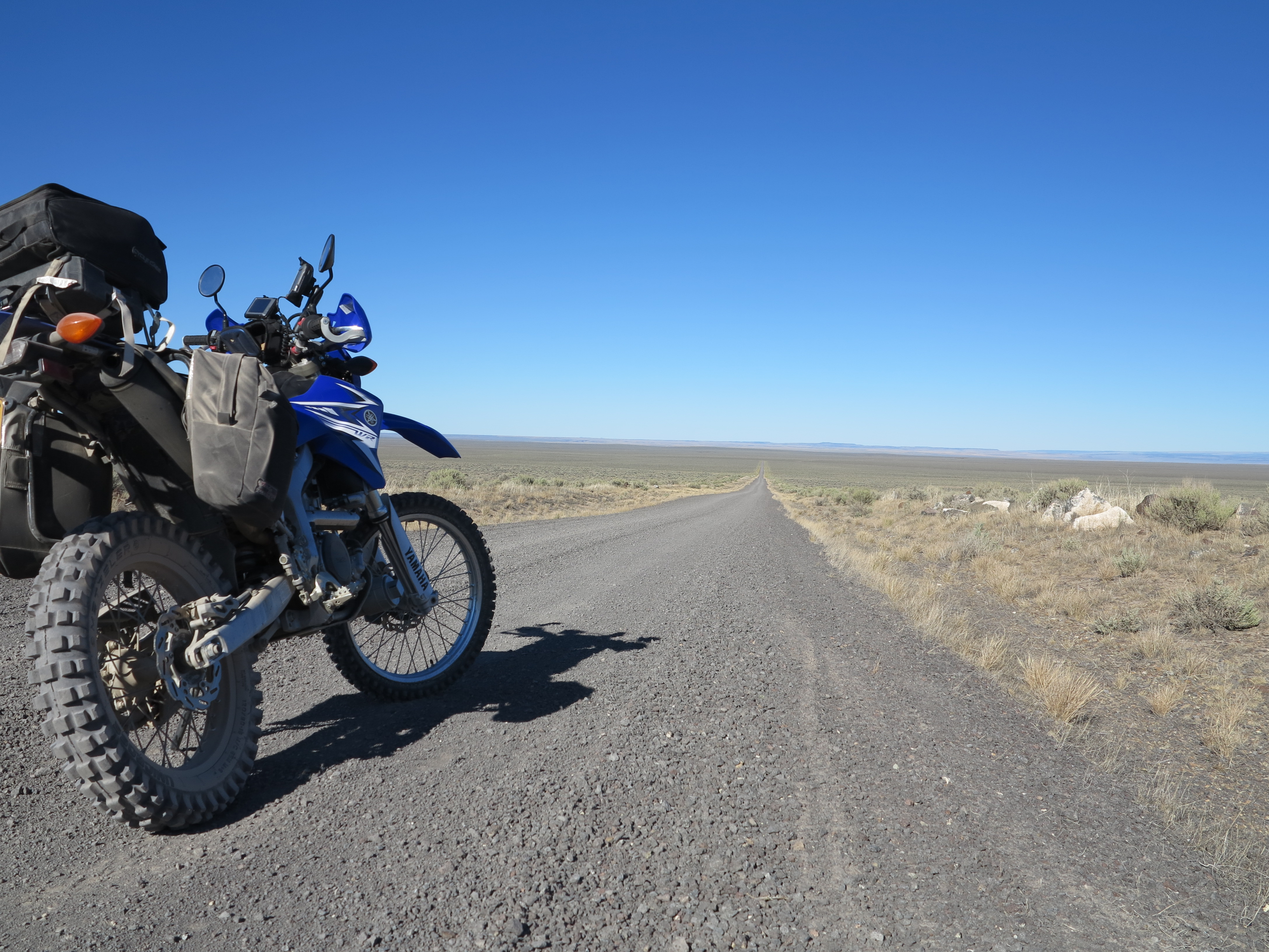
After lunch and fuel we went back north to connect with Hogback road. There were strong winds from the southeast, a perfect match for my direction of travel, right from behind, making the little WR250R cruise effortlessly at 65-70 mph in 6th gear on this gravel highway.
Hogback Road, a smooth gravel highway
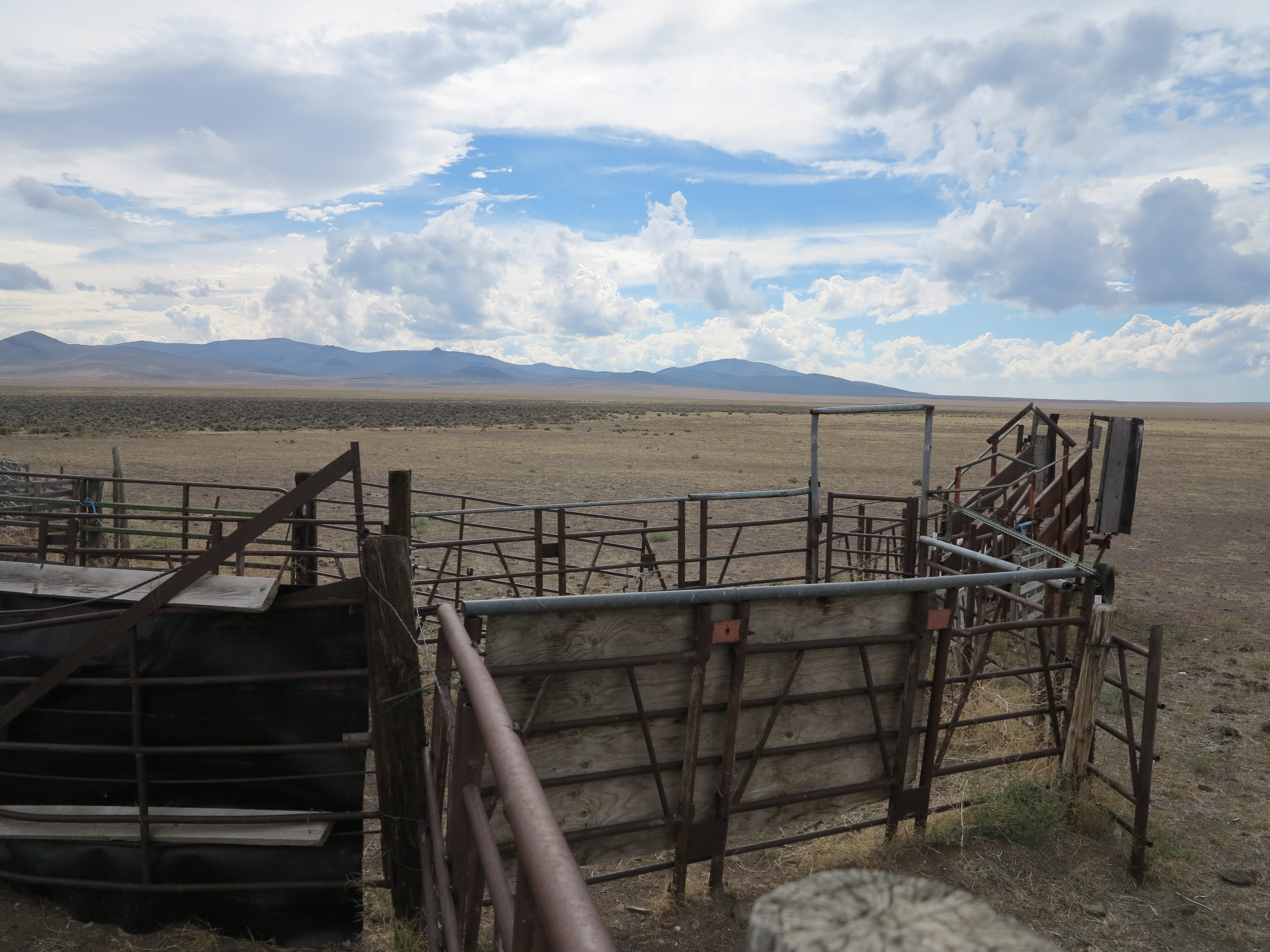
I’ve been on this road a few times and had never paid attention to a cattle corral, just on the side of the road. I went flying past the structure, noticed it this time, and decided to turn around and photograph it.
Corral along Hogback Rd
With the cloudy skies, the road, the corral, it made for nice views.
The corral alongside Hogback road. Looking east.
During my childhood and through my teen years I would spend about a month of my summer vacation in our family’s and our relatives’ cattle ranches. And during my stay in these places, especially in my uncle’s property in Uruguay, one of my favorite locations in the world, I would always get involved in some work with cattle.
Rancho Las Flores, Vichadero, Uruguay, April 2006.
I would join the ranch staff, leave early in the morning riding Criollo horses to gather the cattle from the several areas of that large ranch, bring the cattle in groups of about 100 to the corral for a dip (tick control), vaccination, tagging, and all other activities needed. I’m talking about the very corral that is depicted in the pictures above and below this paragraph, which I’ve taken during my last time to that ranch in Uruguay, in 2006.
Criollo horses, Rancho Las Flores, Vichadero, Uruguay, April 2006
I’ve never been to a cattle ranch here in the United States. I can safely assume it is a completely different operation here in these areas of Oregon, when we compare to the Pampa grassland that supports a much higher number of heads of cattle per acre. At some point I would like to visit a ranch here in Oregon, or other western states, to learn about their operations.
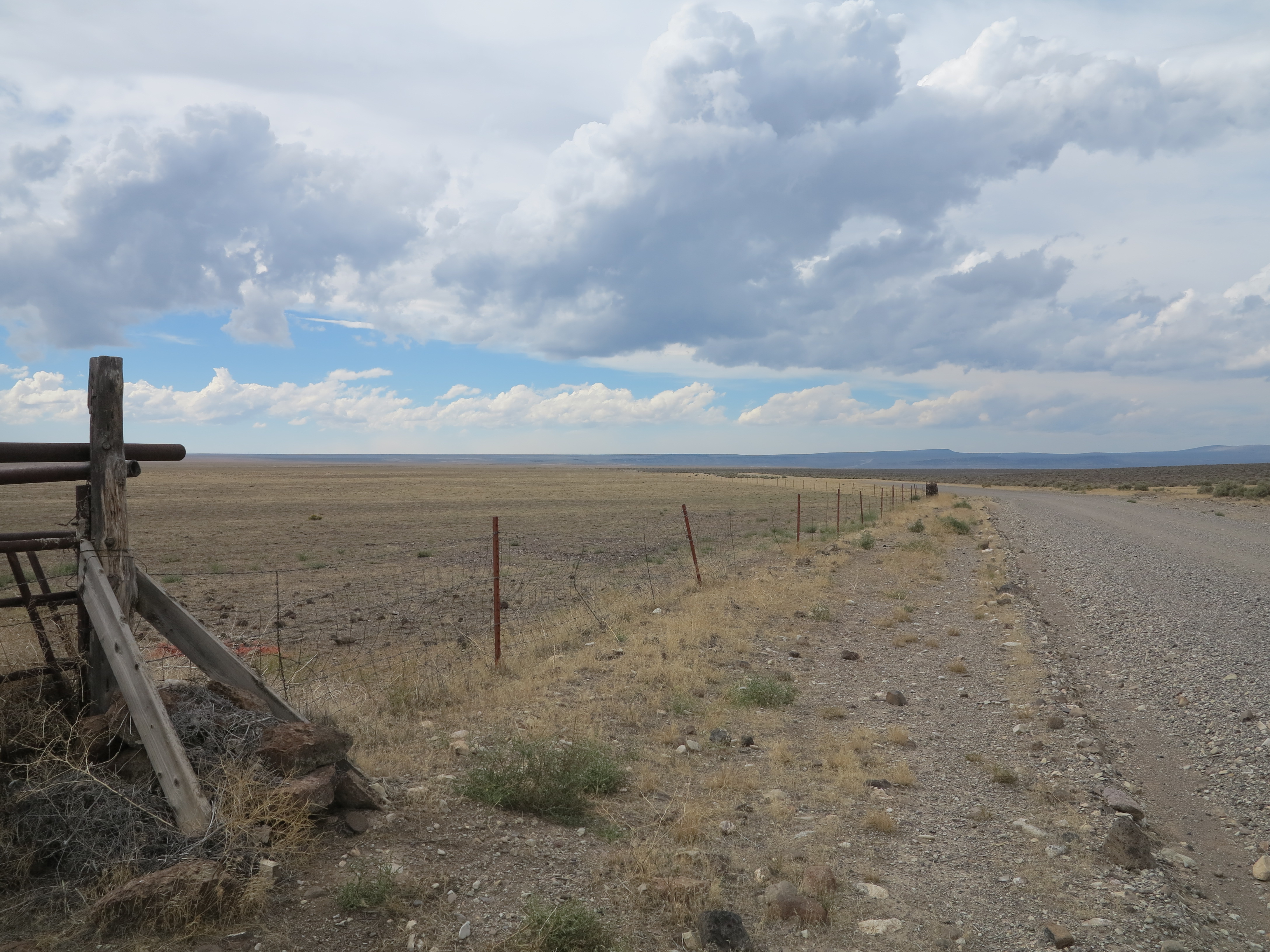
Hogback Road, looking west
We continued on Hogback road, reached 395.
Hogback road and Hwy 395
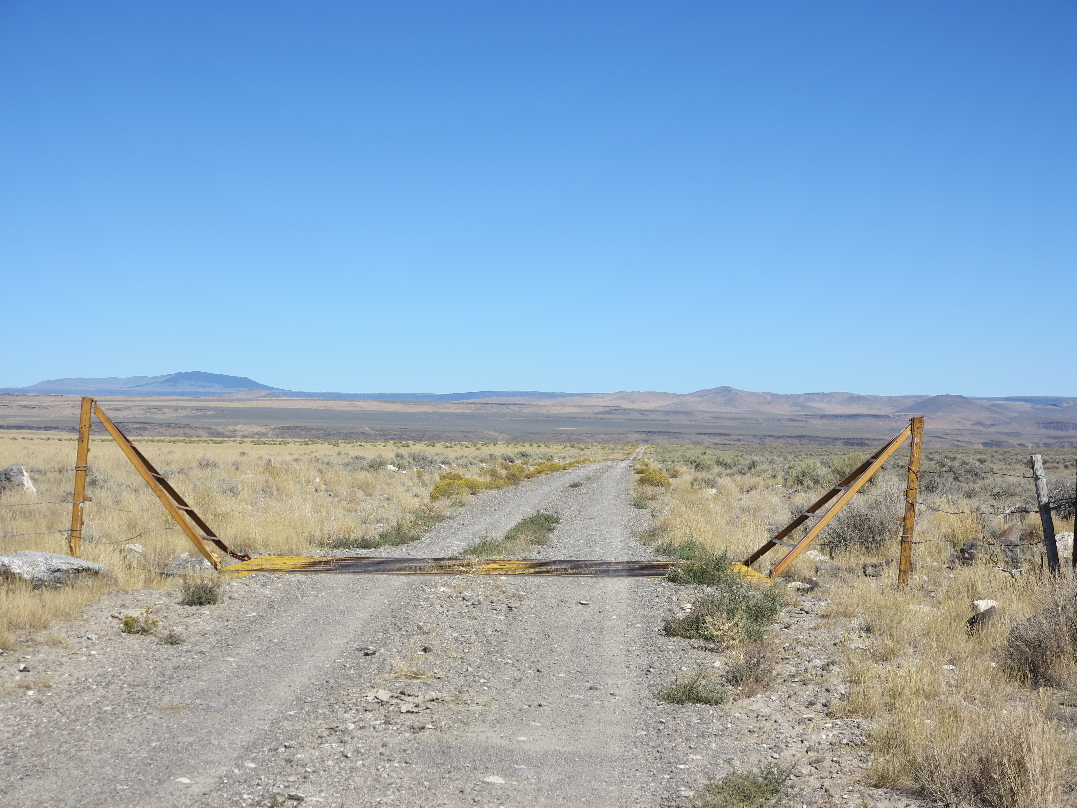
We rode south on 395 for a couple of miles to connect to the XL Ranch road, which eventually gives you two options: a left turn takes you to Forest Road 6124 towards Paisley, a right turn takes you towards the north to Twin Buttes Rd, connecting to Sheep Rock Rd and then Fandango Rd towards Christmas Valley. That’s the way I took in 2010 on my way to the Steens. We went left towards Paisley, retracing my foot steps, or my thread marks, as this was the same way I took this year on my way to the Steens.
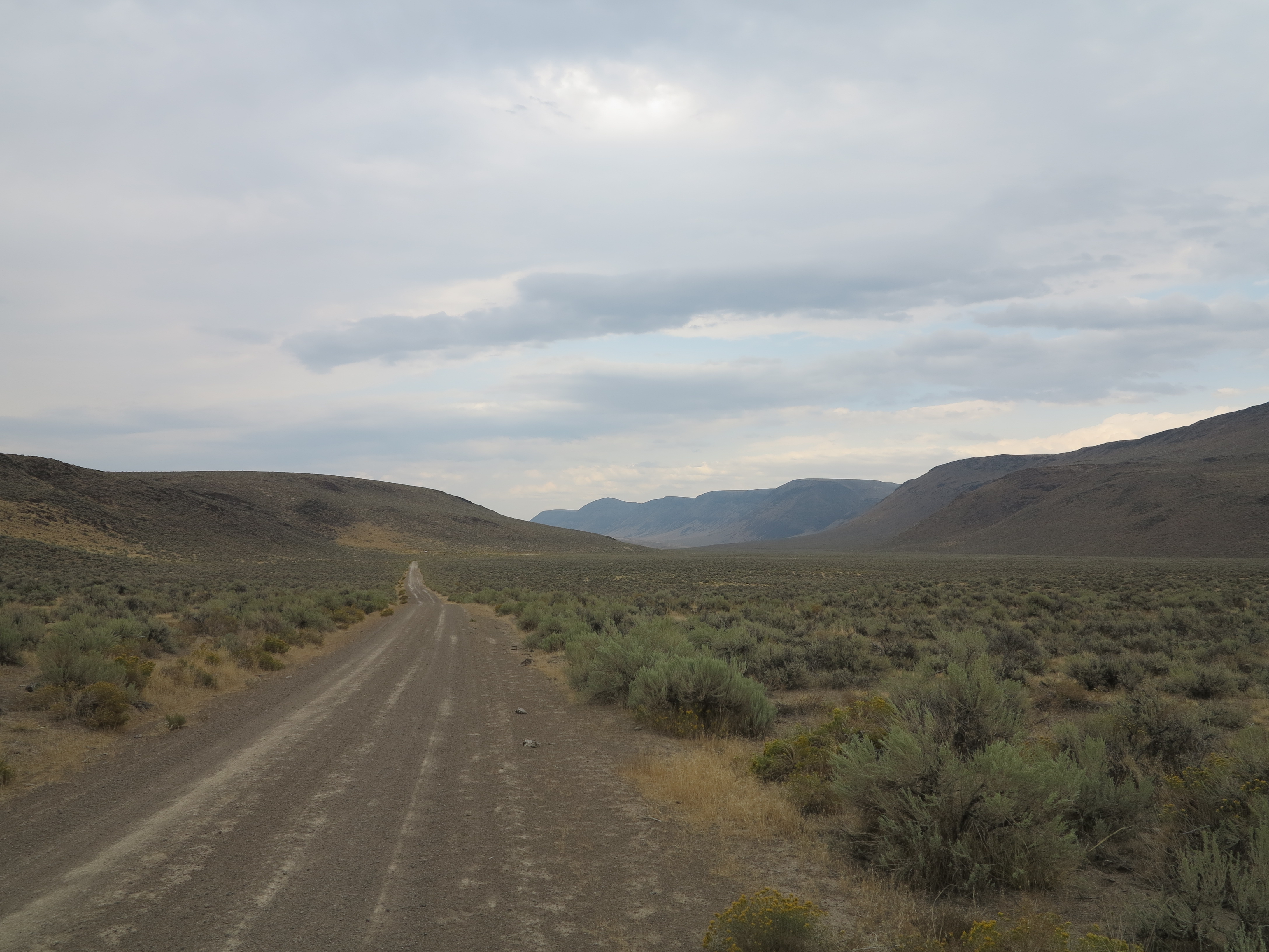
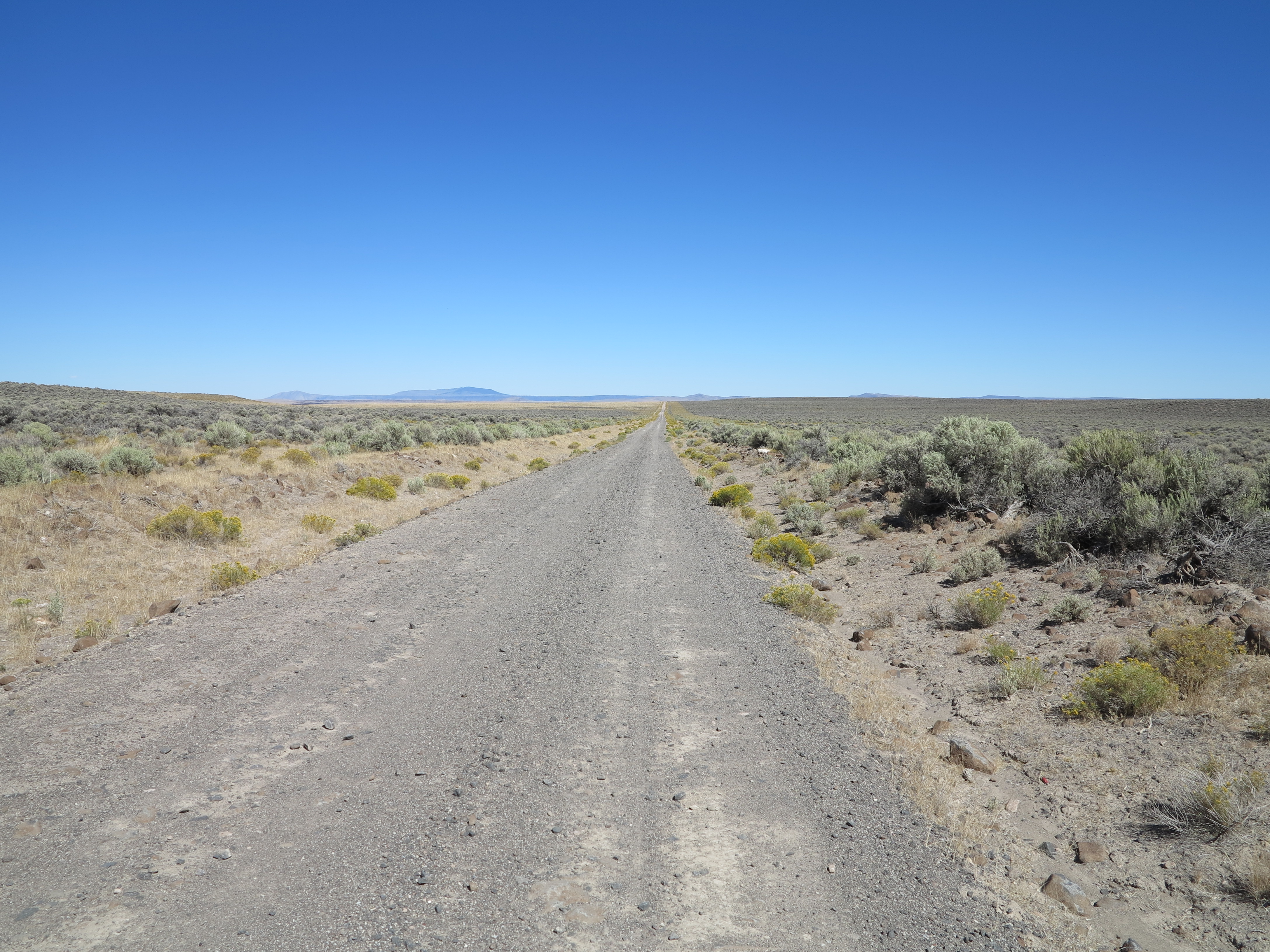
Forest road 6124 towards Paisley
Once we could see the Summer Lake area, we could also see a sand storm. We went from rain in the morning to dry weather and a sand storm in the afternoon. But at times on this track of road, things get pretty isolated. I just feared the F800GS getting a flat tire. It would be Christian and I resolving the problem, both having not worked on that bike before (this is his brothers’ bike). I was confident we would resolve it, I had tools and spare tubes. The tubes would fit that bike, I was not sure my tools would fit though, and my other concern was that it was getting late. So I was glad when we got to civilization again. At the same time, this is really the transition zone from my favorite geography and riding area in the state, to something a bit more impacted by humans, and also naturally more forested. We were leaving the desert and the deserted areas I like so much.
Summer Lake area, and sand storm
We got on Hwy 31 just north of Paisley and continued north towards the Summer Lake Hot Springs, where we were supposed to meet Doug and Annie and establish our camp for the night.
Going north on Hwy 31 towards Summer Lake Hot Springs.
When we got to the Summer Lake Hot Springs, it was total chaos. Lots of people, more than the average crowds you would find there on typical summer days! I rode slowly around the area and could not find Doug and Annie’s truck. I stopped, checked my phone and they had left a few messages. That’s when I learned what was about the out of ordinary amount of people there: they were people returning from the Burning Man event, at the Black Rock desert in Gerlach, Nevada. For me to take the picture below, it took me a little while and some zooming and framing until the moment when it cleared enough for the photo to look like no one was there. Also it was later in the day and people were leaving the spa and getting to their campsites, it was getting closer to dinner time.
The “spa” at the Summer Lake Hot Springs campground. September 2, 2013
Anyway, Doug and Annie’s messages indicated they were in Paisley and suggested we camp at the Marsters Campground, some 8 miles west of Paisley. I called them and we would meet them in Paisley and find the campground. From Paisley we drove together to the Masters Spring campground.
Marsters Spring Campground
It was a good opportunity to dry t tent.
Drying the tent
Instead of digging into our boxes to find our food supplies we decided to hop on Doug’s truck and go to Paisley for dinner. Except, his truck only accommodates two passengers.
Setting the go pro on the roof of the truck
No problems, we will get on the bed of the truck and ride Doug and Annie’s bikes to the restaurant.
“Riding” bikes to the restaurant
It was a bit chilly but we made it there. It was worst on the way back, when it was colder and in the dark.
From the campground to Paisley for dinner. September 2nd, 2013
We got to the Homestead Restaurant, had a good dinner, western style cuisine, I suppose.
The Homestead Restaurant, Paisley, OR, September 2nd, 2013
After dinner, we got back to camp, lit a fire, had more whiskey and more conversation around the campfire. I had already forgotten about Trout Creek Mountain. It was good to still be together as a group.
Up next I will report the last day of this trip, including a few more adventures before getting back to Eugene.
What is your favorite road? Most riders have a favorite road or type of roads, the place where the rider + motorcycle + road combination provides the best riding experience. It could be a favorite road because of where it is, or because of the landscape, ocean, mountains, deserts in the area where the road goes by. It could be because of the road’s destination. It could be about how the motorcycle handles this road, or how one rides the motorcycle when on this road. It could be about memories it brings when riding this road, or what and how the road inspires the rider, it could be the smells of the vegetation along the road. I would never be able to come up with a complete list. Each rider has their own reasons and explanations. And I bet each one will have multiple favorites, one for each motorcycle they’ve ridden, because depending on what makes it a nice experience may change from motorcycle to motorcycle.
Entering Funnel Canyon. 2006 edition of the Lone Mountain Loop
There are riders who will not tell you about that one great road they really like. Or they will ask you to swear secrecy before they tell you about it. There are good reasons not to advertise a favorite road or loop. If it happens to be a dirt road on private property then a possible increase in traffic may get a road closed by the farmers or ranchers if the increased traffic disrupts their operations – what if someone leaves a gate open, for example. After a few of those cases there will be a lock on that gate, end of story for that road. If it is on public dirt roads, its popularity could call the attention of the environmentalists, it gives them ammunition to propose road closures.
Funnel Canyon, the 2006 edition of the Lone Mountain Loop
In case of paved routes, more traffic may be awarded by speed enforcement by traffic authorities, for example. Or you do not want to see too much traffic, and weekend warriors, on your favorite road. Or you simply do not want disruptions when you are on your favorite meditation grounds.
Domingo Pass, the start of the Lone Mountain Loop. 2010 Edition.
Having said all of that, I will tell you about this road, actually a set of roads that compose a loop, my favorite dirt roads loop. I call it the Lone Mountain Loop. Because it is on a remote area and I have a limited number of readers who live in this region, I disclose to you this 100 mile loop in the hopes it will not bring hordes of riders to have a go at it.
Looking east, from the top of the Domingo Pass. Lone Mountain Loop, 2010 edition.
For as long as I live in Oregon and ride adventure bikes, I plan to visit this loop every so often. I need to travel more than 300 miles to get there, but it is worth it. Getting there is part of the fun. Actually, the simple fact that it is that far away, not too far, not too close, and the many places I have to go through to get there, makes it even better or more special. A three-day weekend takes me there. One day to get there, one day to ride the loop, one day to ride back home. Starting early in the morning, I think I could actually do two loops in one day – the Trout Creek Mt. Loop and the Lone Mt. Loop, which together can be done as a figure 8. But that will be another story, something for next year’s labor day weekend, perhaps.
Rincon Flat rd, Lone Mountain Loop, 2010 edition
In 2010, the last time I was on the Steens Mountain area, Doug and I and all the others who were with us on that trip, had agreed to go on the Lone Mountain Loop. Doug is a very easy-going guy, ready to ride any challenging road. But the tables turn very quickly when he hears about rain. He starts talking about flash floods, mud, he wants to run away from the rain (and in most cases he would be right for playing safe and staying away from these situations). In September 2010, the day we were supposed to get on the Lone Mountain Loop, it rained, and it rained a lot in that morning.
I remember that day as if it were yesterday, the treacherous ride, the 50 miles from our campground in Page Springs (Frenchglen) to Fields, a stage point for the loop. We traveled those 50 miles on the paved Hwy 205 under pouring rain. Once we got to fields the rain had subsided. But Doug and everyone else in the group had settled in the Fields Station restaurant, some of the riders in the group had gotten wet on the way there.
They decided not to go on the loop. I argued with them… in September, after the summer months with zero rain in the desert, this first rain in the fall would not be enough to turn dirt into mud. And if it would flood, it would be in lower areas, we could wait for the water to go down or turn back if possible. We wouldn’t drawn, I argued, and at the most we would get wet and would have to be patient, I insisted.
Plenty of traction for a quick stop for a photo. Rincon Flats, Lone Mt Loop, 2010 Edition
As you can tell from pictures I’ve been sharing, 2010 was not my first time on this loop. I had done it in 2006 in my BMW Dakar, and that’s when I realized the much fun I could have when riding my motorcycle on these roads. The best part of the loop, what makes it really especial, are the roads in the Long Draw, the Hawks Valley, Funnel Canyon, and the opening of the Catlow Valley, all of these roads and sequence of valleys happen when traveling from south to north. That’s what I did in 2006 when I rode in this area for the first time. I was in awe of the beauty of the geography, the solitude of the area, and how nice the roads are for spirited riding. The perfect storm.
Playa in the south end of the Catlow Valley, Lone Mt Loop, 2006.
Talking about storms, let’s go back to the Fall of 2010, when we huddled in the Fields Station, everyone intimidated by the rain, and I failed to convince anyone to join me in the loop after the rain. They had found a booth in the restaurant, ordered coffee, and they told me they eventually ordered burgers, and from there never left until it was time to ride back to the ranch in the mid-afternoon.
Meanwhile, against everyone’s advise, I ventured on the loop on my own. And I had a great time. The 2010 edition turned to be better than the 2006 edition. For one thing, I was on my own and you know, I’ve talked about this on several posts already, I like riding on my own. For another, it happened that I was right, or I was simply lucky, because all that rain did not turn dirt into mud. There were no signs of flash flood anywhere. Perhaps if it were in June, I would have backed out of it.
Leaving Hawks Valley, 2010 Edition of the Lone Mt. Loop.
It could had gotten sketchy, I admit, and it rained again when I was on a very desolate area of the loop, in the Hawks Valley area. But it did not turn to mud on those mostly sandy soils. Below is a video when I traveled through those puddles you see on the picture above. As you can see in the video, there are signs of water having run over the road, but aside from the puddles, there were no problems whatsoever riding these roads, no rivers of water to turn into a flash flood. Maybe it needs to rain a lot more to trigger flash floods? In the end, riding in the post rain on these roads was just bonus fun. And you can see also in the video, how sun and clouds alternated. It only served to enhance the beauty of the area. The clouds framed the views, the rain brought color to the vegetation. My one and only regret was not to have a better camera at that time.
The clay soil areas, yes they could possibly get slippery, but even those areas were really good, and there are very few and short patches of clay soil in this loop. All together clay soil areas do not make more than five miles, I would say, on this entire loop. Bottom line, no traction problems at all.
I can say that because of the rain that ride was actually in the best conditions you can possibly imagine for dirt riding: just enough wetness to firm up the soil for great traction and no dust. The worst part of the loop… let me re-phrase that, the only muddy part of the loop, and only muddy enough to make the bike look good, was at the very end of the loop, close to where Catlow Valley connects back to the paved Hwy 205. But it was not slippery and it was not deep mud, just surface mud with plenty of gravel to keep things going.
The bike at the end of the 2010 edition of the Lone Mountain Loop
When Doug saw my pictures and videos from that ride in 2010 he understood what I had been talking about when I mentioned the Lone Mt. Loop. Now, 2013, we are back at the Steens Mountain area and he wants to ride it. Excellent!
After this long introduction we are finally back on track with the story, back to September 2013, when we were back at the Steens… Annie had prepared another great breakfast. She was going to stay in the campground area, do some hiking, and work on her painting. And the guys took off towards Fields for the start of the Lone Mountain Loop.
Fuel in the Fields Station, the 2013 Lone Mountain Loop
From Fields it is a short jaunt to the Domingo Pass.
Chris and Doug ready to start the Lone Mountain Loop, 2013.
The first destination: climb the Pueblo Mountains via the Domingo Pass and reach the Rincon Flat on the other side.
Pueblo Mountains, the Lone Mountain Loop, 2013
The climb will give you an opportunity to work on a few switchbacks. Similar to riding technical roads, like we did the day before (previous post), switchbacks are also fun, but it is not a road characteristic that enthuses me. I did not elect this loop as may favorite loop because of roads with technical areas and switchbacks. I see technical areas as something I have to endure to see the views from the top and to get to where, for me, the real fun starts, on the other side of the Pueblo Mountains.
There’s Chris, working his way to the summit of the Domingo Pass. Lone Mt Loop, 2013
The west side of the summit affords you the view of the south side of the loop. Once we go down the Pueblo Mountains we reach the Rincon Flat, we make a left on that road (I’m not sure what is the name of that road, let’s call it Rincon Flat Rd) and travel south towards Nevada.
View of the west from the summit of the Domingo Pass. Lone Mt Loop, 2013
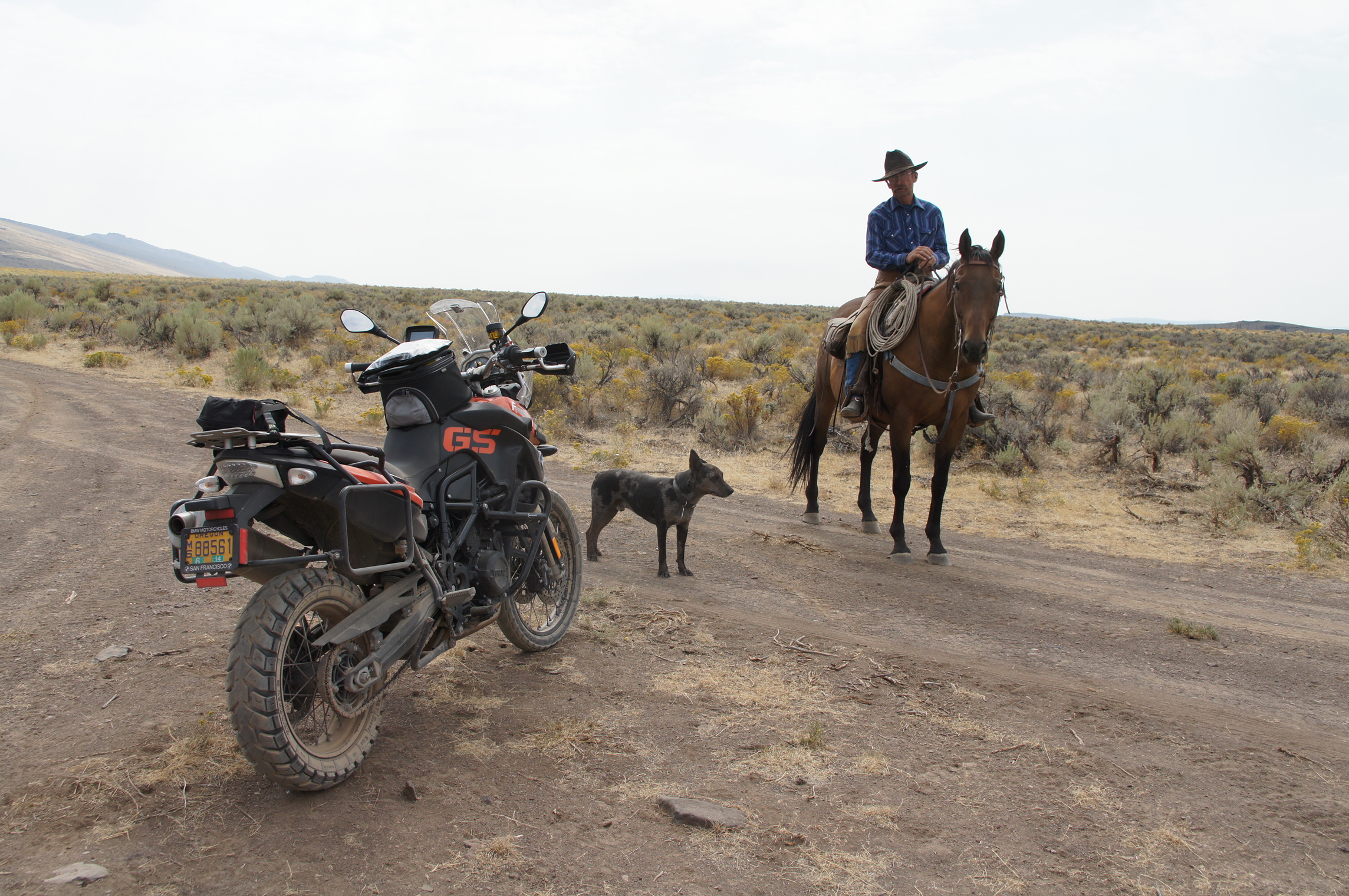
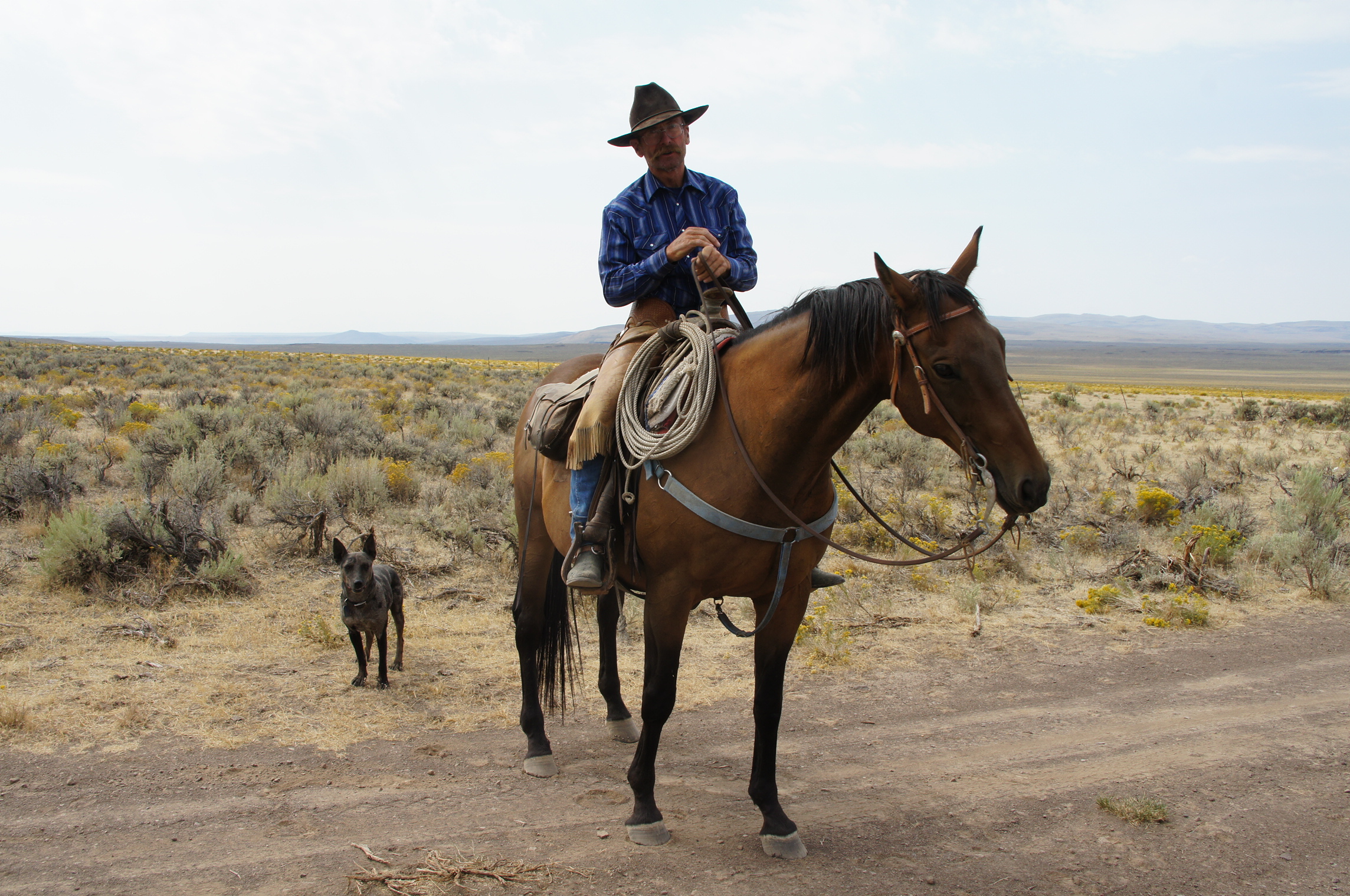
In the Rincon Flat, that’s when Chris met the cowboy, the guy I included in the story, two posts ago, as the “Steens Gaucho”.
The Steens Gaucho. Lone Mt. Loop, 2013. Photo Courtesy Christian Abächerli
This is the first fun road of the many fun roads that make this loop really great and y favorite. This road goes all the way to Nevada, which is actually no too far, perhaps a couple of miles, from where the loop gets to its southernmost point and turns west to then start the north track, my favorite part of the loop, the sequence of roads and valleys I described earlier.
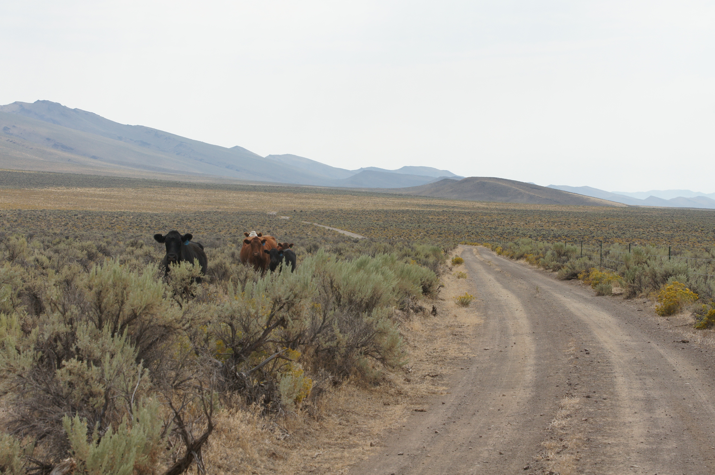
Rincon Flat, some cattle, in the Lone Mt Loop. Photo courtesy Christian Abächerli
The views are really good.
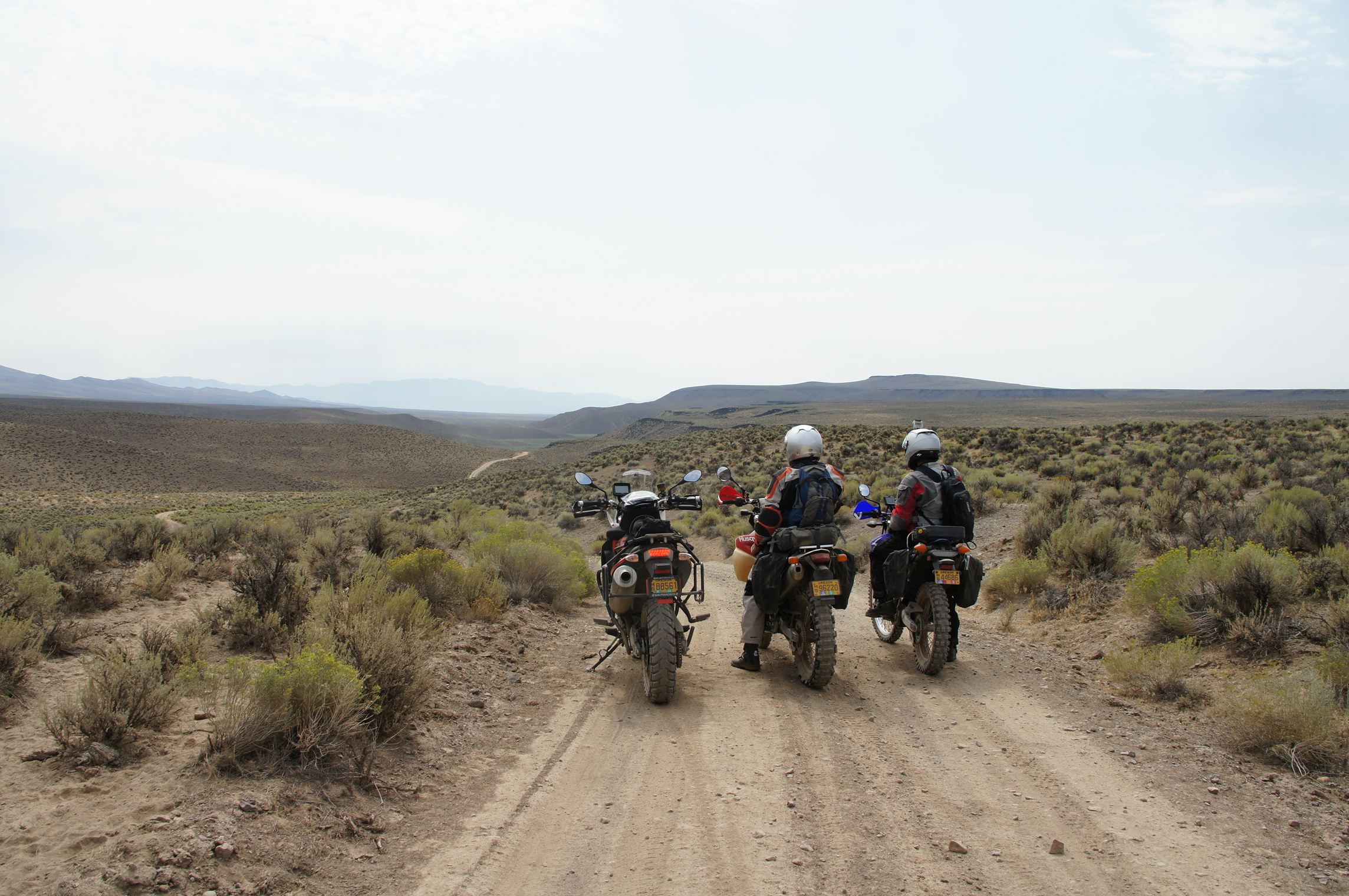
Los Tres Amigos (one taking the photo). Rincon Flat. Lone Mountain Loop. Photo courtesy Christian Abächerli
And one of the key characteristics that make these roads great, and why they are part of my favorite loop, is that you can see the road ahead, miles ahead. At some point we noticed dust ahead, a vehicle was coming towards us. It gave us plenty of time to find a spot on the side of the road to provide safe passage for the vehicle. Not something you can safely do on forest roads, where you ride at slower speeds since most of the time there is no clear view of the road ahead.
The only other vehicle we crossed while on the loop. Photo Courtesy Christian Abächerli
It is also my favorite set of roads because although most of them have gravel, it only has enough gravel to make things interesting. Overall, it is a good road to ride fast. And, my friends, this is what I mean by not being a technical road. On the so called technical roads you have to slow down for rocks, switchbacks, ruts (actually some people don’t slow down for that, but I do). Add to this equation the fact that you can see through the apex of the curves, and you can see far ahead where the road goes next. This is a formula that allows you to ride with abandon. The Rincon Flat Road is not yet my best road on this loop. But it is close enough and it is representative of what I particularly like about riding a motorcycle in the dirt: dirt roads where you can ride fast, well, not too fast, but on a good pace, where you slide tires, some with the front and more with the back, just enough to make it interesting. On the video below, I’m chasing Doug and his Husqvarna 610 on this road.
As we approach the Nevada border the road becomes a dirt highway, smooth and straight, all the way into Nevada. If you like dirt highways, the loop includes this little stretch of speed for you, part of the diversity of roads included in this loop.
Rincon Flat turns into dirt highway before reaching Nevada. Lone Mt. Loop, 2013 edition
This is the further south point of the loop. I turn right here, a short cut to reach Long Draw and from there start going north.
The point we turn west, for the most desolate areas of the loop. Lone Mt. Loop.
This time around, instead of turning here, we had decided to continue south and explore the Bog Hot springs in Nevada and later check the southern area of the Pueblo Mountains, back in Oregon. So we continued south on the dirt highway towards the hot springs.
Nevada here we go!
We got to the Bog Hot springs, but the water was too hot to get in. We were lucky about that, because soon after we checked the water, someone arrived and mentioned to us the red spider mites were in full swing.
Bog Hot Springs, NV
No soaking for us.
Bog Springs, NV
So we turned our attention to the Pueblo Mountains. The plan was to find our way to the remains of the B-24 “Liberator” that crashed in the Pueblo Mountains in February 9, 1945.
Pueblo Mountains, looking at the general direction where the remains of B-24 are located
We had the coordinates and found a road that would take us in the general direction of the crash site.
Road climbing the Pueblo Mountains
Although this road looks smooth on photos, it is not quite the case at all times. It has some sandy spots, some dry creeks to be crossed, and in general things get worst as the road reaches the steeper parts of the mountain. Eventually the BMW found its way to a rut.
BMW stuck in a rut
What you can’t see on this photo is how steep and highly off-camber this stretch of road is, especially just before the area where the BMW went off. Chris lost momentum on the off camber area, and as he got some gas to climb it, the BMW slid into the rut. Doug was farther ahead, it took a while for him to realize we were not behind him and return to find us. The duty to get this bike out of the rut fell on Chris and I. And it was quite the effort. It gives you a clear perspective, it is not a good idea for someone to ride a bigger bike on his/her own on remote areas. It probably could had been done, one person alone could have possibly extricated the bike from the rut, but it would have taken time, ingenuity and effort to get this bike from that rut by one person. Anyway, Doug gets back to us when we are done and reports the road gets worst up ahead. We quickly decided to turn around and try it some other day, next year perhaps, and perhaps via another route we had heard about.
Back to the Rincon Flat area. Bog Reservoir ahead.
By this time we had accumulated two failed attempts: the Bog Hot springs and the Pueblo Mountains. That is adventure riding, you go and try places until you find the limit, then you turn around, if not, you continue on and conquer new territories and adventures for you and your motorcycle. Adventure riding is also about the experience of enjoying that one favorite set of dirt roads. With these thoughts in mind we got back north to find the Lone Mountain Loop. We turned left on the short cut between the Rincon Flat Road and the Long Draw Road. All roads are fun, this short cut is really good as well, another opportunity for the WR250R to have fun with the Husqvarna.
And we then arrive at my favorite spot on this entire loop.
Good friends at the top of the Long Draw road. Lone Mt. Loop, 2013 Edition. Photo Courtesy of Christian Abächerli
This is the view of my favorite stretch of road in this loop. First of all, isn’t this a beautiful view? You could say it is comparable to some exotic far away places in our planet. And to think it is not too far from my by home base.
Long Draw
Second, check this road there. This road is my riding nirvana. Do you see that sequence of “s” curves way back in the distance where yo can barely see the road, where it intersects the direction to which the mountain chain on the right points? That is just one of the nice features of this road. When riding this road all my senses are concentrated in the moment. This road is a true meditation enabler. The video tells me it took me about 5 minutes to cross the visible part of the road in the photo below. But it could as well had taken me 30 minutes, I would not have known.
I like this road because there is no ditch on left or right, no surprise rocks hidden behind a blind curve, nothing that interferes with the ride. It is the bike, the road, lots of dirt, and your courage to go as fast as you dare ride. I ride this road with abandon. But I did not ride it as fast as I probably can. I mean, I’m sure the bike can go faster with a better rider. One of the evidences of it is that I used the brakes only twice on this entire stretch. One time the rear brake, one time the front brake. I was far from reaching the bike’s limit, but to me, it was as fast as I could go. If I were riding an 800cc bike, my Tiger or that F800GS, I would be even farther from the bike’s limits. And perhaps slower overall, I don’t know. But it is something that I want to try some day. And perhaps I would do the whole thing second gear on these bigger bikes, instead of my spread of 2nd, 3rd, and 4th gears.
There it is, my favorite road!
When riding this stretch of road, all I have in my mind is what gear, what speed, how tight is the next curve, how much are the wheels sliding. Talking about slides, unfortunately the video only capture the bigger slides, like on minute 4:08 when the front end tries to wash out, too much yaw, as Keith Code would say. But the bike was sliding a lot, not too much, just that subtle slide, enough to make things interesting. At times I could feel the front wheel going, and then rolling on the throttle the rear would catch up, barely slide, just enough to settle the front. I can’t tire of that gradual, minimal sliding process that some roads “give” you.
Gradual sliding is something that makes dirt riding really easy compared to paved rides: on dirt you can more easily recover from something that would probably terminal for keeping rubber side down on paved roads. On dirt, the bike recovers easily, in my view, because the start and end of the slides are gradual. I know it sounds contrary to conventional wisdom, but I can’t see it differently. First of all, on dirt most of us are riding slower than on pavement, and we are using a lot less lean. Now couple that with how things happen more gradually on dirt, with plenty of signalling and more obvious feedback. The bike tells you what is going on before it is too late. All of that, in my opinion, is what I perceive as being easier to ride on the limit on dirt. On pavement, when things go wrong, you won’t know until it is too late, things go wrong really fast! You need to be really good and fast on your reactions to recover from a front slide on pavement, for example. And a slide on the rear wheel, on pavement, can result on a nasty high side. Ask me how I painfully know. Something that has never happened on dirt with me.
Back to my favorite dirt road, I will hit the “s” curves on minute 1:12 on this video. I will scale up the speed on minute 2:00. I will get distracted on minute 4:55 and almost run out of road (you will see when I quickly check something on the left and that one split second takes my concentration away from the road). I can only try to imagine what goes in the mind of riders at the Dakar or the Baja races, day after day of full concentration and speed, perhaps they travel at double my speeds. But to me, these 5 minutes were my Baja and Dakar race combined into one.
On most of this stretch of road, in these five minutes of video, I’m on 3rd gear. I start the video when I’m on 2nd gear. At some points on this video you can see I want to go back to 2nd gear, to get more engine braking, but 2nd gear proves to be too low for the speeds I’m riding, so I have to quickly get back to 3rd. I also hit 4th gear in some of the straight areas of this stretch of road. If you don’t like seeing videos like this as a rule, at least try to see this one. Maybe you can, by watching this video, understand my perception of what makes this road so nice.
Right after this spirited ride I stopped to wait for Doug and Chris, and we decided to have lunch on that very spot I had stopped, right after the fun stretch of road.
Lunch break. Lone Mountain Loop, 2013 Edition
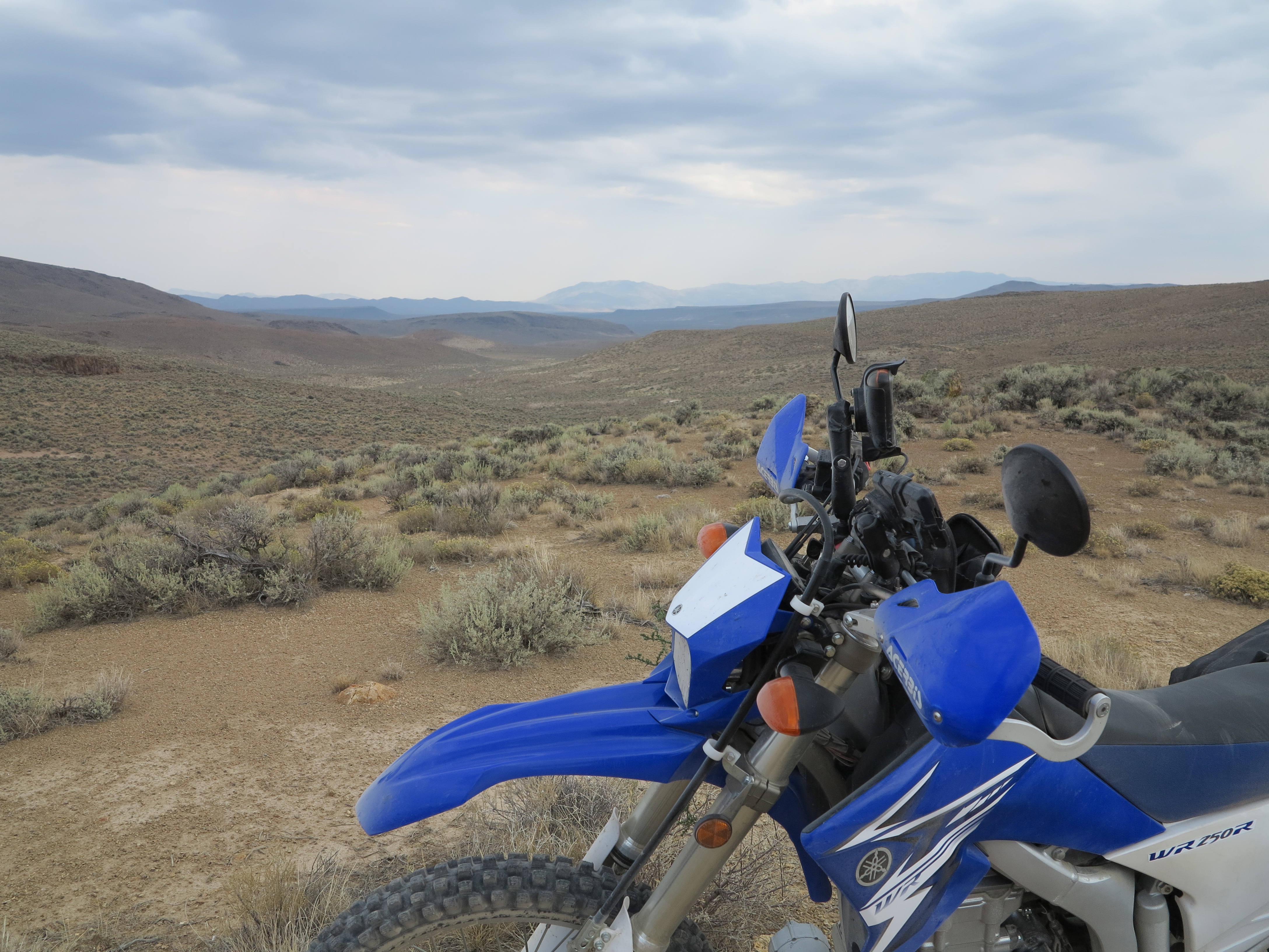
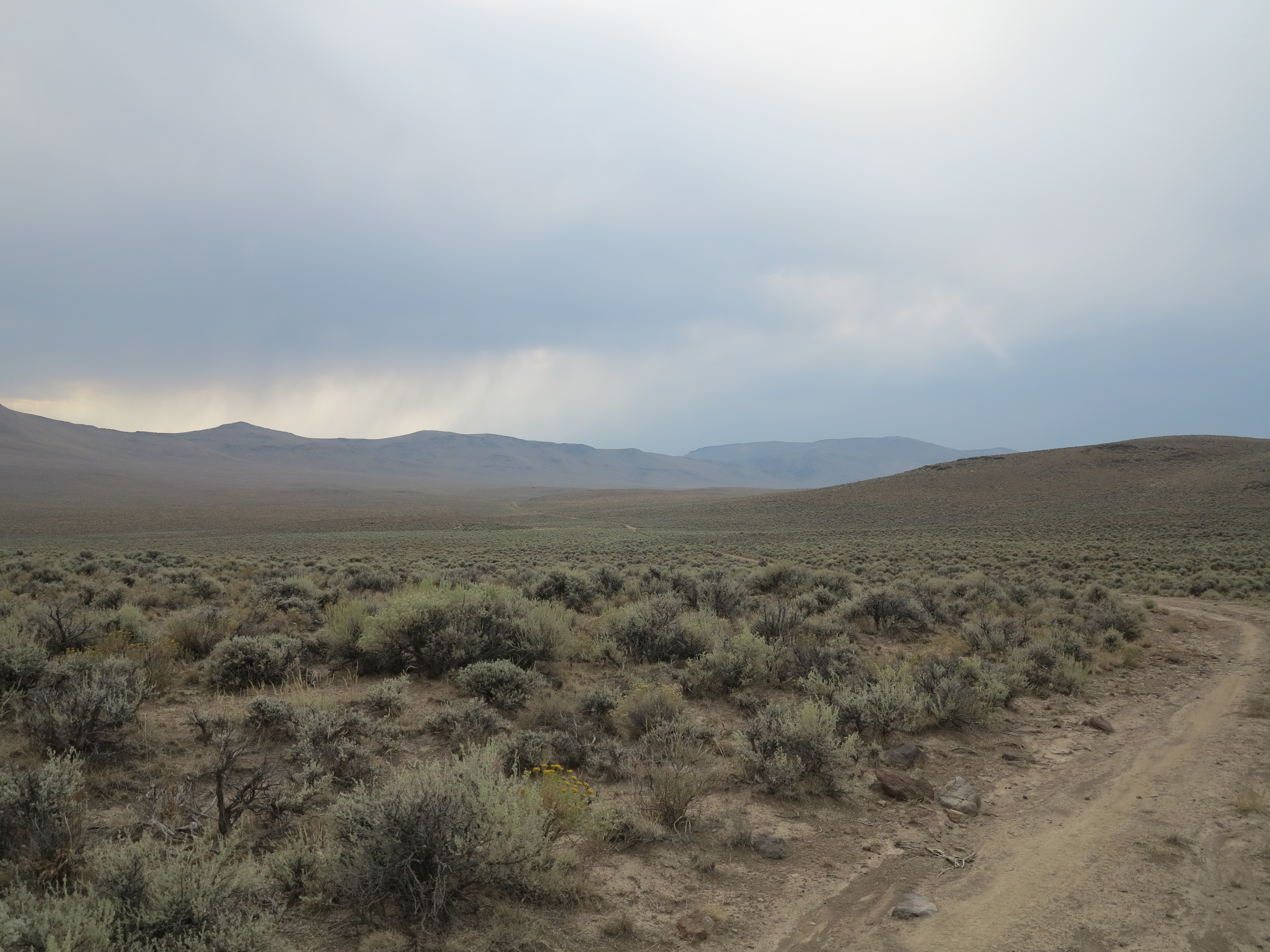
For me, from now on everything else on this loop is just bonus. I’ve accomplished my goal, to ride my favorite stretch of road. The landscapes get better and better from this point forward, though. We continued on the Long Draw road, where we hit the more mountainous areas of this road as we ride the narrower valley formed by the Lone Mountain to the right and Lone Juniper and Hawks mountains on the left.
Long Draw Road. Lone Mountain Loop, 2013 Edition
Below is a photo looking back to the Long Draw road, as we climb towards the end of it.
The WR250R, a valiant bike and a sample of the terrain it conquers so easily.
We arrived at the Hawks Valley, yet we encounter more beautiful landscapes and more nice roads.
Arriving at the Hawks Valley. Lone Mountain Loop, 2013 Edition
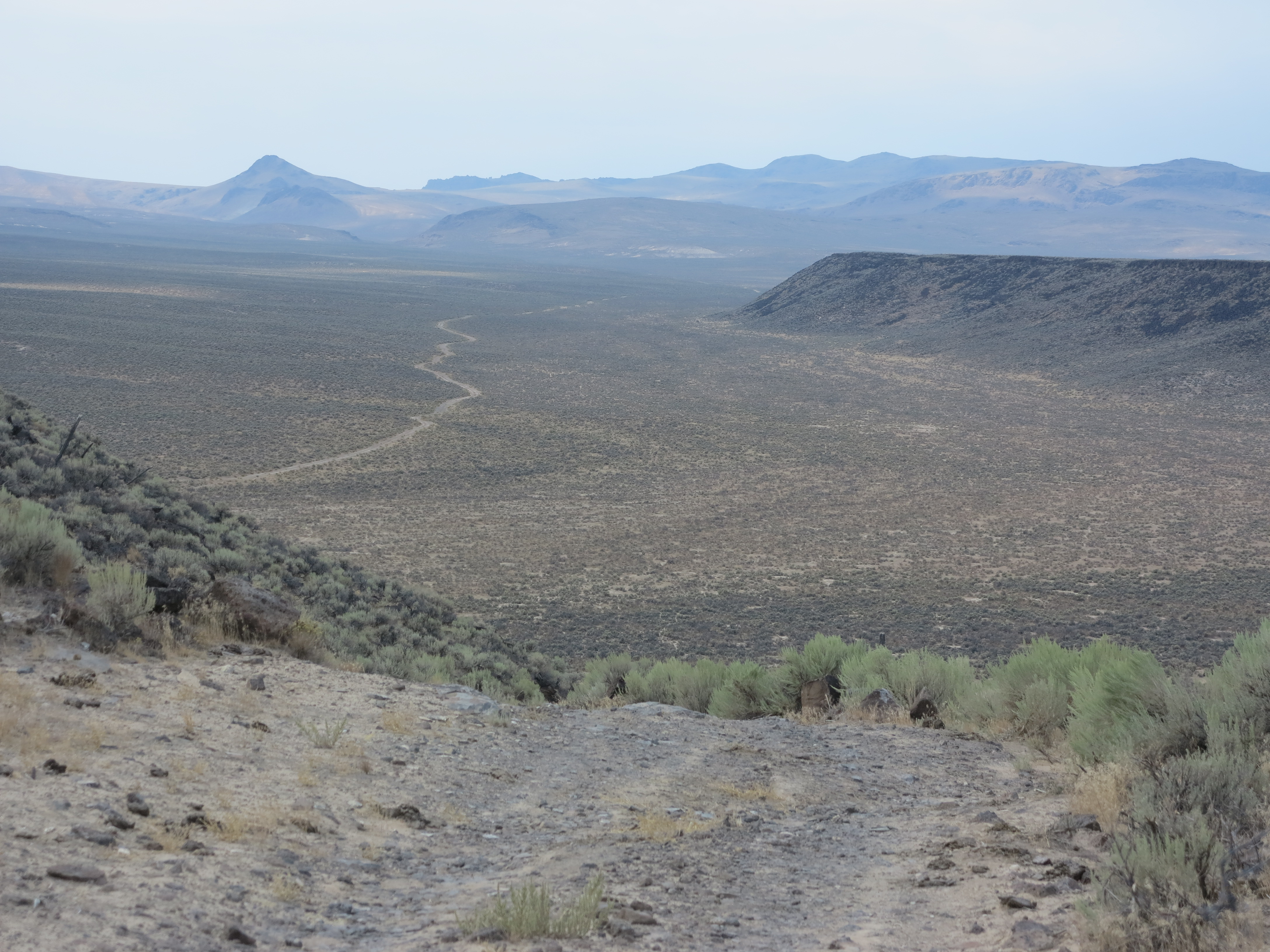
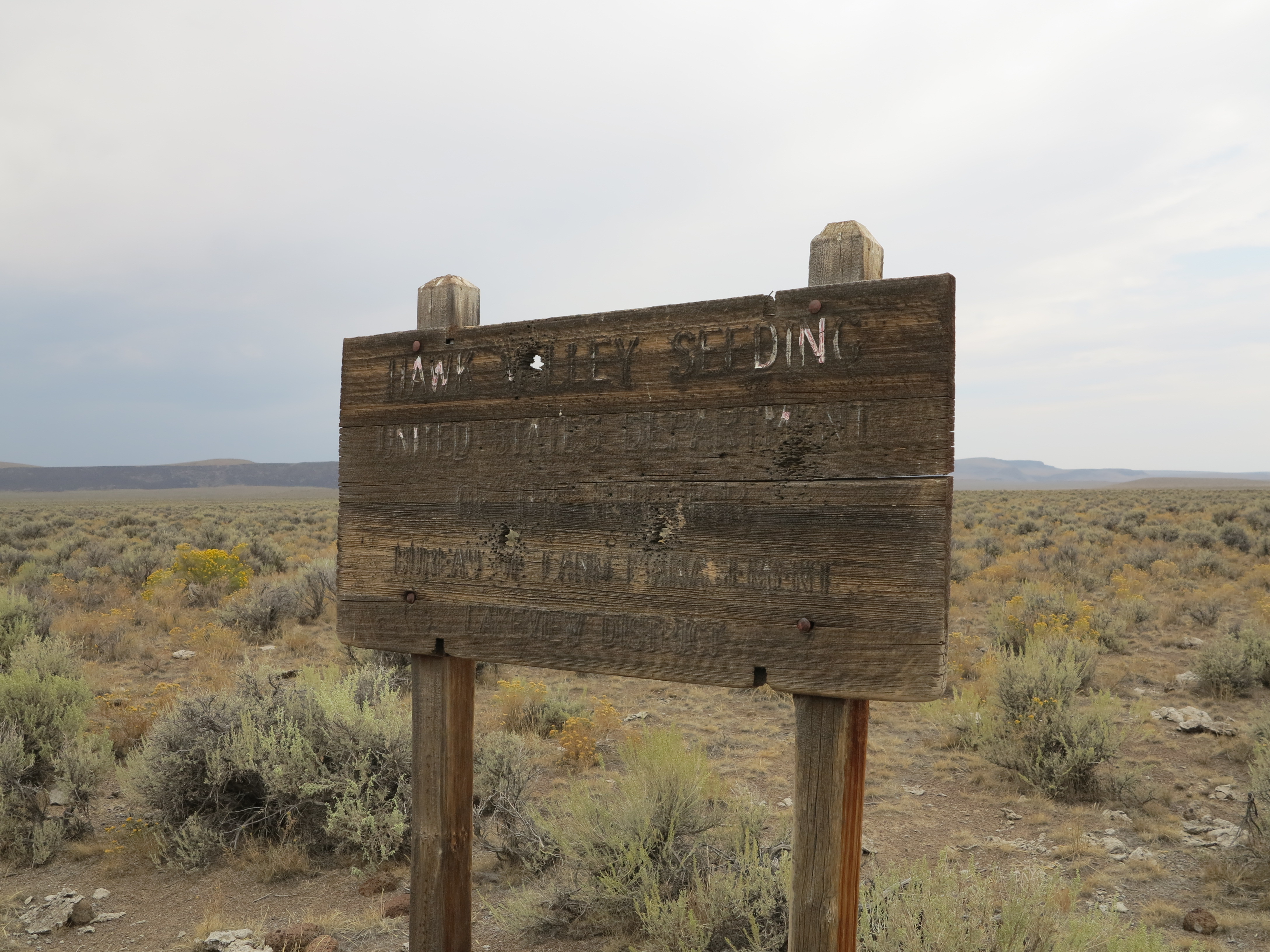
Each time I go past the Hawks Valley sign it seems to be more difficult to read it. It reads: Hawk Valley Seeding, United States Department of the Interior, Bureau of Land Management, Lakeview District.
Hawks Valley. Lone Mountain Loop, 2013 Edition
We continued on Hawks Valley for a few more miles (by the way, the Oregon Benchmark Maps and other Atlases indicate it as Hawks Valley. The sign indicates it as Hawk Valley).
Hawks Valley. Lone Mountain Loop, 2013 Edition
From the Hawks valley we connect with the Funnel Canyon, with the Catlow Rim mountains on the right.
Funnel Canyon. Lone Mountain Loop. 2013 Edition
What can I say, the photos tell a better story about how nice this area of the state is than I can describe in words. The valley gets narrower, as the road approaches the point when the two sets of mountains get closer to each other, like if you are riding into a funnel. No wonder that’s what they call this canyon.
Funnel Canyon, Lone Mountain Loop, 2013 Edition
And on the other side, as you go through the funnel you arrive at the Catlow Valley, where things open up substantially.
Catlow Valley. Lone Mountain Loop, 2013 Edition
And then we came across the playa, close to the end of the loop, and decided to check it out for some extra fun. Let’s call it the icing on the cake.
Playa in Catlow Valley. Lone Mountain Loop, 2013 Edition
Doug turned into a hooligan teenager, riding at speed at the Playa. Well, we all did. Then we all settled down for a chat. Chris and Doug chat…
Chatting in the Playa. Lone Mountain Loop, 2013 Edition
…while I do a little photo shoot.
The Playa in the Catlow Valley. Lone Mountain Loop, 2013 Edition
Great views from all angles.
Playa in the Catlow Valley. Lone Mountain Loop, 2013 Edition
Me and my little bike, mission accomplished.
Me and the little bike, Lone Mountain Loop, 2013 Edition (Photo courtesy of Christian Abächerli)
And this was it, one of my favorite sets of roads ever. To summarize: dirt, speed, landscape, no trees for long views of the road ahead, big sky, and desolation. These are the characteristics that make this set of roads my favorite roads in the world up to now. I’m looking forward to the roads that will take over from these roads their favorite status. But I know, no matter what, this particular set of roads will remain as one of my favorite riding places in the world. It is a long list that I have, and I plan to continue to add nice roads to it.
From Fields to Fields, 109 miles for the Lone Mountain Loop, as measured by the WR250R’s odometer
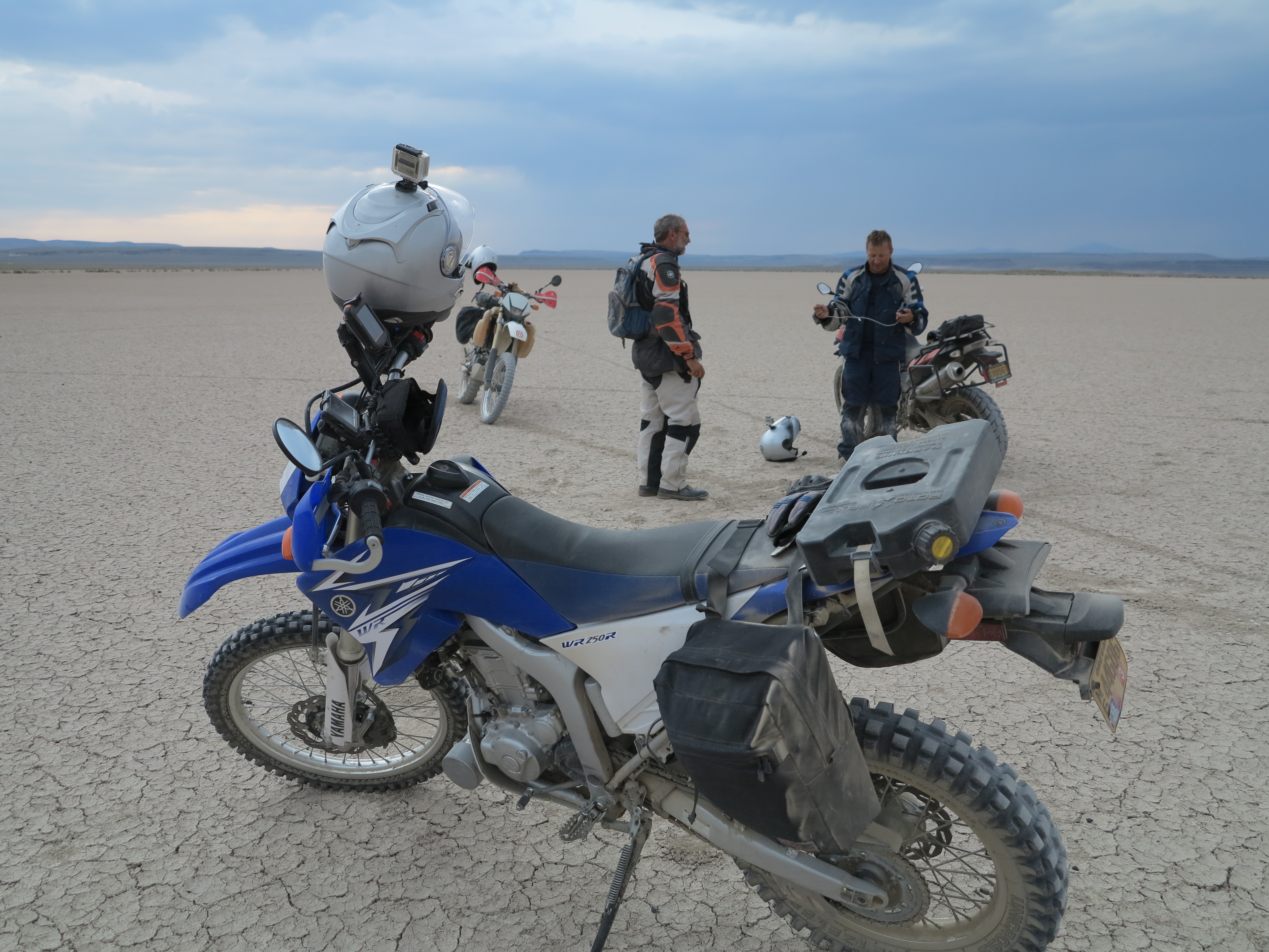
I had ridden 109 miles to complete the loop from Fields to Fields. We went down to the Fields Station to refuel the bikes. Family, friends and the staff of the Fields Station were hanging out, enjoying the end of a nice day.
Fuel in Fields Station.
We traveled the last 55 miles back to camp on Hwy 205 under the beautiful light of the magic hour of the day.
Going north on Hwy 205 at the magic hour of the day
Another great dinner. Thank you again Annie!
Dinner!
This time our campsite had gathered Kyle and his friend Jared. One more reason, actually two more reasons for larger stories around the fire, and more shots of whiskey.
The end of another great day of riding, friendship, and food! I’m thankful for that.
About 200 miles in total, that was a super great day, when I had the chance to ride my favorite road with great friends and then had a chance to celebrate with them at the end of the ride. I’m already thinking about the next time I will ride these roads again.
Next day we woke up to rain and Doug had his rain-fears surface again. Nothing like having a great Plan B, and with that, we started our return to Eugene. All of that and more on the next post!
The Steens Loop is formed by two roads, north and south, both traveling east from different points of the Hwy 205 and completing the loop by connecting in the summit area of the mountain. The north access road to the Steens Mountain summit starts in Frenchglen. For the south access road you continue south from Frenchglen on Hwy 205 for a few miles.
Frenchglen
Last time I was here, in 2010, the south road was a bit on the rough side of things: rocky, and at some points it was narrow with some ruts added to the mix. It was lots of fun chasing Doug on the way down that mountain on the south road. And the north road was a gravel highway, very well graded, with small “ball-bearing” type of gravel, good enough for any motorcycle or car to comfortably get to the top of the mountain. With the WR250R my choice was to go up the mountain on the south road. If it was fun coming down on that road, it should only be better going up that road.
Frenchglen Mercantile, August 31st, 2013
The plan was to go to the top of the mountain, visit the regular overlook sites, then explore some of the smaller, two-track, and unimproved side roads branching out of the main roads.
After a great breakfast, thank you Annie, we got on our way to Frenchglen for fuel. And from there Doug and Annie took the north road for an easy and quick way up. Christian and I got on 205 south towards the south access road.
Sign at the entrance on the south access road
The first portion of the south road, before reaching the mountain itself, was all nicely graded, like it was already back in 2010, with the same ball-bearing gravel as the north road. After a few miles on that road you get a clear view of the mountain.
The Steens Mountain, a view from the south access road
And then we start the climb itself, where the fun would start. However, the former rocky road I was looking forward to riding was nowhere to be found. That road has been graded and graveled all the way to the top since the last time I was there.
Christian enjoying the climb
We made a few stops here and there to check the views.
Big Indian Gorge
The south road climbs on the north side of the Big Indian Gorge, one of the canyons originated from the mountain. The climb was more dramatic when the road was less improved. It gave the feeling someone could relate, with good imagination, to what I’ve seen on photos and video footage of the famous death road in Colombia. Minus the traffic, of course. But now it is a smooth and easy ride all the way to the top, although you still have a chance to ride close to the edge of the mountain, and with no guard rail.
And then it reaches a plateau between two canyons, the Big Indian Gorge and the Little Blitzen Gorge.
The plateau, and the Big Indian Gorge on the right
On the plateau you get the impression you are riding on top of the world. Thanks to Christian, I get to be photographed in action on this trip. Christian stops for pictures, has a nice camera and a great eye for great shots – I will share some of his shots along the way. The Little Blitzen Gorge is on the left on the photo below.
That’s me, riding the south access road on my way to the top of the Steens Mountain – photo Christian Abächerli
And this is what the road looks like when viewed from the top, between the two canyons. You can see, way back there, how the south road goes down on the side of the Big Indian Gorge, going towards the left before disappearing from view.
Looking west from the top of the Steens Mountain. A gravel road snakes down from the mountain. August 31st, 2013
And here is a short video of the climb, and then reaching the other road on the top. You can see how close the road gets to the edge. Please adjust video quality to 720HD for a better image.
We met Doug and Annie on the top, they had arrived a few minutes earlier and had already done some investigation and suggested a route and stops.
Deciding where to go next.
We decided to first check the East Rim overlook, which is just ahead from where the photo above was taken, then check the summit, the Kiger Gorge view point, Fish Lake, then try some of the side roads, and go back down to the camp on the north access road of the Steens Loop.
From the East Rim overlook, here is the northeast area, towards Idaho.
Looking to the northeast
Looking east and to the south, you can see the Alvord lake, the playa, and the desert. Probably Nevada in the background.
Sometimes in June the lake has actual water, something like a foot of water
Next we went to the Summit. Doug had noticed earlier the gate to the summit was open. Cellular companies have built towers on top of the Steens, AT&T reception was perfect. But access to the summit is now limited.
The very summit of the Steens Mountain
Since the cell tower crew was working on the area, they had the gate open, unwillingly allowing us access to the summit. They told us they would be leaving soon, and we should leave before they did, they were going to close and lock the gate on their way out.
Dangerous job, actually the most dangerous occupation in the US
I had heard of accidents with people working on cell towers just recently – this type of work has been rated the most dangerous job in America, more dangerous than working on a crab boat in Alaska. I talked to the crew and of course, they were very aware of these reported accidents. They had all the safety gear on.
I had never been to the summit before. It is a very steep incline to get there, and no cars were there except from the crew’s truck.
Chris riding to the summit
And of course, our motorcycles with their “special access” granted by first doing it and explaining it later if needed (and asking for forgiveness if it turned not to be okay). But as I mentioned, they were nonchalant about us being there, just asked we left before they did.
The three bikes on the top. Annie decided to hike to the top instead of riding
Of course, from the summit you get all kinds of views. To the southwest, you see Wildhorse Lake and beyond.
Wildhorse Lake and beyond towards Nevada
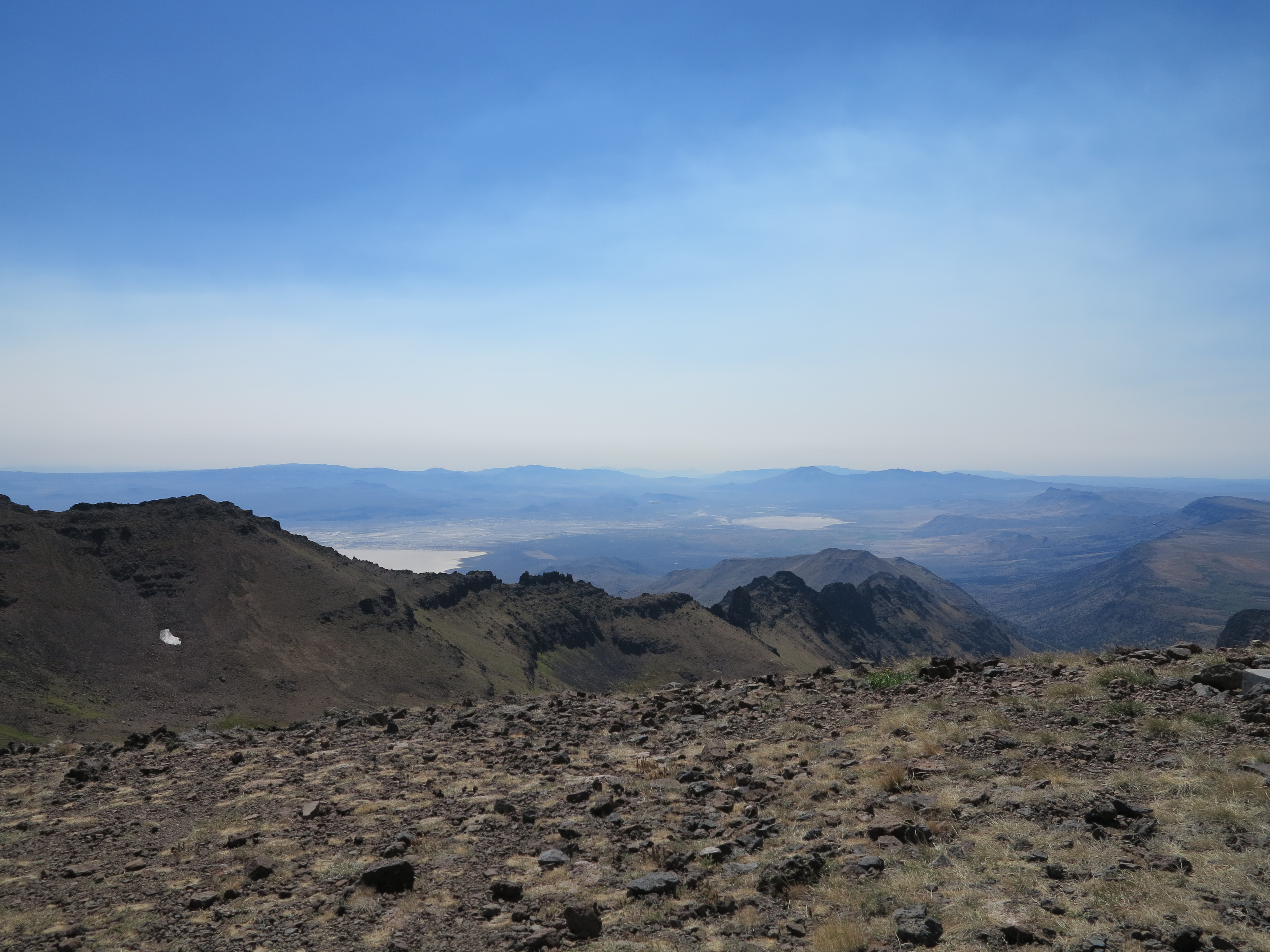
To the south east you see the playas south of the Alvord Desert. That one white spec on the side of the mountain is left over snow from last winter. When I was here in September of 2010, there was a lot more snow. This year we only saw traces of snow here and there, a result of the dry winter we had this year. Actually, in 2010 when we were here there was fresh snow on the ground when rode the East Rim overlook area.
Looking towards the south east, towards Nevada
Looking east, Idaho is there at some point in the not so distant horizon.
Looking to the east, towards Idaho.
Anyway, lets talk about the WR250R, what a nice little motorcycle it is. All along this ride I was wondering what a larger motorcycle could do on these roads. Chris’ F800GS did very well on this trip, a really impressive motorcycle. It can’t go as fast the WR250R does on some of these narrow and rough roads. I can throw the WR250R into these roads without worrying much, it is light, easy to handle if needed. But I just wonder… and I think about my Tiger800XC, and while I know it can travel these roads, my question is always about the fun factor: will the 800XC be as much fun as the WR250R? I doubt it. But I know if I had at least some 10-15 extra HP in the WR’s motor it would be a lot more fun.
I’m thinking… and wishing Honda, which is finally snapping out of its doldrums, would go one step further and make a version of its sweet CRF450 Rally bike available to the public. I even thought about that CB500X. The Honda Racing Team, in its Thai chapter, has made a nice version of that bike, adding a 21 inch front wheel and the CRF250 front end and upgrading its rear spring/shock and adding an 18 in wheel in the rear. It looks nice, and its twin cylinders should provide good road action. And it could be a lot of fun on these roads. And I always liked the F800GS, although it is almost as heavy as my Tiger.
The WR250R on the top of the mountain, August 31st, 2013
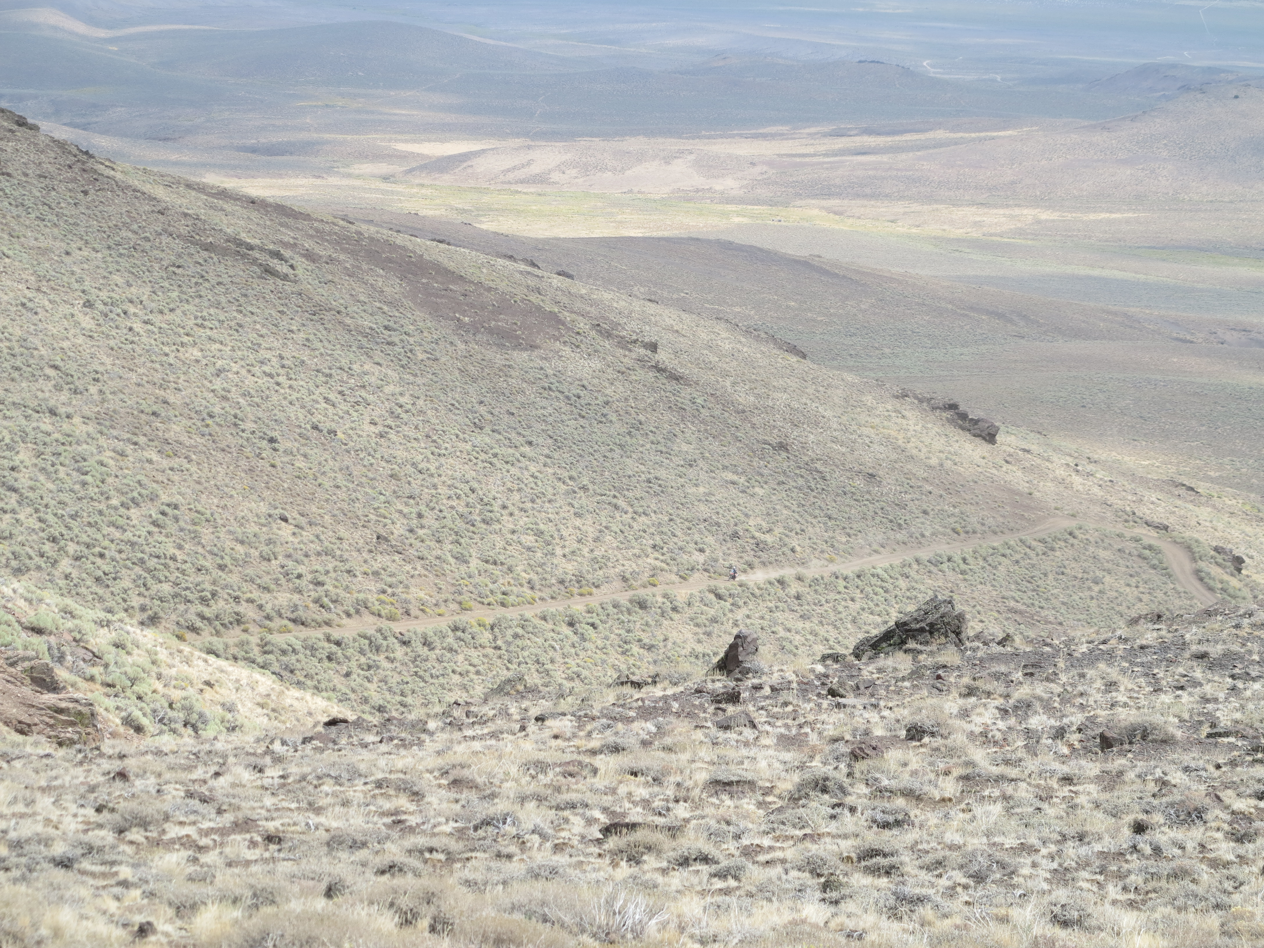
But for now, the WR250R does the job well. I was the last one out of the summit. I videoed the descent, I don’t think I ever took it out of first gear. In the video you can not see how steep this road is at times, but take my word for it, at some points, it is steep. You will notice when I slowed down right before I went past Doug and Annie that were hiking up to the summit and the tires are barely holding traction. I did not venture getting my hand off the handlebars to wave at Doug and Annie.
From the summit we went to Kiger Gorge, another nice area to enjoy the vistas from the Mountain.
Kiger Gorge, August 31st, 2013
We had lunch there, Doug and Annie had brought bread, cheese, salami, it was just perfect!
Nice chat after lunch
From here we started down on the north road of the Steens Loop and eventually turned off the main road to take a look at the Fish Lake.
Doug going down on the north road of the Steens Loop
Fish Lake.
Fish Lake
From Fish Lake, Annie went back to Kiger Gorge to sketch the Kiger Gorge on water colors. And we took one of those side roads I was talking about. Doug had heard there was, some time ago, many years ago, a hunters’ lodge or cabin somewhere in the mountain. Not only that, but he had heard if we went past the cabin we would find vistas to one of the canyons coming from the west side of the Steens Mountain, the Little Blitzen Gorge. Very few people have a chance to see the views that were promised to us.
The road was really unimproved, lots of ruts, real ruts, off camber, two tracks, lots of rocks here and there, some rather large. We made it to the cabin, or lodge as some refer to. I was really impressed by the F800GS and Chris’s riding, they made it through all of this without a hitch.
The Hunters’ Lodge
There isn’t much left of the lodge.
Barely standing
It is barely standing.
Hunters’ Lodge
The interior. No one dared entering it.
Almost 45 degrees – will fall soon.
We continued on the road for a couple more of miles and found a place where we could see the Little Blitzen Gorge.
Little Blitzen Gorge
Here looking towards the east, towards the Steens Mountain.
Little Blitzen Gorge, looking towards the Steens Mountain
Chris and Doug on the edge.
Chris and Doug on the edge of the canyon
And here is the video of the road we took get to the cabin and the view of the Little Blitzen Gorge. The road got worse and less traveled that farther from the main road we went. You will see on this video some of the rocks, the ruts, including the one time where my little WR250R decided to check the bottom of a rut. But since it is a light machine, it was easy for me to get it out of it. It was a fun road! Of course, it involved chasing Doug for a while, for that extra fun factor…
After we were done with this small road we went to the other side of the north road and checked another road, one we had used in 2010 to come from Diamond to the top of the Mountain, by-passing Frenchglen and much of the north access road.
This road will take you all the way to Diamond (or somewhere near Diamond)
After all was said and done, we decided to go back to the ranch, to our campsite. What does Annie have in store for us for dinner?
Pasta,tomato sauce, sausage, cheese and pesto. It was perfect!
That was another nice day for an adventure ride. We built the fire again, more stories were exchanged, checked the bright stars in the sky, and planned our next day. The plan was simple: go to Fields and fuel up, from there do the Domingo Pass – Rincon Flat – Long Draw – Hawks Valley – Funnel Canyon – Catlow Valley loop.
View of the Long Draw – my favorite road in my favorite loop – Up Next
This is my favorite loop for its roads, views, and isolation. If I happen to fall on a “Ground Hog Day” while riding, this is the loop I would like to be riding when it happens, so I could be riding it day after day.
Shaped like a small mountain chain, on a 45 degree angle running northeast to southwest, the Steens Mountain is tall enough and distinct enough from other geographical features in the area. It can be viewed from many miles away.
Coming from the west, looking towards the east: view of antelopes, sage brush, and the Steens Mountain on the background
It is located in one of the less inhabited areas in the state of Oregon, at the corner with neighboring states Nevada and Idaho in the south east of the state. The region is a desert, sage brush is the most common vegetation. The sparse population is mostly made out of cattle ranchers and the people working on the few establishments in the area (small hotels, restaurants, general stores, gasoline – in some locations all these functions are provided by one single establishment). Hunters, tourists, bird watchers and adventure riders take turns visiting the area. With roads allowing vehicles to go all the way to the Steens summit, the mountain is a destination in the region, and going to its summit allows you to see the region on all directions.
View from the Summit of the Steens Mountain, looking north, northeast – August 31st.
What makes it an attraction for tourists and adventure riders? Besides the mountain itself, I can only speak of what is special to me, how that region lured me there for a third visit. Obviously there is the beauty of the region, its large scale, big sky proportions heightened by its emptiness of people. Its absence of trees, people, and bright colors… there is something about melancholy there and something that inspires adventure. And many nice roads to ride with abandon.
Looking towards the south, from the Summit of the Steens Mountain
But most importantly to me, this geography takes me to the Pampas in South America, my gaucho land. If we go from my Pampas, my home in South Brazil to the Pampas of Uruguay and far beyond towards the Argentinian Pampas and continuing to the south, now deep in Argentina, we get to Patagonia, where there is geography similar to the Steens Mountain.
A green view of Serra do Acegua on the background, where is the border between Brazil and Uruguay, my Pampas. Photo taken from Rancho Las Flores in the Pueblo of Vichadero, Uruguay, April 2006
Though the pampas are greener and not mountainous, I want to think the people who live in the Pampas, Patagonia, or Steens Mountain area (and many sparsely populated areas anywhere in the world) and interact with their horses, maybe they work with cattle, share a common thread, a similar story line. These are usually barren unpopulated landscapes, places where the wind contributes to writing their life stories. In my mind this is the image of the Gaucho. I am a gaucho. Not a cowboy, although some gauchos are cowboys. The Steens area reminds me of the Gaucho culture.
Instead of trying to explain this, I should let you find it in the poetry of Argentinian Atahualpa Yupanki, have him tell this story. In many poems and songs he described the Patagonian landscape as if it were intertwined with the Gaucho peoples and their struggles. With a strong social justice flavor from the mid twentieth century, Atahualpa talks about a lonely Gaucho and his travel by horse, unveiling in his well written verses their struggles while at the same time describing the landscape of the Pampas, the Patagonia, the Andes mountains in a multitude of tones of solitude.
When I meet the local people in these areas I feel respectful for their predicament, envious of their choice. There is something about living in such environments, something about introspection and a symbiotic relationship with nature. A gaucho perspective, my interpretation of a gaucho.
Oregon “Gaucho”. Steens Mountain area, September 2013. Photo courtesy of Christian Abächerli
But I also mentioned the great riding in this area, the many rarely used dirt roads traversing the area. They take you to the top of the Steens Mountain or to beautiful valleys or playas, these roads are perfect for riding with abandon, without worries about traffic or fauna inadvertently crossing the road. Because there are no trees to obscure your long view of the road, on most of them you can see miles ahead, as the roads snake through open valleys or flat desert floor to either disappear on the next valley, mountain, or simply in the horizon far away. You can ride fast and get in the moment. The problem is that it is so beautiful, I have to snap out of the moment, pause the full concentration riding mode to stop and take a picture every now and then.
Looking west from the top of the Steens Mountain. A gravel road snakes down from the mountain. August 31st, 2013
I’ve been there in 2006 and in 2010. Needless to say, I’m always thinking about riding there, ready to get back to that area on my motorcycle. I’ve claimed that area and its many roads as my favorite riding area in the world. I can be riding there or towards that area, thinking I’m riding the Ruta 40 in the Argentinian Patagonia. Or I could imagine it would be similar to traversing Mongolia, I place I have yet to visit, but I’ve seen its many two-track pathways on photos and videos posted by other riders.
My good friend Doug also likes to ride in the Steens area. And because motorcycles are often included in our conversations, it is not difficult for the Steens to be brought up every now and then in our conversations around a drink or three at Meiji’s, our favorite hangout in Eugene. Arranging a trip to the Steens has been a question of finding an open window in our calendars early or late summer, to avoid the heat of July and August.
We started talking about going back to the Steens this year, the conversation went back and forth. We got several others in our riding group interested in joining us, but at some point it was down to Doug, Annie and I. And then Christian, a rider from Switzerland whom I met last year, was going to be riding in the United States at about the same time. I invited him and he promptly accepted the invitation. Eventually our friend Kyle, who was in the Steens with us the last time decided to join us for a day as well, bringing with him a friend of his. We now have six people on our troupe.
The plan was simple: meet at the Page Springs Campground at 5pm on Friday of the labor day weekend. Doug and Annie would be driving their truck, carrying their bikes and supplies, I would be riding my bike from Eugene. Christian was on a ride, on his brother’s F800GS, traveling the Washington coast and other areas of Washington and northern Oregon. I gave him the coordinates, he would be there Friday at 5pm. Kyle did not give us a specific day or time for when he was going to get there, but he was going to be there at some point.
So, what bike to take? Doug and I ride a very similar pace when we are off pavement. Part of the riding fun is to chase each other on those fun dirt roads. But we need to be in compatible motorcycles otherwise it doesn’t work. If he brings his KTM Adventure 950, I would bring the Triumph Tiger 800XC. But we wanted to explore some of the smaller side roads, with lots of rocks, ruts, and sand, which are a lot more fun on the small bikes. So we decided for the small bikes, Doug would bring his Husqvarna TE610. I would bring my Yamaha WR250R.
Getting the Yamaha ready for the trip: preparing the power source to charge electronics
I realize an entire season was almost over and I had only taken this bike out for a couple of times. One of these times was a five mile ride to test the new tires I had installed last spring and the other time, some 10 miles or so, was to get the fluids warmed up, do an oil change and air filter maintenance, and fill up the tank. I point my finger squarely at Ducati, I blame it for situation. Like the Streetfighter before the Multistrada, they are the only bikes I want to ride.
The evening before: WR250R is ready to go. August 29th, 2013
But the Yamaha can be a lot of fun, as confirmed by this trip. It just needs the appropriate context to deliver its fun factor. The Steens is one such area where this bike shines.
I filled a large plastic latch box with my camping gear and other supplies and dropped it off with Doug and Annie to go in their truck. The tools, spare tubes, rain gear, a change of clothes, some food, water and one extra gallon of fuel would go with me. This bike has a very small 2.2 gallon tank, the reserve fuel amber light comes on at about 90 miles of riding, and at that time you probably have another 20 miles before you run out of fuel. Extra fuel is a necessity, although I never had to use it on this entire trip. Thursday evening I had the bike packed and ready to go.
Ready to go, navigation tools, camera bag for the G1X.
I woke up Friday morning to gray skies and a few drops of rain, actually it was more like a coast mist, but enough to accumulate drops of water in the visor when riding. I knew it was supposed to rain at some point, even in the Steens area, but the forecast for rain was for a few days down the road only (and we encountered it). Despite the gray skies and the mist, I trusted the forecast, kept my rain gear in the bag and wished for the sun to appear soon.
I started my trip at about 7am. The plan was to take 105 to 126 to 242 (fuel up in Sisters) to 20 to 97 to China Hat for some gravel (fuel up in Christmas Valley) and then 31 (fuel up in Paisley) and from there I would make a decision about fuel, go to Plush for a last tank of fuel or not, depending on how the bike was consuming fuel, and from there there it would mostly be dirt and gravel roads on the desert all the way to the Page Springs campground.
Climbing McEnzie pass on Hwy 242
For the first hour of this ride there was no sun, it was a bit chilly. It was only higher up in the McEnzie pass when I saw the sun for the first time. Meanwhile I was just getting used to the bike and getting on the travel mode. The new tires’ tall and spaced out knobs were flexing, making for an interesting riding experience. It was as if the bike floated on the road when going straight. But on curves the rear tire gave the sensation it was almost flat. I had set the air pressure at the upper band of the manufacturer’s recommended pressure for these tires, and I had to stop and re-confirm the air pressure was still there.
Getting my Sisters’ blessings
A couple of views of the Sisters mountains with a date stamp. Who knows what this will look like in terms of snow coverage, in the end of August, let’s say 20 years from now.
Sisters Mountains, August 30th, 2013
Soon I went through the McEnzie pass summit.
The McEnzie Pass Summit
The fuel amber light had turned on during the McEnzie climb, at 76 miles since I had filled the tank the last time. It made me worried, is there something going wrong with this bike’s gas consumption? It came on 10-15 miles earlier than expected. I got easy on the throttle. And I took in consideration I was on a steep climb, I had let the engine run on idle several times in my process of doing oil change, filter maintenance, chain cleaning a couple of months ago, and it was old gasoline by now.
Full tank of Non-ethanol gasoline
When I filled the tank in Sisters, I had traveled 95 miles from home, 103 miles since the last time I had filled the tank and the bike had taken 1.85 gallons, making approximately 56 mpg. Not too bad, easing the throttle on the way down the other side of the pass probably helped.
From Sisters I traveled to Bend and from there a short burst on 97 south towards the China Hat road for some gravel. Although the picture below doesn’t show it well, the China Hat road was a washboard. I don’t remember it being that way in the past. My new tires, that were giving me the cushion ride on pavement now made me feel I was riding a jackhammer. As the Magliozzi brothers of the Car Talk show mentioned on the shows aired these last two weekends, going fast (55-60 mph, they said) is the best way to take care of the problem. But it doesn’t solve it completely. I’m pretty sure too much air in the tires was a major contributing factor.
Washboard from Hell!
The road got better once we cleared the tree area and the road gravel changed from gray to red. I’m not sure that was the reason, but it was better from this point forward.
End of the washboard section, beginning of a smoother ride
People are always surprised when I tell I ride this little bike on long distances. Well, if I had to ride paved roads all the time, this bike would be a problem. But when I ride it on gravel, it just seems it can go forever, miles go by and the time dimension loses importance. Yes, I would like for it to have more power. But it is good enough, it will reward me later. Soon I was in the Fort Rock area.
Fort Rock under a cloud
From there I took some flat roads towards Christmas Valley. The cold of the morning had disappeared completely, it was now warm and sunny.
Close to Christmas Valley. Beautiful clouds.
I stopped for fuel and lunch in Christmas Valley. The bike had now traveled 206.2 miles from home, 111.7 miles since last refuel in Sisters, and it took 1.8 gallons, making for an average consumption of 62mpg. That’s more like it. I had a great lunch. Well, it tasted good.
Cheeseburger and a coke.
There hasn’t been a time when I stopped in this gas station and market in Christmas Valley and didn’t see a lot of exchange taking place. Delivery trucks, customers of all sorts getting gasoline and other supplies. This is the center of commerce in this region, a prosperous business. To prove my point, they are expanding the building, the construction foundation was going in, soon this will be a larger market or restaurant, maybe a hotel as well?
Christmas Valley gas station and store – a growing business
From Christmas Valley I took Hwy 31 towards Paisley. The last two times I went to the Steens Mountain, at this point in Christmas Valley I had taken Fandango rd. But I wanted to stay away from that very remote area, although I would eventually take some remote roads this time as well. But not as remote as the Fandango and Sheep Rock roads can be.
On my way to connect to 31
Nice views.
Nice views on my way to Paisley
Paisley was just 56 miles down the road from Christmas Valley. I filled the tank again with non-ethanol gasoline. Now I had to make a choice, which roads to take to get to the Page Springs campground. The most direct route is a dirt road only, with no more gas stations all the way to Page Springs 120 miles away. Or I could stop in Plush, adding some 20-30 miles to my itinerary but have a full tank of gas and be on the safe side. I decided to go the most direct route. With the bike’s 2.2 gallons and the extra one-gallon I could travel 180-200 miles. Good enough, let’s go!
Gas station in Paisley
From now on, I would only see pavement for a little while when crossing 395, and later 205, close to Frenchglen, just a few miles before arriving in the Page Springs campground.
I was now about to enter the deserted areas, the much anticipated Gaucho zone. And when on these roads, I feel like the Gaucho described by Atahualpa Yupanki, my motorcycle is my horse, riding alone with my thoughts and the motorcycle and its noises as my company.
Road 6184 (Halfway Buttes), from Paisley to XL Ranch Road
Here we go, sir, I come from the other side of the mountains where the sun sets, riding my motorcycle, through life I go
Here we go, sir, reality and dreams over rocky roads, constructed from enduring life, and solitude
Here we go sir…
If when we die we reach serenity, I swear, life, I’m going to miss you.
Here we go sir, I come from the other side of the mountains where the sun sets.
from the song “Ahí andamos” by Atahualpa Yupanki
(Note: translated from Spanish by me, I’m not a native Spanish speaker, so I may have missed a few things. And it has a couple of minor changes to reflect motorcycle riding and not horse riding)
Same road, further ahead
Eventually the road connected to the XL Ranch road, as I got closer to Abert Lake and eventually 395.
Abert Lake with Abert Rim on the background
On the other side of 395 I got to the Hogback road, a gravel highway. It is often windy here, and this road probably resembles some parts of Patagonia’s Ruta 40. The parts of it that are still unpaved, that is.
Hogback Road
And from here I climbed Hart Mountain.
View of Campbell Lake on the climb to Hart Mountain
I went past the Antelope Refuge.
Antelope Refuge headquarters
I was on the final stretch, 49 miles to Frenchglen, and Page Springs would be another 3 miles from there.
Final Stretch
Saw some antelope.
Antelope, Steens Mountain on the background
I was feathering the throttle, traveling at 65-70 mph, making sure I had the fuel consumption in check. Although I had the extra gallon, I was not interested in stopping and re-fueling. In 2010, the last time I came this way, and having come from Christmas Valley via Fandango road, by this time I had already added to the bike’s tank 1.5 gallons of gasoline (the extra gallon and the two quarter gallon MSR cans).
Still going, mostly downhill, right?
The amber light came on at more than a 100 miles from the last re-fuel. A record! And I was less than 20 miles from my destination, that meant I would make it there without the use of the extra gallon.
I made it to 205, a few miles of pavement going north towards Frenchglen.
And soon I was there. 385.6 miles, some 620 Km. The bike had traveled 123.3 miles, the furthest I’ve ridden with one tank of gas. Overall it was a nice trip there, a great opportunity to ride on my own, living it as the Gaucho I am, enjoying my motorcycle, my horse.
It was a great run.
When I got there, at just about 5pm, Christian had just arrived a few minutes earlier.
If you look closely, there are four bikes there.
Christian had never met Doug and Annie before this day, they got along very well. When I got there they were seating under the shade of a tree, talking away like old friends.
Under the shade of a tree: Christian, Doug and Annie
In the past, before our friend Alain moved to Australia, our riding trips were well organized by him, we had common meals set up. But we were planning this on our own, no one was really organizing it properly. There wasn’t a proper plan. All we had was a destination, but the dates kept changing, at some point we were unsure who was really going to be there, food would be every one bringing their own. But in the last hour Annie came to the rescue. She planned all meals, bought all the supplies, including dry ice and regular ice to keep things well preserved and the beer cold. It was perfect, and every evening we had a great meal and every morning a great breakfast. Much better than I ever imagined possible. Thank you Annie!
Forget about freeze-dried food, Annie came to the rescue! Dinner on the first day at Page Springs
And later that evening we got the fire going. And a shot of single malt whiskey. Great conversations. Perfect end for a perfect day, where I traveled to my beloved Pampas, navigated through my Gaucho soul, and arrived at the camp which was warm from the fire and by great friends.
Fire, whiskey, friends and stories
Christian is great company, a great match for Doug and Annie and me. This group had a great time going places together for a few days. In the next post I will describe our adventures doing the Steens Mountain loop, including a trip all the way to the summit. Following that story I will document my favorite riding loop in this favorite riding area of mine. And the final post will be our return to Eugene. Great times, great photos and a couple of nice videos!
It had been a long time coming. Since the time the Multistrada arrived and became my touring bike, the Tiger was to assume the “adventure” role. I’ve taken the Tiger on several dirt and gravel road rides with its factory equipment and it does fine. But there are a few bolt-on accessories that will help prevent some of the wear and tear the bike gets from riding on gravel roads.
The day I bought it, July 2011
I’ve been reluctant to invest on this bike and get it ready for adventure rides. Many people love the three-cylinder motor, and yes it is great and all. But it is more akin to a four-in-line than a single-cylinder, it feels more like a street bike. Eventually I got to a point where I had to make a decision: sell it or give it another chance? I decided for the latter, invest a few dollars now, decide later on the future of this bike. At least I wanted to have it ready for when that trip to Alaska, Colorado or the Mexican Baja materializes.
Fully farkled and ready to go on an adventure, September 2013
I made a list of things to get, nothing too fancy like suspension work or exhaust, just the basics:
Skid plate
Engine guard
Front fender extender
Rear spring protector
Headlight protection
Pre-filter for the air filter
Larger foot print for side stand
Tires with a bit more of dirt bias
12V power to the top box
Bags (I already had the Giant Loop bags for this bike, and had already installed the pelican top case).
It is interesting how we are now solidly on the purchase on line mode. We cannot see or manipulate the actual goods before purchasing them, but we gain access to a wider range of options and information from national and international vendors.
From Australia came the Uni pre-filter for the engine’s air filter. Triumph, Tour-a-tech and Powerlet were some of my other web-based purchases, all from domestic sites representing companies from England, Germany, and the USA. The only local purchases was a set of car mats, from which I engendered a protector for the rear spring, and the Shinko tires, purchased at and installed by Cycle Parts, the local Triumph shop, during this bike’s regular maintenance.
In mid July I started getting the packages in the mail. When all the parts were available I set one Sunday aside to install everything at the same time. It was a great Sunday, working around the bike was a good bonding experience with it after all, almost as good as if I had taken it for a ride.
Farkles gallore, ready to be installed
First was the tires. I selected the Shinko 705 for the price and its promised true dual purpose for road and dirt. As I mentioned before, they were installed at the Triumph shop during the bike’s regular maintenance visit.
My true work started with the skid plate and engine guards. I selected these parts from the Triumph catalog, assuming Triumph designed them for the best fit and purpose possible. I know some people want to also protect “plastic parts” of the bike. It results in bars going all over the bike which in the end may offer higher leverage that can generate more damage to vital parts of the bike (motor and frame) on a crash. My priority was to protect the engine case only. The installation of these two parts, with no instructions whatsoever, went very well. It was very straight forward.
Perfect fit, straightforward installation of engine guard and skid plate
Next was the headlight protector. I learned a lesson riding my Yamaha when its headlight lens broke when following Doug on a fire road. The replacement cost for that assembly is $230. I did not research what the cost to replace one of these fancy Tiger headlights is, but certainly will be more than the Yamaha’s $230. I went with the rugged look of the Tour-a-tech part. It was a very easy installation process with instructions and easy diagrams to follow.
Tour-a-tech headlight protector
Next was the extension of the side stand footprint. Also from Tour-a-tech, very easy installation as well.
Wider footprint for side stand
I also installed a fender extender for the front fender. This came from the Triumph catalog. It is installed with double-sided tape. I may need to reinforce it with screws at some point. It is holding well with the double-sided tape so far.
Fender extender
For a fender for the rear tire I bought the cheapest set of car mats available and cut a piece from one of the mats to match the width and the length from the outside of the battery box down to the swing arm and installed it with double-sided tape as well. I had to make a drawing of the attachment area, which is quite irregular at that point, to cut the mat to match it and have the largest contact patch possible on the battery box. It is holding well so far. And I have plenty of material for re-installation and re-design if needed.
Rear fender a cut out from a car mat
Next was the Uni pre-filter. This bike’s air filter is under the tank making regular maintenance a chore. The best way to deal with this problem is to be preventive about this issue. The Australians took advantage of the situation designing a nice pre-oiled pre-filter. It substitutes the under the seat snorkel. Let’s keep that area dry, though! And it needs some maintenance (cleaning and re-oiling), but at least you only need to remove the seat to work on it. Installation was straightforward but requires some finger dexterity to connect it to the air box.
Uni Pre-filter squeezes between the battery and the bike’s frame
Last action was to electrify the top box. This required a battery connection extending under the seat and going all the way towards the back and which is also ready for a battery tender. I also purchased a special Powerlet connector that allows the 12V wire to go through the top box. I chose to install it under the box, to prevent water leakage into the box.
Powerlet 12V extension from the battery
Let’s see if it will work.
Powerlet connector inside the top box
I got two bags that I attached to the engine guards. These bags are designed for a another bike, but they somewhat work in the Triumph. Not the best fit, I needed to make some adjustments, use zip-ties to attach them to the bars. They are handy to carry spare tubes and tools. But they are not water proof. That’s what you get for $60.
Tools and spare tubes bags.
I made a time-lapse video of the action. I misplaced the portion of the video the shows the installation of the skid plate and engine guard. But you can see most of the action on this short video. The bags were installed on another day.
All I have to say about this particular Sunday is that I had a great time in my garage working on this bike. This year I cleaned this garage up, got rid of the many unused construction materials that have been stored there from previous owners, patched the cracks on the concrete floor, built a nice work bench area and I now really enjoy my time there, either working on the bikes, getting them ready for a trip, or simply checking on the bikes every now and then. It is a great space where my mind wonders, daydreaming about the faraway places I haven’t visited by motorcycle yet.
Celebrating a great day around the bikes with a barbecue!
To complete a great Sunday with the bikes, and to celebrate a job well done with the Triumph, I fired the grill for a nice gaucho dinner.
Next, I will set the WR250R for a nice trip to the Steens Mountains. I have great photos to share, great adventures to talk about! Stay tuned!