
Our plan for the third day in the Steens Mountain area was to ride the Trout Creek Mountain loop. I had ridden the Trout Creek Loop for the first time in 2010, great roads, great views, and I was looking forward to another go on that loop. Kyle and Jared, who had arrived just the evening before, would do the Steens Mountain Loop and from there they would go home. Right after breakfast Kyle and Jared left for the Steens Mountain Loop. And then it started to rain.
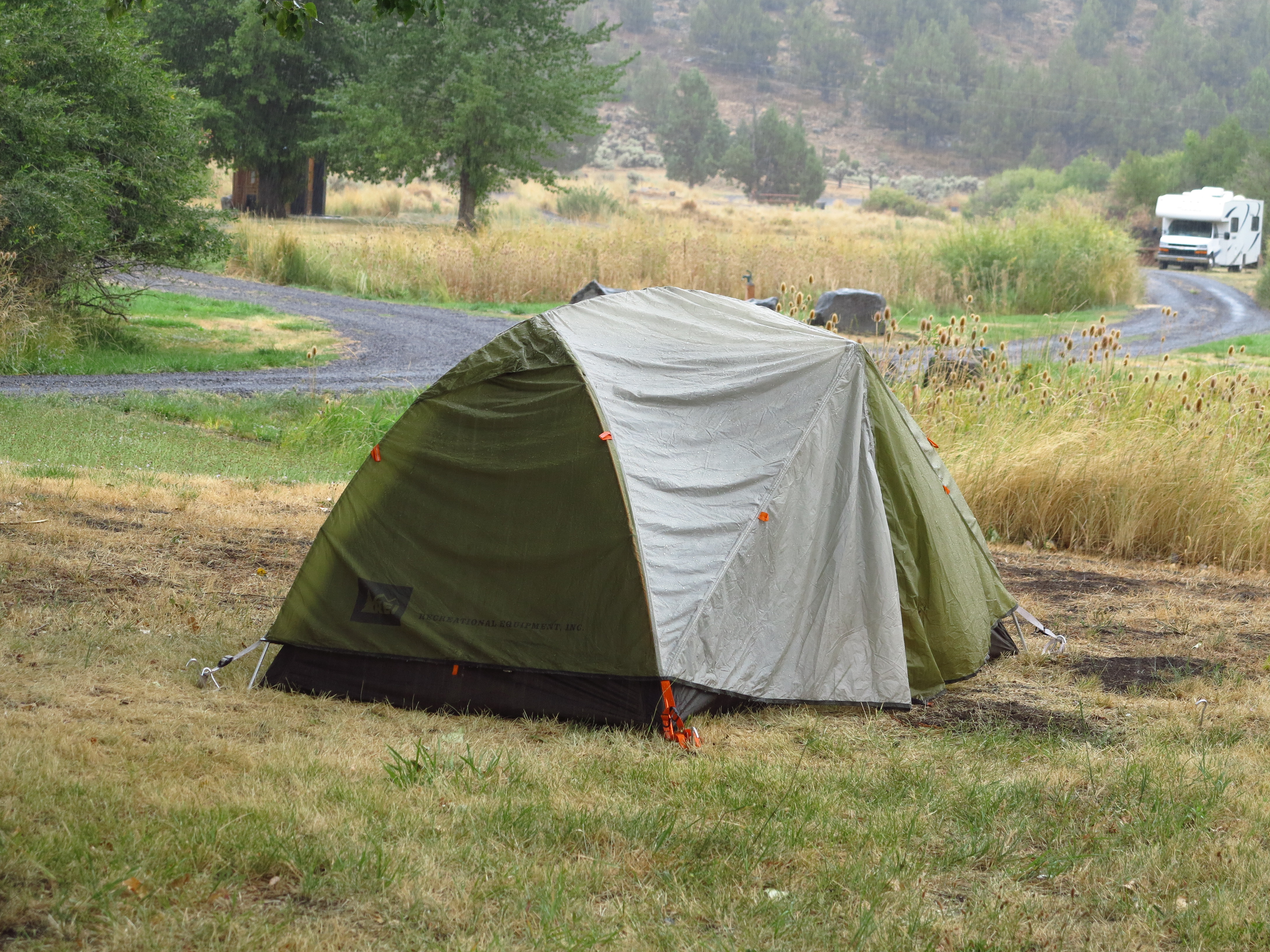
My tent and the storm. September 2nd, 2013
It was quite a miserable scenario. It rained in very similar fashion to what happened in 2010 when we were there. Rain was in the forecast, so we were half ready for it. That is, we knew it was coming, but we were hoping forecasters were wrong. September 2013 repeats September 2010.

Real rain.
I checked the weather stations, and it indicated rain would clear during the day. I moved my bike under a tree, and even there it got wet as the rain intensified and rain water started going through the leaves. My plan was to wait and see… hoping to have a go at the Trout Creek Loop anyway. I look at the picture above, my old Nuvi 260, a cheap, no thrills, not-water proof, car GPS, and I have to smile. That thing has been used on all my motorcycles since 2007, it has thousands of miles of significant abuse. It has been in the rain, it has been at speed on dusty dirt and gravel roads. And it hasn’t missed a beat.

The little Yamaha under a tree. Water was coming down. September 2nd, 2013
I put my camera in the pelican box, protected the other electronics as well. And then we started the debates. Doug, as you would expect (if you’ve read my other posts) did not want to deal with the rain. Trout Creek Mountain is high ground, all roads, except for the main roads to get there, are on high ground and I would guess one area with a potential problem was the cross of the Trout Creek. I figure we would try it, and if we get there and find the creek flooded, we turn around. I had in my mind the images of the landscapes I would be seeing, the clouds framing the horizon, rain making the desert come alive in bright colors contrasting with gray skies. But of course, Doug had nothing to do with it. He started packing and we helped him load his and Annie’s bikes on the truck.
Running away from the rain
In 2010, when rain developed, it was in the middle of a four day stay and we knew it would clear after a day of rain. So we did not lift camp. I went riding, Doug and the guys had burgers in Fields Station, it was all good. Now in 2013 it was a different story. It rained in our last day, so Doug decided to lift camp and go home. My problem is that I was relying on Doug to carry my tent and camping supplies. I did not have the luggage systems to carry all of that with me in the small WR250R. That meant game over for my Trout Creek Mountain Loop. I should had known better. Well, I know better. So I’m the only one to blame for missing out on the Trout Creek Mountain Loop adventure.

All camping gear packed and ready to be loaded on the truck
Meanwhile, Christian was ready for whatever we decided. When it comes to riding he is as relaxed a guy as I’ve ever come across! His only concern was about packing his tent and gear while it was raining and everything was wet. But we packed everything wet as they were. And in probably less than 30 minutes we had our tents and camping gear packed, the truck loaded and Christian’s BMW F800GS and my WR250R ready to go.
We all decided for a Plan B: instead of going home we would ride/drive east towards Summer Lake, where weather prediction indicated it would be dry, camp there, and the next day go home. Doug and Annie would take the truck and Christian and I would ride our bikes there and meet in the afternoon. I thought it was a good compromise. And we would remain as a group, which was a good thing, after all.

Back to the Frenchglen Mercantile for gas
So we put the plan into action. Christian and I rode to Frenchglen for fuel for the F800GS (I had filled up my tank with left over non-ethanol fuel Doug had brought). Here in the desert, for one thing services are far and between and for another you can’t always rely on services being available as indicated, and mostly will close at about 4:30 in the afternoon and also may require cash only for fuel. As an example, when we got to the store we saw the sign at the door, it was closed for a couple of hours. If you are in real need for fuel you will need to wait until they open, or ride to Fields, 50 or so miles south, hoping Fields Station will be open. It is part of the experience.
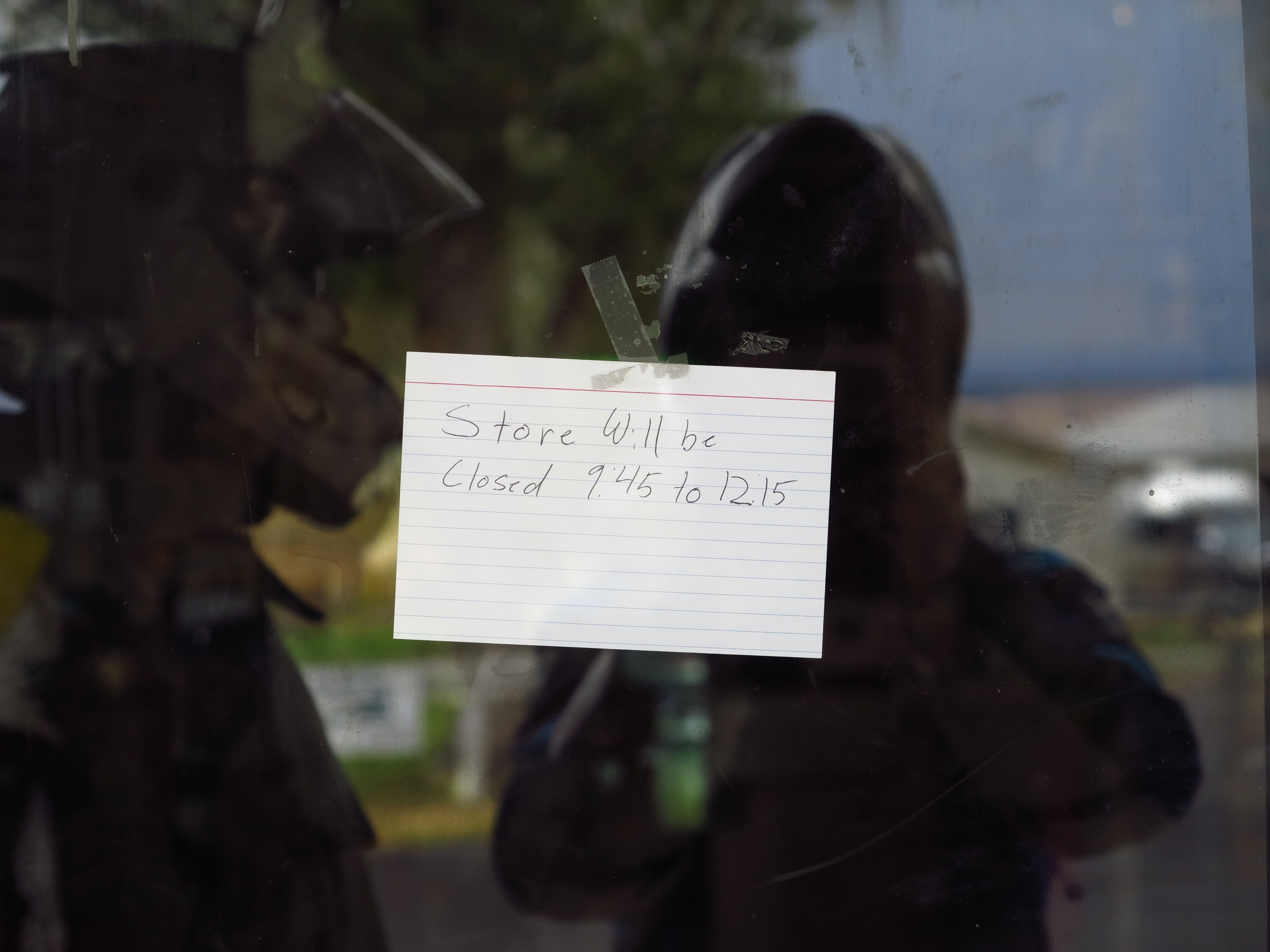
Frenchglen Mercantile closed for a few hours
In our case, Christian had filled the tank the day before in Fields, had ridden about 60 miles since then, so he had a little more than three gallons, which is enough fuel to make it to Plush, our next destination, or even Paisley our final destination. And I had an extra gallon of gasoline on my bike, just in case. We were good. As we were leaving town, we ran into Kyle and Jared, who had stopped at the Frenchglen Hotel for a cup of coffee after returning from the Steens Loop.
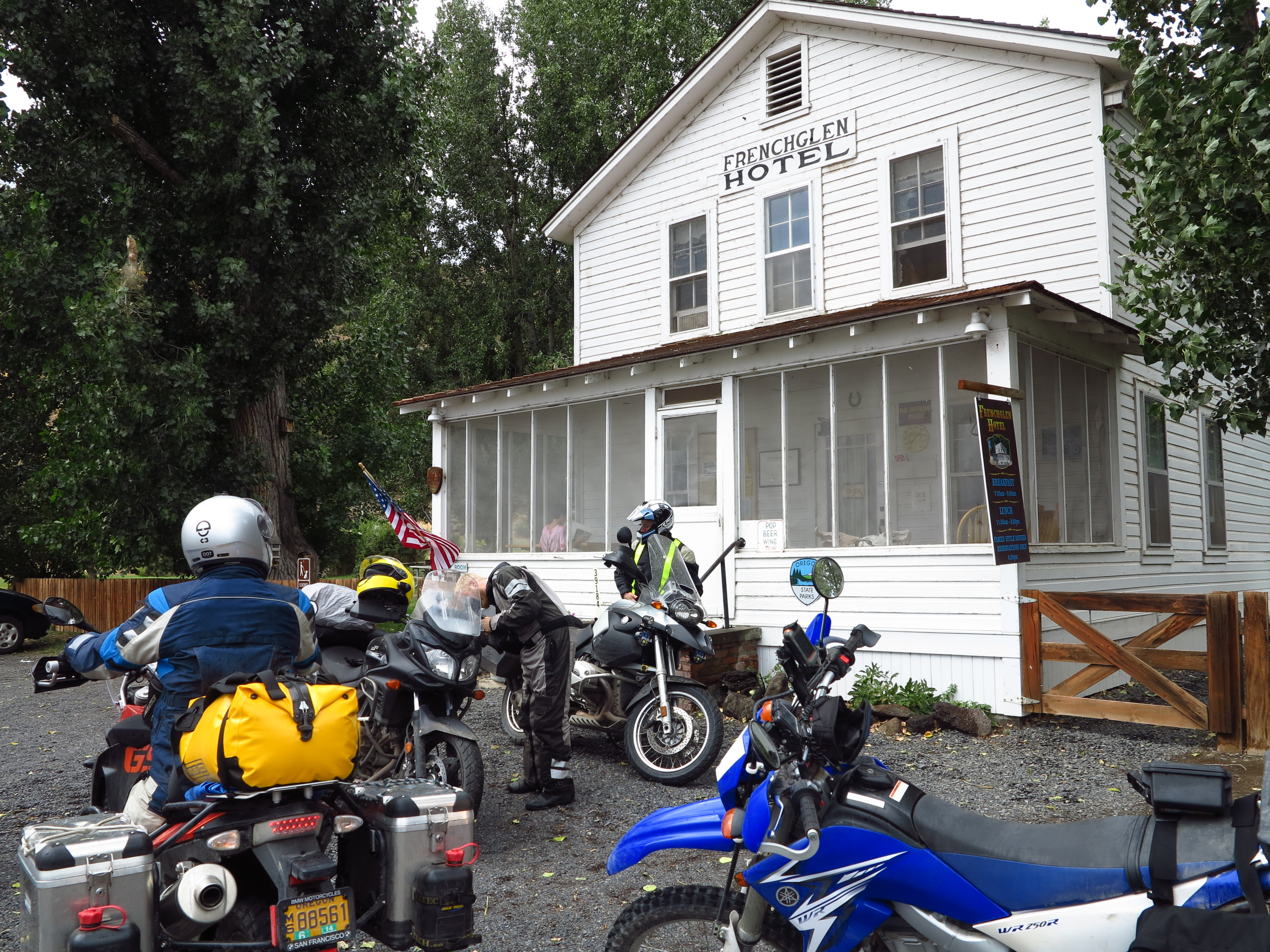
Kyle and Jared after they had a cup of coffee
They reported their encounter with the rain storm on top of the Steens. But it was all good. Except they needed a cup of coffee to warm up before continuing on their way home via Burns, to the north. Actually, after all the fuss about the rain, all the fears about flash floods, the mud, and the walls of water that would engulf us… well, the rain was practically gone. Here we are, leaving this beautiful area under just sprinkles of rain, under skies that were gradually turning clear. We said our good byes to Kyle and Jared and found our way south towards Rock Creek Road where we made a right turn towards the west.

Going west on Rock Creek Rd. September 2nd, 2013
The plan was to go towards Plush for fuel and from there towards Paisley, and the Summer Hot Springs. Back on this road, back with my dreams of Patagonia. But it is quite a big difference riding these roads with someone else. Everything has pros and cons. It is safer, you have company, you can talk at stops. But it is more difficult to get in that mind set of the solitary horse rider depicted so prominently in the poems of the Argentinean Gaucho poet Atahualpa Yupanki.

Hart Mountains straight ahead
Looking back (photo below), that was our last view of the Steens Mountain area. You can barely trace the outline of the Steens Mountain on the horizon, as the last traces of rain still enveloped the area. But you can already see a patch of sun on the mountains in the horizon. I will be back!

Looking back, towards the Steens Mountain area
We see some antelope as we approach the Antelope Refuge headquarters. Every time I’ve been on this road I’ve seen antelope.

Antelope and the Antelope Refuge headquarters on the background
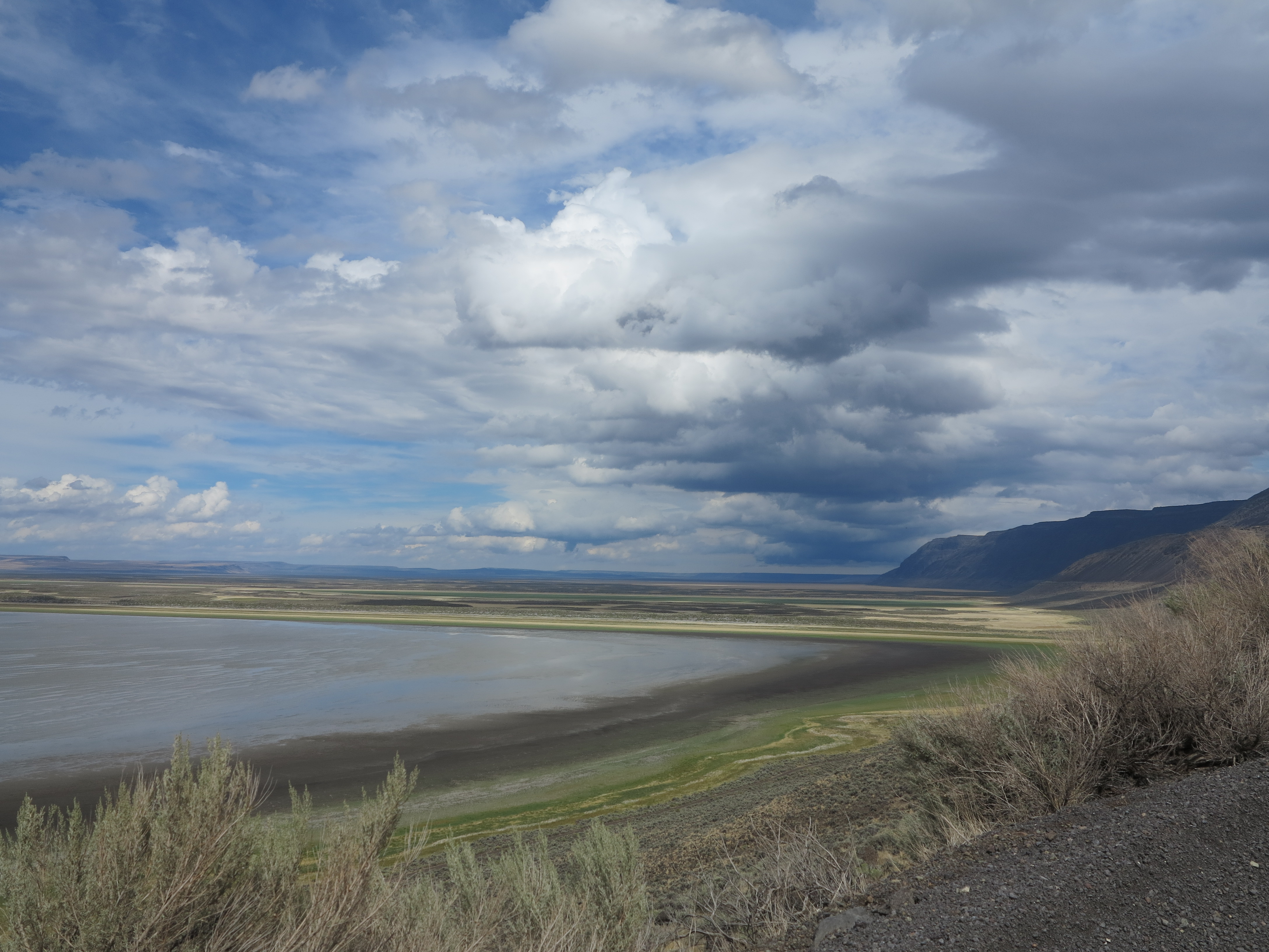
On the other side of the Hart Mountains there is the view of the Warner Valley and Lakes. All framed by the nice cloud formations, left overs from the rain as the weather pattern was still moving away.

Beautiful skies, beautiful vistas
But it was also getting hot and the rain was definitely gone by now. Time to get rid of the cold and the rain layers on our riding suits.

Getting rid of the cold and rain layers of clothing
The colors were fantastic.
Nice colors
Some black Angus enjoying lush greens on the edge of the Campbell Lake.
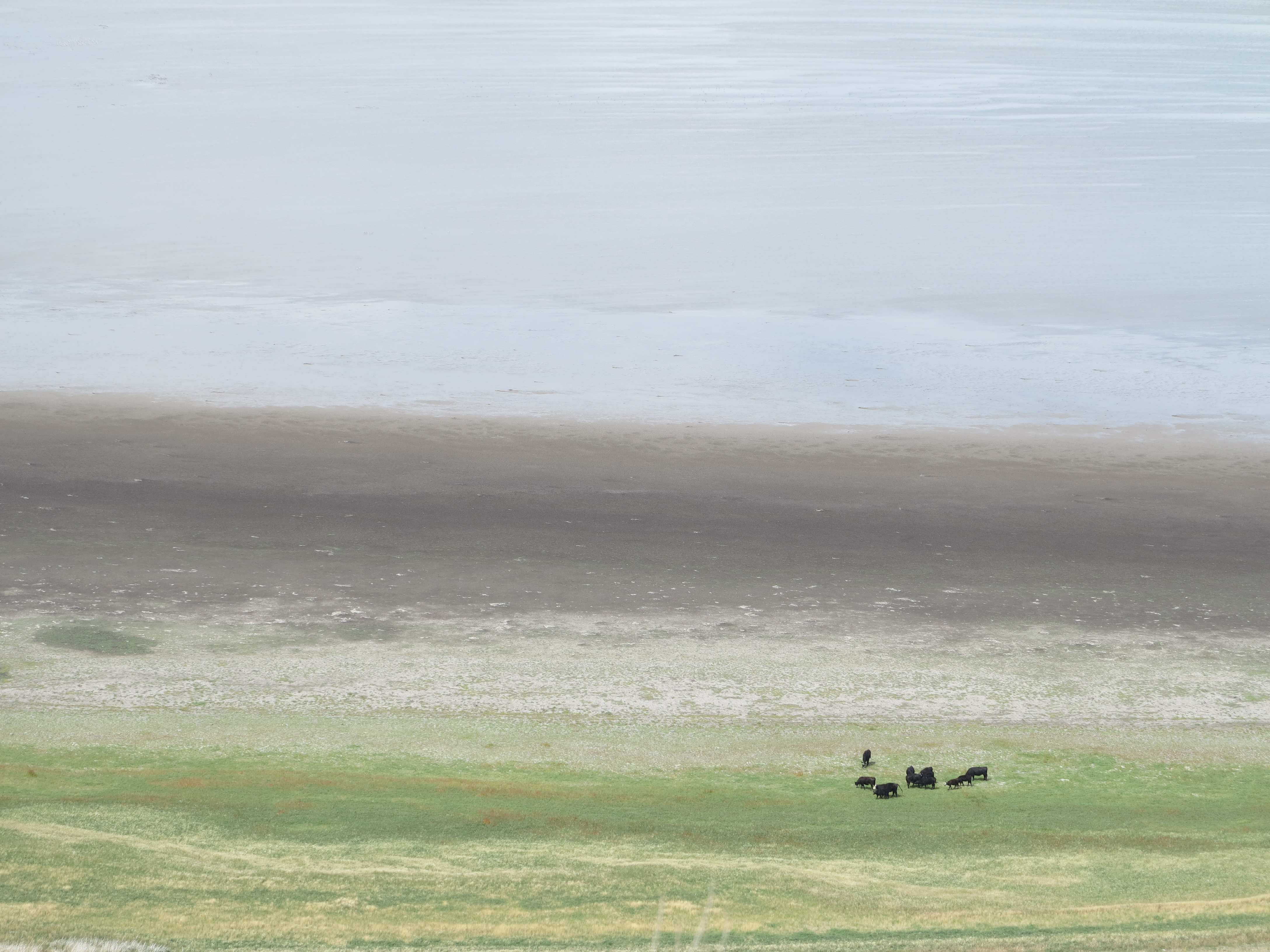
Campbell Lake
We decided to take a side road and check Campbell Lake.
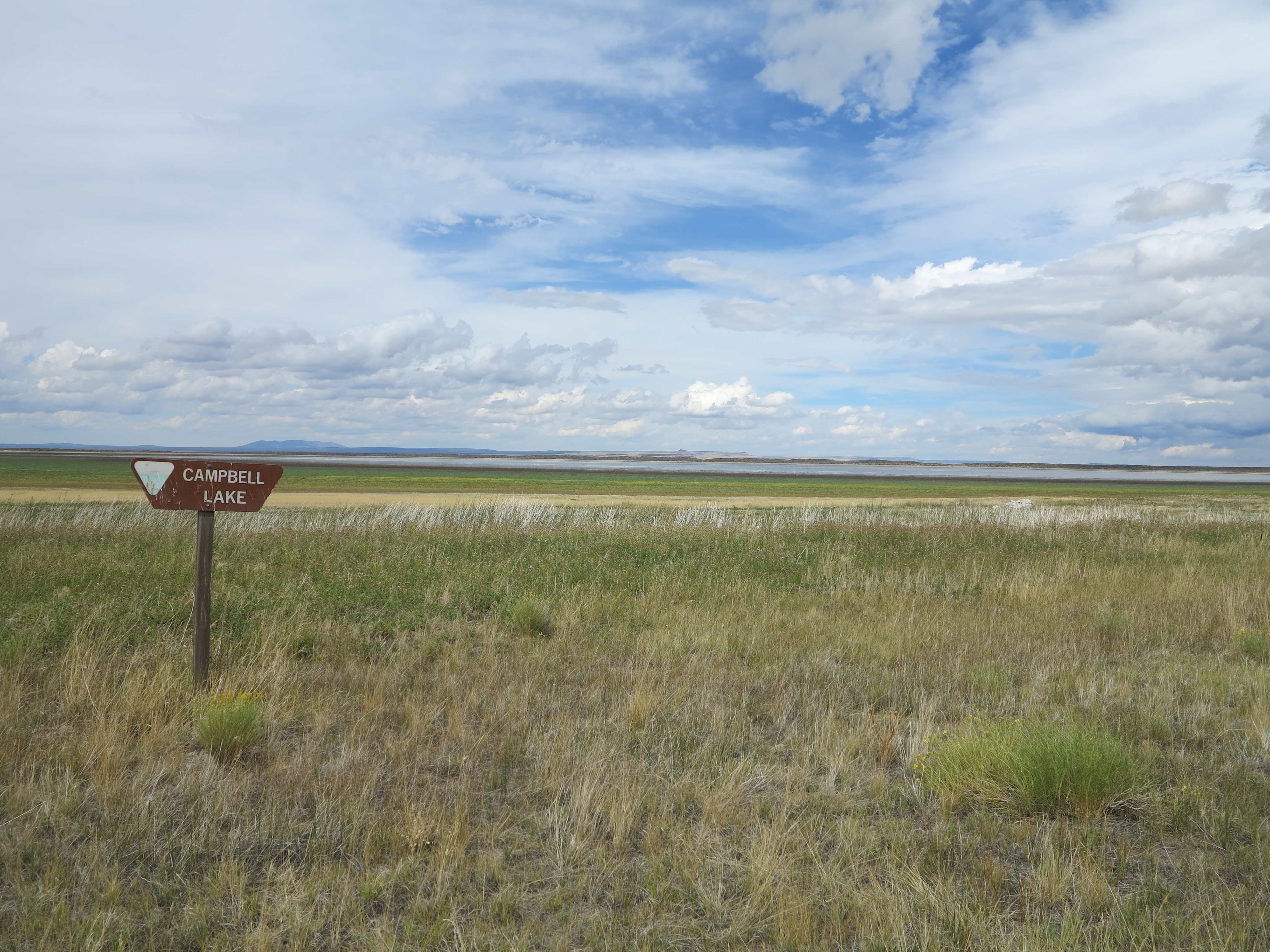
Campbell Lake
You can see some signs of the rain that hit the area earlier in the day.
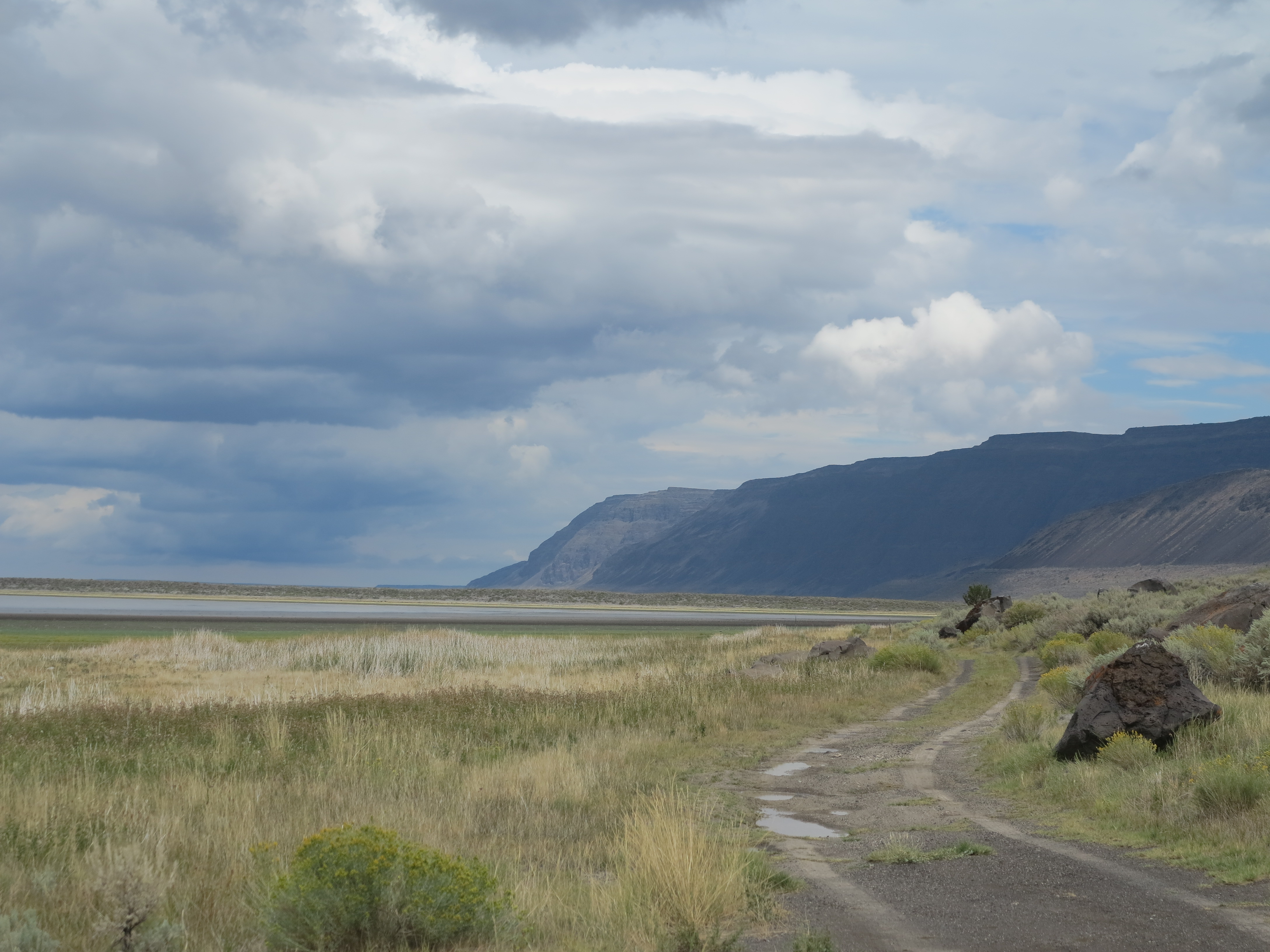
Campbell Lake
We turned around and got back towards Plush. We stopped at the Warner Wetlands view point. It was a quick stop.

Warner Wetlands
We continued, and soon we were in the outskirts of Plush. Nice view of horses on an old homestead, Hart Mountains on the back. It is a beautiful area. Last time I had been here was in 2006, on my first trip to the Steens.

Horses just outside Plush, OR.
We found our way to downtown Plush, and the famous Hart Mountain store.
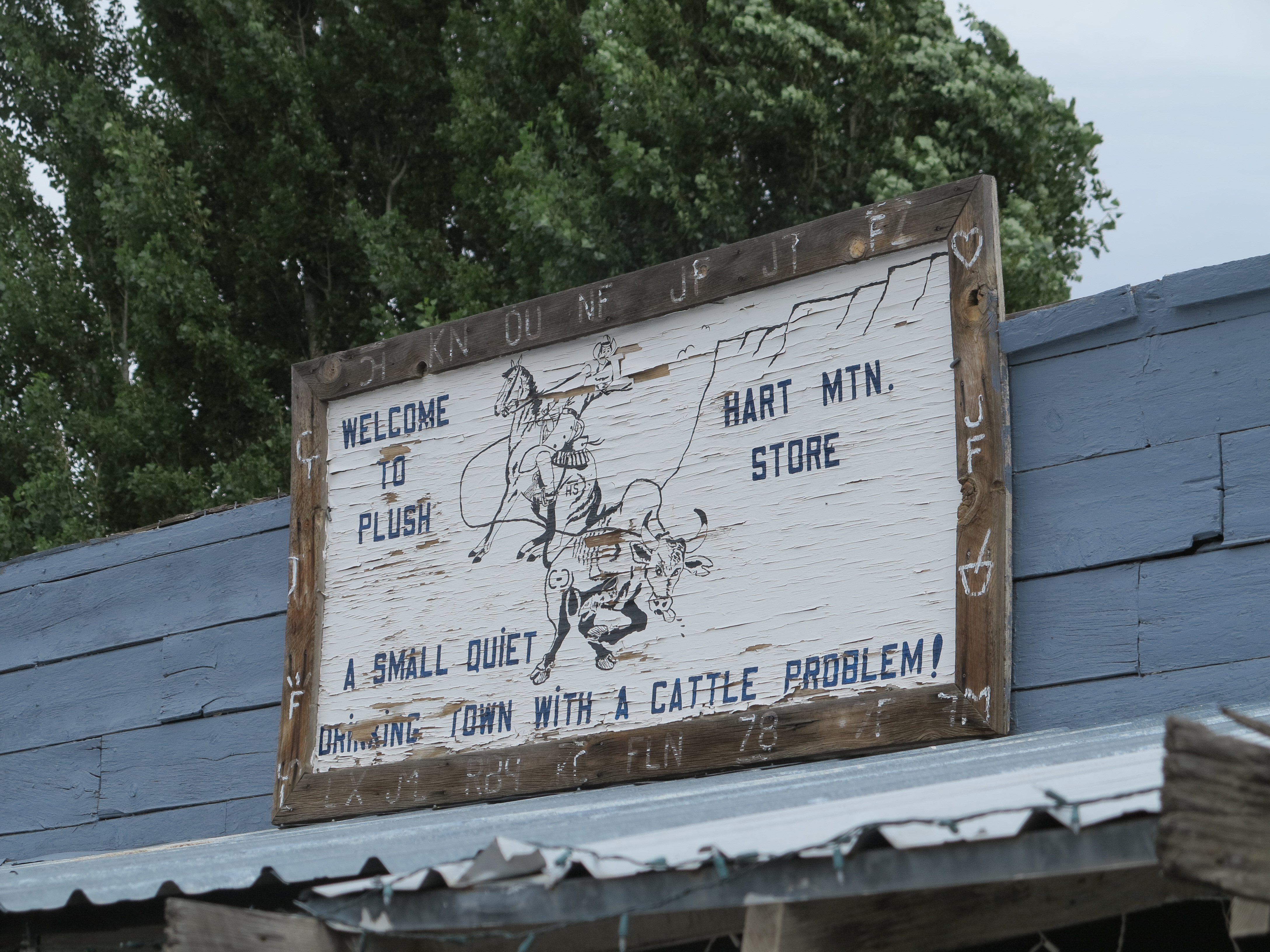
Hart Mountain Store, Plush, OR
We filled the tanks of the bikes and had hamburgers for lunch.

Fuel and Hamburgers in Plush, OR
Christian spotted hummingbirds feasting on flowers just on the side of our table. Nice picture! There were at least three of them. And these little birds are feisty and territorial, only one was at the flowers most of the time, the other two were being chased away every now and then.

The humming bird in the Hart Mountain store. Photo courtesy Christian Abächerli
After lunch and fuel we went back north to connect with Hogback road. There were strong winds from the southeast, a perfect match for my direction of travel, right from behind, making the little WR250R cruise effortlessly at 65-70 mph in 6th gear on this gravel highway.

Hogback Road, a smooth gravel highway
I’ve been on this road a few times and had never paid attention to a cattle corral, just on the side of the road. I went flying past the structure, noticed it this time, and decided to turn around and photograph it.
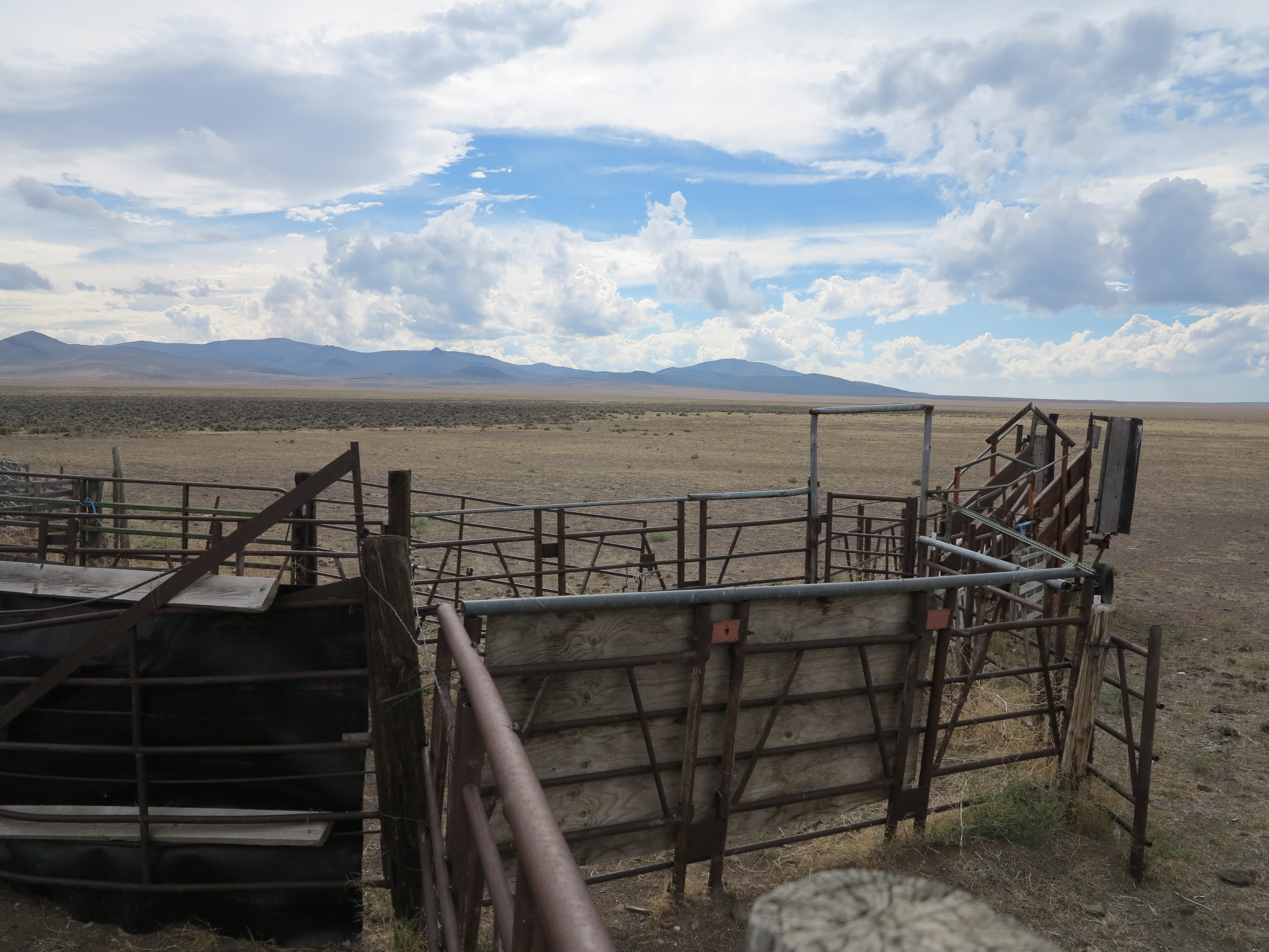
Corral along Hogback Rd
With the cloudy skies, the road, the corral, it made for nice views.

The corral alongside Hogback road. Looking east.
During my childhood and through my teen years I would spend about a month of my summer vacation in our family’s and our relatives’ cattle ranches. And during my stay in these places, especially in my uncle’s property in Uruguay, one of my favorite locations in the world, I would always get involved in some work with cattle.

Rancho Las Flores, Vichadero, Uruguay, April 2006.
I would join the ranch staff, leave early in the morning riding Criollo horses to gather the cattle from the several areas of that large ranch, bring the cattle in groups of about 100 to the corral for a dip (tick control), vaccination, tagging, and all other activities needed. I’m talking about the very corral that is depicted in the pictures above and below this paragraph, which I’ve taken during my last time to that ranch in Uruguay, in 2006.

Criollo horses, Rancho Las Flores, Vichadero, Uruguay, April 2006
I’ve never been to a cattle ranch here in the United States. I can safely assume it is a completely different operation here in these areas of Oregon, when we compare to the Pampa grassland that supports a much higher number of heads of cattle per acre. At some point I would like to visit a ranch here in Oregon, or other western states, to learn about their operations.
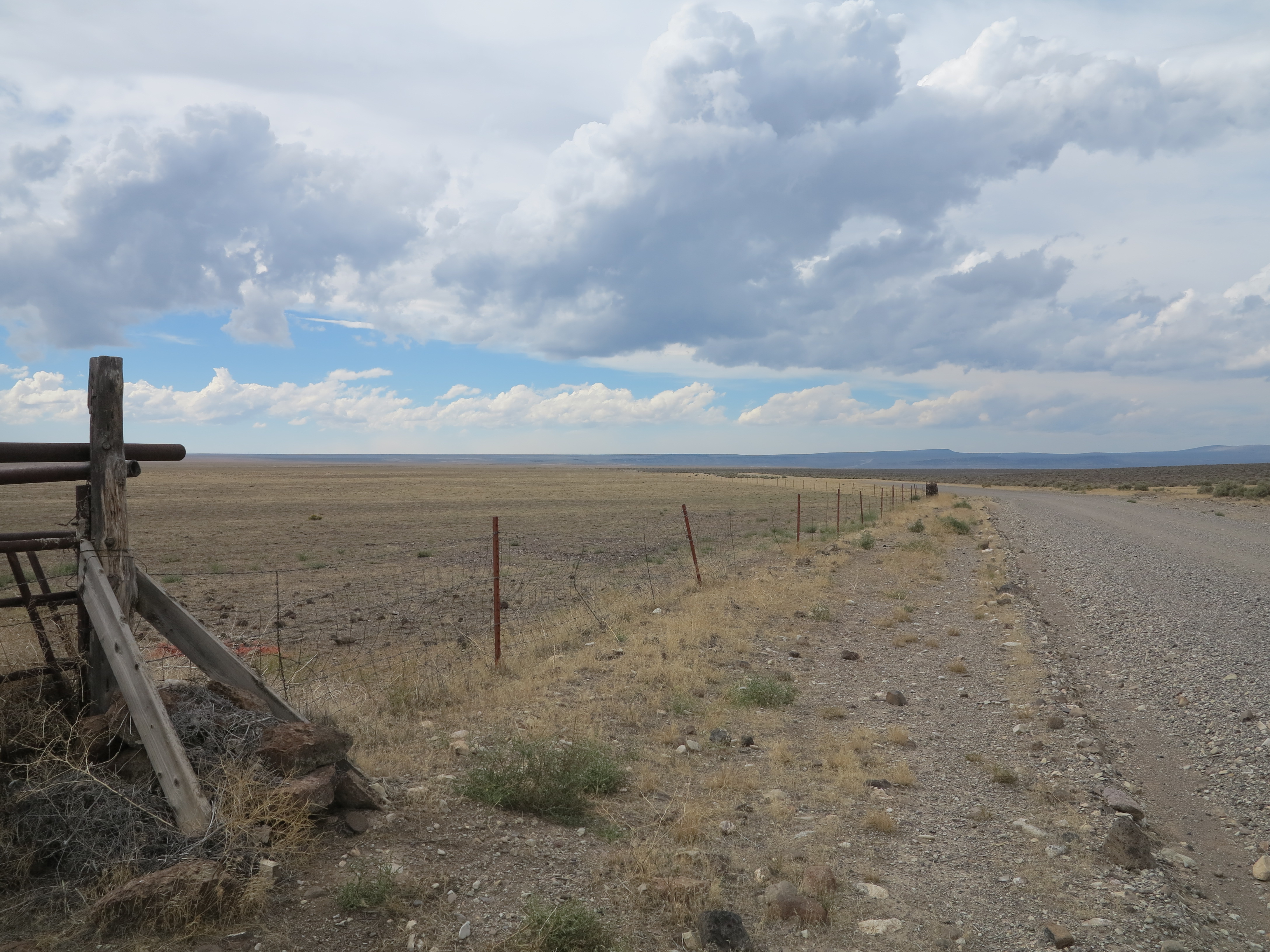
Hogback Road, looking west
We continued on Hogback road, reached 395.

Hogback road and Hwy 395
We rode south on 395 for a couple of miles to connect to the XL Ranch road, which eventually gives you two options: a left turn takes you to Forest Road 6124 towards Paisley, a right turn takes you towards the north to Twin Buttes Rd, connecting to Sheep Rock Rd and then Fandango Rd towards Christmas Valley. That’s the way I took in 2010 on my way to the Steens. We went left towards Paisley, retracing my foot steps, or my thread marks, as this was the same way I took this year on my way to the Steens.

Forest road 6124 towards Paisley
Once we could see the Summer Lake area, we could also see a sand storm. We went from rain in the morning to dry weather and a sand storm in the afternoon. But at times on this track of road, things get pretty isolated. I just feared the F800GS getting a flat tire. It would be Christian and I resolving the problem, both having not worked on that bike before (this is his brothers’ bike). I was confident we would resolve it, I had tools and spare tubes. The tubes would fit that bike, I was not sure my tools would fit though, and my other concern was that it was getting late. So I was glad when we got to civilization again. At the same time, this is really the transition zone from my favorite geography and riding area in the state, to something a bit more impacted by humans, and also naturally more forested. We were leaving the desert and the deserted areas I like so much.

Summer Lake area, and sand storm
We got on Hwy 31 just north of Paisley and continued north towards the Summer Lake Hot Springs, where we were supposed to meet Doug and Annie and establish our camp for the night.

Going north on Hwy 31 towards Summer Lake Hot Springs.
When we got to the Summer Lake Hot Springs, it was total chaos. Lots of people, more than the average crowds you would find there on typical summer days! I rode slowly around the area and could not find Doug and Annie’s truck. I stopped, checked my phone and they had left a few messages. That’s when I learned what was about the out of ordinary amount of people there: they were people returning from the Burning Man event, at the Black Rock desert in Gerlach, Nevada. For me to take the picture below, it took me a little while and some zooming and framing until the moment when it cleared enough for the photo to look like no one was there. Also it was later in the day and people were leaving the spa and getting to their campsites, it was getting closer to dinner time.

The “spa” at the Summer Lake Hot Springs campground. September 2, 2013
Anyway, Doug and Annie’s messages indicated they were in Paisley and suggested we camp at the Marsters Campground, some 8 miles west of Paisley. I called them and we would meet them in Paisley and find the campground. From Paisley we drove together to the Masters Spring campground.
Marsters Spring Campground
It was a good opportunity to dry t tent.

Drying the tent
Instead of digging into our boxes to find our food supplies we decided to hop on Doug’s truck and go to Paisley for dinner. Except, his truck only accommodates two passengers.

Setting the go pro on the roof of the truck
No problems, we will get on the bed of the truck and ride Doug and Annie’s bikes to the restaurant.

“Riding” bikes to the restaurant
It was a bit chilly but we made it there. It was worst on the way back, when it was colder and in the dark.

From the campground to Paisley for dinner. September 2nd, 2013
We got to the Homestead Restaurant, had a good dinner, western style cuisine, I suppose.

The Homestead Restaurant, Paisley, OR, September 2nd, 2013
After dinner, we got back to camp, lit a fire, had more whiskey and more conversation around the campfire. I had already forgotten about Trout Creek Mountain. It was good to still be together as a group.
Up next I will report the last day of this trip, including a few more adventures before getting back to Eugene.
