
In the last several months I attended work related meetings in Washington DC, Atlanta, Chicago, Philadelphia, and Portland.
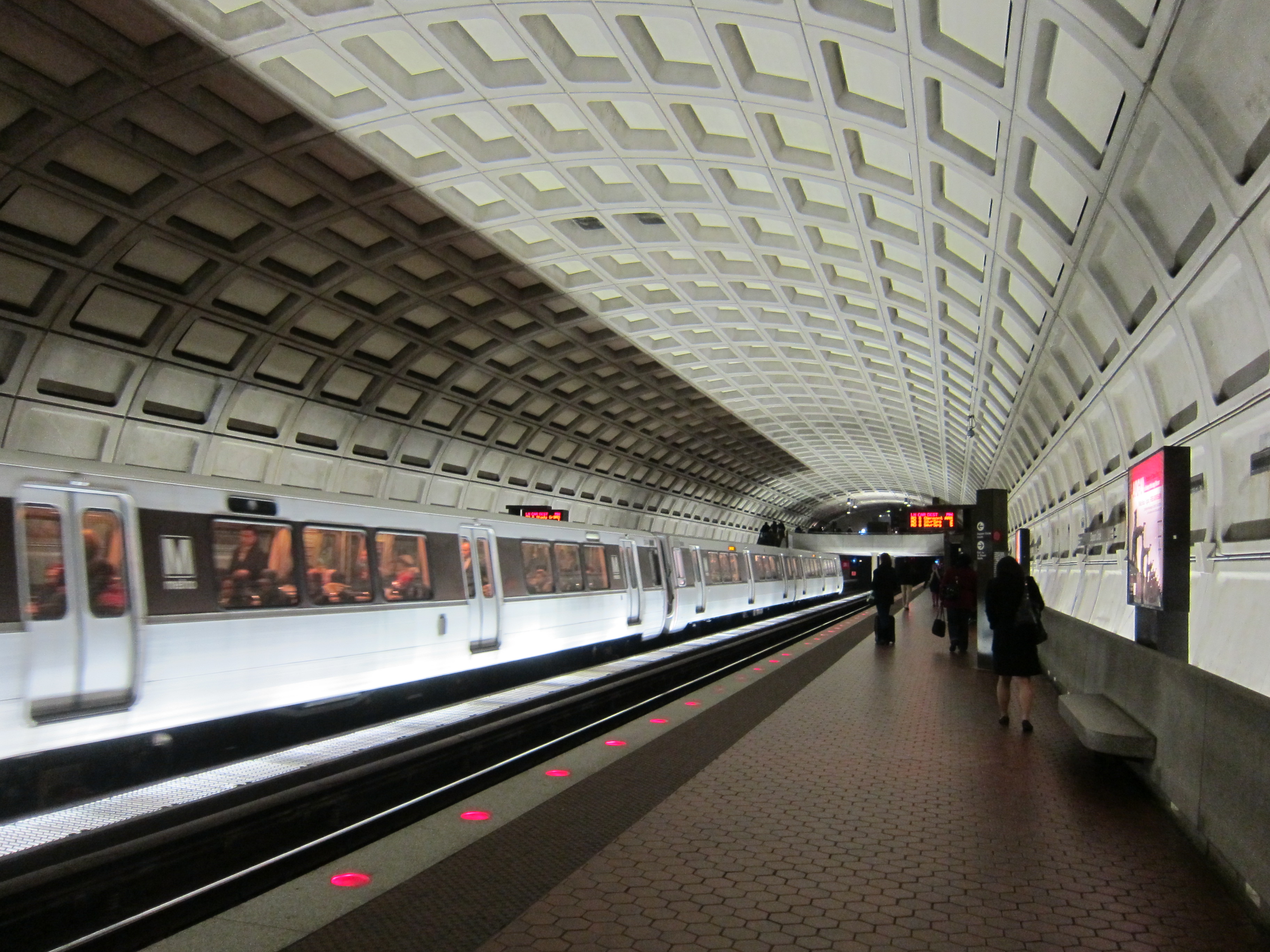
Washington DC, March 2013
In all of them I made use of their public transportation system. Using those systems was convenient to me in terms of taking me where I needed to go, it was efficient in terms of how fast it took me to where I needed to go, systems were sufficiently clean, and they were also inexpensive when compared to the alternatives.
Washington, DC, March 2013
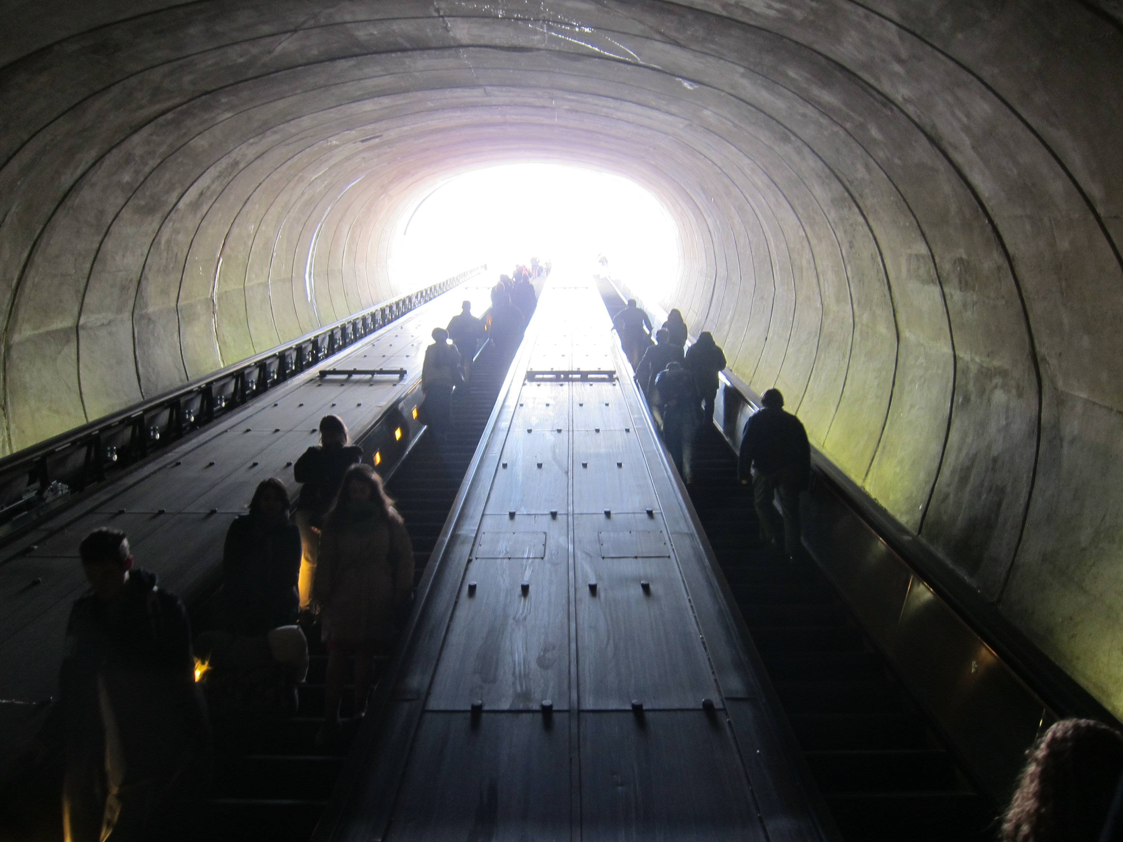
In some cases, like in Chicago, when I first was introduced to its train system several years ago, I was actually in a cab going from downtown to the airport and traffic was at a standstill just outside downtown. I asked the driver how long it would take to get to O’Hare (ORD) and his answer was about 90 minutes. It would mean I would miss my flight. So he drove me to the next train station and probably less than 30 minutes later I was safely at the airline’s desk at the airport. And at a fraction of what the cab ride would have cost me. I never looked back.

Chicago, March 2013
A couple of weeks ago I was in Philadelphia, participating at a conference in Philadelphia’s convention center. Hotels in the vicinity of the convention center had no vacancy or were rather expensive. I had no problems selecting a hotel by the Philadelphia airport. To be honest with you, I did not research whether there was public transportation from the airport to downtown Philadelphia. I just booked the hotel and hoped for the best.

Marriott Hotel at the PHL April 2014
I was pleasantly surprised by Philadelphia’s public transportation. From my hotel room at the PHL I walked probably no more than 5 minutes and I was at the train station where trains departed every half hour to the city center. Trains departed at the :12 and :42 of every hour. Everyday I timed my trip from my hotel room to the station so I did not wait more than 5 minutes to get on the train. I picked the 6:42am train and at 7:10am I was in the city center.

Arriving in downtown Philadelphia
Perfect! But not only that, when exiting the train at the East Market station, it dropped me right by the Reading Station Market.

Reading Station, Philadelphia, April 2014
Where I could have a nice breakfast before attending the meetings.
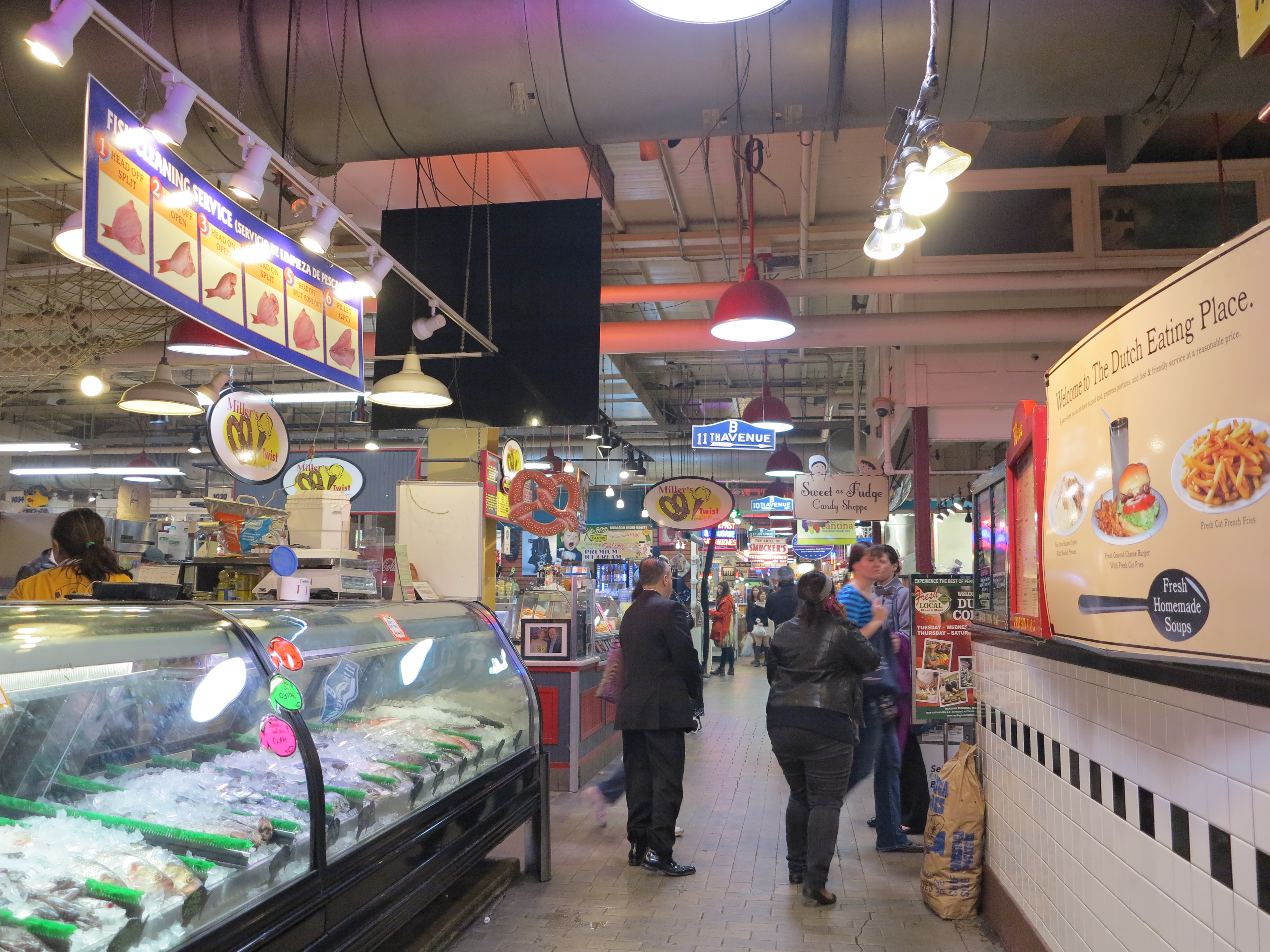
Reading Station Market, Philadelphia, April 2014
Or I could walk directly from the East Market train station right into the Convention Center.

From the East Market station to the Convention Center
At the end of the day, I would find my way back to the East Market station. And I would be back in my hotel room some 25 minutes later, and at a $12 round trip.

East Market Station
During the years I lived in Columbus, from 1987 to 2005, I witnessed the growth of a town driven by a perfectly designed system of highways. Not unlike some other mid-western towns, this system of highways was a great example of the “if you build it they will come” growth model. In the specific case of Columbus, it determined the car-dependent suburban sprawling to be the rational and efficient way for the city to grow.
It has been 7 years since I last was in Columbus. During my time there, its wide spread geography and its well designed systems of freeways worked well for me. Besides the morning or evening rush hour, the rest of the time traffic flowed relatively well around its system of freeways. I have to say I made great use of the freeways in Columbus, favoring them over the back roads and shortcuts through the city. But while in Columbus, I also got in the City and Regional Planning master’s degree program at the Ohio State University. So I had no choice but to learn a few things about urban planning and design. At the same time I knew the highway system in Columbus worked well, I also knew, should the city grow as expected, eventually his system would not only collapse, but it would offer no alternatives for viable public transportation.
Just recently I visited the Central Ohio Transportation Authority (COTA) site to see how things were going over in Columbus and took a look at their projected traffic and transportation alternatives. Traffic has become a problem and is projected to become worse as population growth in the metropolitan area is projected to remain decentralized and spread throughout the suburban areas. There are no visible transportation corridors now. Nor in the future according to this projection, where pockets of growth, in red, are spread almost evenly throughout the mapped area.
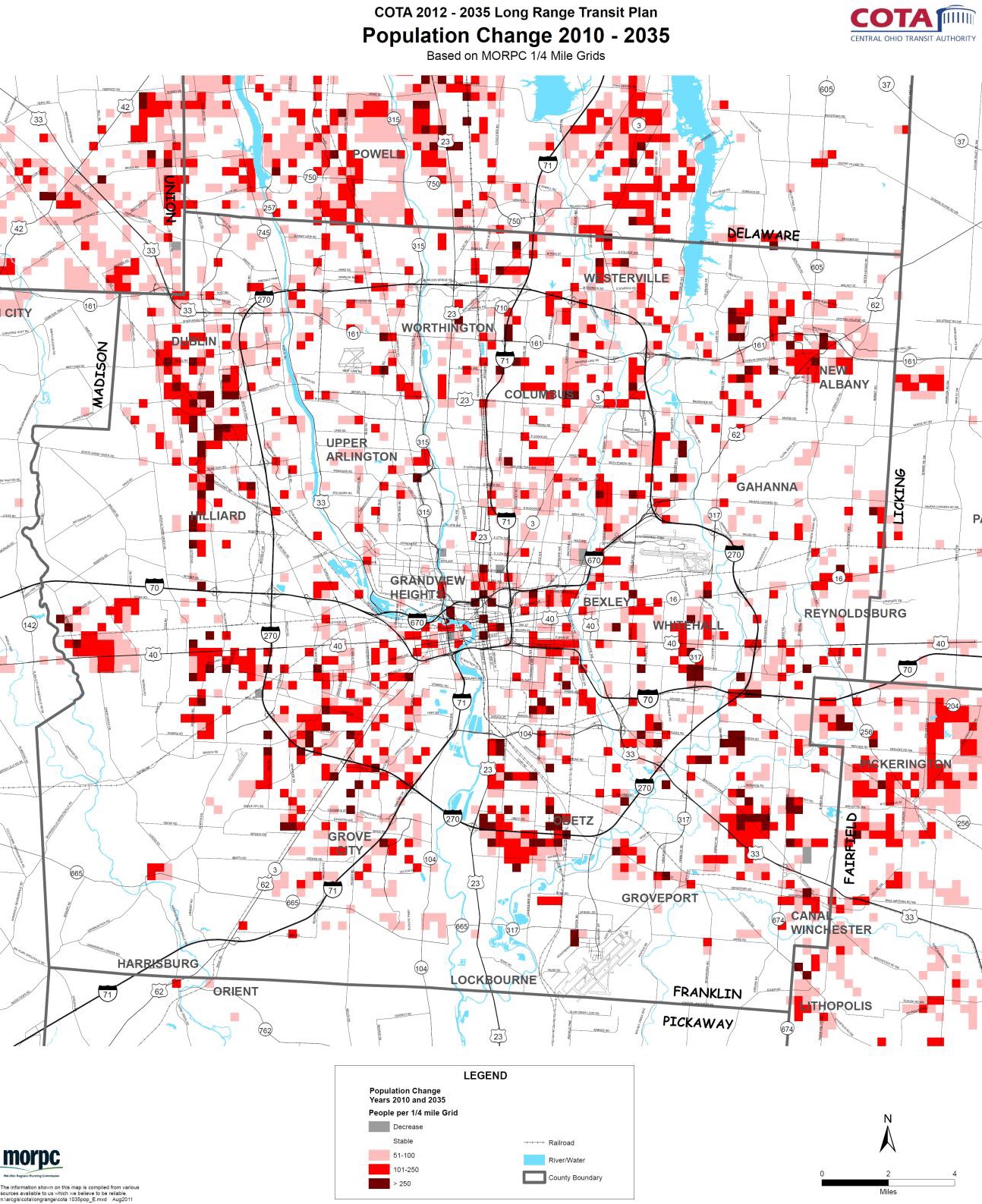
COTA Study: Projection of Population Growth in Columbus Metropolitan Area through 2035
That means, its original plan is working well to maintain the automobile as the main transportation mode. But that’s also when the urban area’s sprawled nature is likely to become a problem. That will be the time when building more freeway lanes, if that was possible, will no longer be a solution. And because the sprawled urban area does not provide the economies of scale, the corridors of transportation that would favor trains or light rail, besides cars crawling on freeways, the only viable alternative is a bus system, which is more flexible and not as dependent from the economies of scale provided by well defined population corridors.

COTA Study: Bus Routes in Columbus, past trends and projection
And with this projected population growth, COTA’s solution for Columbus is the Bus Rapid System (BRT), which is not expected to be in place until 2016. And it is projected to operate with only one line. BRT is something from which Eugene already benefits. Controversial as it may be for the business community (some business possibly won’t benefit from it and will incur costs from its development), the current BRT line here in Eugene (called the EmX – connecting downtown Eugene to downtown Springfield) has positively impacted public mobility between Eugene and Springfield. And it could actually have been one of the factors in the process of revitalization of downtown Springfield.
The point remains that a large urban area like the one in Columbus, with 2 million people in its metropolitan area, about 10 times the population of the Eugene/Springfield area, has become a victim of its well executed suburban-focused growth plan. It worked too well. But now what?
Meanwhile I will continue to use public transportation, whenever it is available. When growing up in Porto Alegre (Brazil) I despised it – despite the fact that BRT was available in my home town in the 80’s, making public transportation rather more efficient than car transportation (more on this on another post, when I will discuss the phasing out of electric street cars in Porto Alegre in 1970).
Although I saw benefits of public transportation as a graduate student at the City and Regional Planning program, I stayed away from public transportation as much as possible. Be it from the global warming perspective, or simply from the cost savings it promoted when I used it in my recent work travels, I have to say I now finally appreciate and enjoy the benefits of public transportation.

I don’t mind public transit as long as I can understand the schedules. When we go to San Francisco we typically fly into Oakland then take the shuttle and BART into SF. I think we scared Rogey with that when he was over from New Zealand. It was normal for us.
But when trying to figure out their bus schedule in town we walked the 11 miles round trip instead, it was easier at that point and luckily wasn’t raining.
It is nice to know the transit systems work so well in the larger cities.
I’ve been impressed with these large city systems. But I agree, it isn’t always a smooth process. Here in Eugene, I’ve taken the walk to downtown and from there the EMX to my office several times. Instead of walking to downtown, I could take a local bus that is on a route going by a block from my house. But it goes by every 30 minutes, and it is never there on the time it is supposed to be there. So I walk instead.
Cesar:
Vancouver has the same problem. No rapid transit, but no roads either. We have one line that sort of goes somewhere but it is not efficient for those who are not close to the line. For me it is not convenient.
For me to go to work I have to walk nearly a mile to get to the terminal. And then take the Skytrain downtown to the terminal on the waterfront where I would transfer to the line that goes East. So the first leg of my journey would be to go in the opposite direction. After I hop on and go east I get to the Mall and then have to walk another mile to get to the office. As you say, there are buses on a half hour schedule. I would have to leave before 6am and arrive at work by 8am. Same deal on the way home. But again I have to walk a mile, then take the Skytrain all the way downtown before I can catch the line going South, and then get off and walk another mile home. I estimate my commute would be around 4 hours or more and cost nearly $10. as I have to go through 3 zones. My car is insured to drive to work and is just sitting there anyway, so I don’t get any insurance savings and I only use 4 ltrs a day. Right now we are up to $1.50 per litre (which is $5.70 / US gallon for regular), so rapid transit doesn’t work for me either in terms of cost or time
bob
A weekend photographer or Riding the Wet Coast
Hey Bob,
…and I though Canada was better than here for public transit. There goes real data to show it otherwise.
Cesar